Category:20th-century maps of the Northern Territory
Jump to navigation
Jump to search
States of Australia: New South Wales · Queensland · South Australia · Tasmania · Victoria · Western Australia
Internal territories of Australia: Northern Territory
External territories of Australia:
Internal territories of Australia: Northern Territory
External territories of Australia:
Media in category "20th-century maps of the Northern Territory"
The following 6 files are in this category, out of 6 total.
-
 Admiralty Chart No 925 Australia - North coast, Port Darwin, Published 1929 nla.obj-232244253.jpg 8,174 × 11,913; 36.74 MB
-
 Cobourg Peninsula 1944 map nla.obj-234063743.jpg 5,000 × 3,604; 8.62 MB
-
 Darwin air defence map 1944.jpg 2,096 × 2,171; 1.32 MB
-
 Map of North Australia Railway in 1936.jpg 2,509 × 2,993; 4.53 MB
-
 Map of Northern Territory(GN04491).jpg 1,452 × 2,150; 418 KB
-
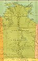 Map of the Northern Territory, Australia, 1916.jpg 1,932 × 3,130; 1.36 MB


.jpg)
