Category:20th-century maps of New South Wales
Jump to navigation
Jump to search
Media in category "20th-century maps of New South Wales"
The following 12 files are in this category, out of 12 total.
-
 1911 Survey Map of Northern Lake Macquarie.jpg 5,000 × 6,711; 20.56 MB
-

-
 Admiralty Chart No 3622 Port Jackson to Cape Byron Australia, Published 1907.jpg 10,969 × 17,835; 66.16 MB
-
 Map blue mountains 1913 copy of G W Evans 1815 original.jpg 5,000 × 3,128; 5.62 MB
-
 Map blue mountains 1913 copy of GEW Evans 1815.jpg 3,000 × 1,877; 2.32 MB
-
 Map of New South Wales, Australia, 1916.jpg 2,624 × 2,116; 1.7 MB
-
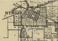 Map of Nyngan 1920.png 971 × 684; 1.34 MB
-
 Map of Wentworth County (NSW) 1918.png 196 × 200; 56 KB
-
 Plan of Leeton, 1914 (3907732895).jpg 1,914 × 1,545; 503 KB
-
 Subdivision of Cunningham Plains near Harden Junction 1907.jpg 3,619 × 4,824; 3.2 MB
-
 The Rocks - resumption plan, 1901 (4931127422).jpg 2,200 × 2,668; 1,000 KB
-
 Yungnulgra County parish map 1914.jpg 5,000 × 9,498; 19.88 MB


_1918.png)
.jpg)

.jpg)
