Category:20th-century maps of Suffolk
Jump to navigation
Jump to search
Ceremonial counties of England: Bedfordshire · Berkshire · Buckinghamshire · Cambridgeshire · Cheshire · Cornwall · Derbyshire · Devon · Dorset · Durham · Essex · Gloucestershire · Greater London · Hampshire · Herefordshire · Hertfordshire · Isle of Wight · Kent · Lancashire · Leicestershire · Lincolnshire · Norfolk · Northamptonshire · Northumberland · Nottinghamshire · Oxfordshire · Rutland · Shropshire · Somerset · Staffordshire · Suffolk · Surrey · Warwickshire · Wiltshire · Worcestershire
City-counties:
Former historic counties: Cumberland · Middlesex · Sussex · Westmorland · Yorkshire
Other former counties:
City-counties:
Former historic counties: Cumberland · Middlesex · Sussex · Westmorland · Yorkshire
Other former counties:
Subcategories
This category has only the following subcategory.
Media in category "20th-century maps of Suffolk"
The following 19 files are in this category, out of 19 total.
-
Admiralty Chart No 1094 Outer Gabbard to Outer Dowsing, Published 1912.jpg 11,097 × 16,208; 55.23 MB
-
Lowestoft & Yarmouth RJD 43.jpg 1,688 × 2,707; 800 KB
-
Becclesmap 1921.jpg 2,544 × 3,504; 1.37 MB
-
Southwoldmap 1921.jpg 2,544 × 3,504; 1.13 MB
-
Frostenden Seaport Map.png 1,260 × 924; 272 KB
-
20th Century map of Ringshall, Suffolk.png 651 × 326; 411 KB
-
Filixstowmap1940.jpg 2,544 × 3,504; 1.58 MB
-
20th Century Boyton Map.PNG 538 × 459; 475 KB
-
20th Century map of Friston.png 609 × 379; 572 KB
-
St Andrew, Ilketshall.png 384 × 414; 392 KB
-
Map of Little Wenham, OS 1946.png 238 × 132; 54 KB
-
Belstead Map 1946.png 573 × 443; 464 KB
-
Ordnance Survey Sheet TM 17 (62 17) Eye, Published 1947.png 7,632 × 9,748; 89 MB
-
Ordnance Survey Sheet TM 59 (62 59) Lowestoft, Published 1947.jpg 7,604 × 9,754; 16.86 MB
-
Admiralty Chart No 1504 Cromer to Harwich, Published 1962.jpg 11,273 × 13,645; 42.34 MB
-
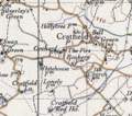
Cratfield 20th century map.PNG 318 × 281; 212 KB


