Category:20th-century maps of County Durham
Jump to navigation
Jump to search
Ceremonial counties of England: Bedfordshire · Berkshire · Buckinghamshire · Cambridgeshire · Cheshire · Cornwall · Derbyshire · Devon · Dorset · Durham · Essex · Gloucestershire · Greater London · Hampshire · Herefordshire · Hertfordshire · Isle of Wight · Kent · Lancashire · Leicestershire · Lincolnshire · Norfolk · Northamptonshire · Northumberland · Nottinghamshire · Oxfordshire · Rutland · Shropshire · Somerset · Staffordshire · Suffolk · Surrey · Warwickshire · Wiltshire · Worcestershire
City-counties:
Former historic counties: Cumberland · Middlesex · Sussex · Westmorland · Yorkshire
Other former counties:
City-counties:
Former historic counties: Cumberland · Middlesex · Sussex · Westmorland · Yorkshire
Other former counties:
Media in category "20th-century maps of County Durham"
The following 11 files are in this category, out of 11 total.
-
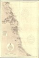
 Admiralty Chart No 3104 Hartlepool to Blyth, Published 1901, New Edition 1915.jpg 11,098 × 15,959; 65.95 MB
-
 Ordnance Survey Alston & Weardale 1" Popular edition 1925 Rookhope area.jpg 2,400 × 1,700; 2.95 MB
-
 Ordnance Survey Durham & Sunderland 1" Popular edition 1925 Consett area.jpg 2,400 × 1,700; 3.3 MB
-
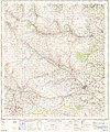
 Ordnance Survey One-inich Sheet 14 Darlington, Published 1925.jpg 12,177 × 8,896; 37.52 MB
-
 Ordnance Survey Popular Edition 1" map Darlington sheet 1925 a section.jpg 2,400 × 1,700; 3.04 MB
-
 Ordnance Survey One-Inch Sheet 84 Teesdale, Published 1947.jpg 10,936 × 12,785; 16.06 MB
-
 Ordnance Survey One-Inch Sheet 85 Durham, Published 1947.jpg 10,959 × 12,754; 16.09 MB
-
 Ordnance Survey One-Inch Sheet 85 Durham, Published 1955.jpg 8,323 × 9,921; 10.41 MB
-
 Ordnance Survey One-Inch Sheet 85 Durham, Published 1961.jpg 8,265 × 9,883; 11.36 MB
-
 Admiralty Chart No 3104 Blyth to Hartlepool, Published 1963.jpg 11,299 × 16,413; 64.81 MB
-
 Ordnance Survey One-Inch Sheet 84 Teesdale, Published 1964.jpg 8,230 × 9,875; 11.42 MB


