Category:20th-century maps of Antarctica
Jump to navigation
Jump to search
Temperate regions: North America · South America · Africa · Europe · Asia · Oceania – Polar regions: Antarctica · Arctic – Other regions:
Media in category "20th-century maps of Antarctica"
The following 99 files are in this category, out of 99 total.
-
The Antarctic Regions. LOC 2002624039.tif 8,333 × 6,542; 155.97 MB
-
Brockhaus and Efron Encyclopedic Dictionary b48 490-0.jpg 2,255 × 1,936; 1.66 MB
-
Wachusett Bank on map of Antarctica.png 1,686 × 1,349; 3.52 MB
-
The siege of the South pole; the story of Antarctic exploration BHL48382118.jpg 4,569 × 3,807; 1.5 MB
-
Polar sea depth.jpg 12,851 × 12,830; 54.64 MB
-
Brockhaus and Efron Encyclopedic Dictionary b85 439-0.jpg 2,300 × 1,911; 1.51 MB
-
1906 Antarctica map (cropped).jpg 1,820 × 2,277; 1.58 MB
-
The Harmsworth atlas and Gazetter 1908 (135848262).jpg 12,692 × 9,603; 114.15 MB
-
General Map Showing the Explorations and Surveys of the Expedition, 1907-09 WDL95.png 1,044 × 1,024; 1.65 MB
-
General Map showing the Explorations and Surveys of the Expedition, 1907-09. LOC 2002624045.tif 5,215 × 5,112; 76.27 MB
-
(Süd-Polar-Karte) LOC 2002624041.jpg 5,676 × 4,763; 4.32 MB
-
(Süd-Polar-Karte) LOC 2002624041.tif 5,676 × 4,763; 77.35 MB
-
Sud Polar Karte.jpg 5,598 × 4,673; 4.23 MB
-
Shackleton Expedition map-plan.jpg 956 × 1,316; 780 KB
-
Worst Journey in the World-1-077.jpg 905 × 2,625; 284 KB
-
Map of South Polar Regions.jpg 2,660 × 1,756; 1.23 MB
-
Ca. 1930 Italian image illustrating the race for the South Pole and a map of Antarctica.jpg 10,627 × 12,750; 44.04 MB
-
Антарктика.jpg 4,288 × 3,216; 7.27 MB
-
Ruta Primera Expedicion Antartica Chilena.jpg 430 × 750; 213 KB
-
1956 Antarctica Claims (30252922504).jpg 5,825 × 4,500; 18.82 MB
-
Antarctica exploration and claims, as of 1 February 1956. LOC 79692772.jpg 11,139 × 8,605; 14.22 MB
-
Antarctica exploration and claims, as of 1 February 1956. LOC 79692772.tif 11,139 × 8,605; 274.23 MB
-
Antarctica, 1967.jpg 1,959 × 2,874; 1.97 MB
-
Admiralty Chart Catalogue 1967 Page 120 Index W.jpg 8,566 × 6,844; 7.39 MB
-
Admiralty Chart No 1240 South Polar Chart, Published 1949.jpg 12,170 × 8,288; 14.44 MB
-
Antarctic Region - DPLA - 00418d9ee5a71c9404cde2fb22835556.jpg 2,552 × 3,276; 5.6 MB
-
Antarctic Region - DPLA - b65e942327db52c2b23d90bb08dedb3a.jpg 2,554 × 3,282; 5.45 MB
-
Antarctic Region - DPLA - cec375069f279d9461b1faf4b0f82310.jpg 2,556 × 3,282; 6.19 MB
-
Antarctic Region - DPLA - fc44ce6b8226eb88ee66b74177f126fb.jpg 2,554 × 3,280; 6.57 MB
-
Antarctic region. LOC 00559366.jpg 2,474 × 3,155; 867 KB
-
Antarctic region. LOC 00559366.tif 2,474 × 3,155; 22.33 MB
-
Antarctic region. LOC 2011587029.jpg 3,163 × 4,189; 1.84 MB
-
Antarctic region. LOC 2011587029.tif 3,163 × 4,189; 37.91 MB
-
Antarctic region. LOC 2011587031.jpg 3,342 × 4,379; 1.81 MB
-
Antarctic region. LOC 2011587031.tif 3,342 × 4,379; 41.87 MB
-
Antarctic region. LOC 95682409.jpg 2,478 × 3,252; 1.12 MB
-
Antarctic region. LOC 95682409.tif 2,478 × 3,252; 23.06 MB
-
Antarctic treaty signatories. LOC 84690252.jpg 5,529 × 6,836; 3.13 MB
-
Antarctic treaty signatories. LOC 84690252.tif 5,529 × 6,836; 108.14 MB
-
Antarctica - DPLA - 2f38428d97dc544a8a1348b7d9e9e2d9.jpg 2,558 × 3,274; 6.54 MB
-
Antarctica - DPLA - 55c1ed72e1d086e7b726389a5deee177 (page 1).jpg 4,175 × 3,486; 2 MB
-
Antarctica 1912 edit.jpg 4,940 × 4,296; 17.94 MB
-
Antarctica 1912.jpg 5,676 × 4,763; 17.15 MB
-
Antarctica 1912.tif 5,676 × 4,763; 77.38 MB
-
Antarctica map.jpg 4,549 × 3,973; 6.18 MB
-
Antarctica, research stations and territorial claims. LOC 84690253.jpg 6,995 × 7,731; 5.79 MB
-
Antarctica, research stations and territorial claims. LOC 84690253.tif 6,995 × 7,731; 154.72 MB
-
Antarctica, research stations and territorial claims. LOC 91682864.jpg 3,422 × 4,414; 2.03 MB
-
Antarctica, research stations and territorial claims. LOC 91682864.tif 3,422 × 4,414; 43.22 MB
-
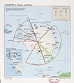
Antarctica, stations and claims. LOC 85697838.jpg 3,718 × 4,208; 1.34 MB
-
Antarctica, stations and claims. LOC 85697838.tif 3,718 × 4,208; 44.76 MB
-
Antarctica- Stations and claims. LOC 78691803.jpg 3,992 × 4,156; 1.93 MB
-
Antarctica- Stations and claims. LOC 78691803.tif 3,992 × 4,156; 47.47 MB
-
Antarctica. 12-55. LOC 73696979.jpg 6,224 × 4,785; 2.24 MB
-
Antarctica. 12-55. LOC 73696979.tif 6,224 × 4,785; 85.21 MB
-
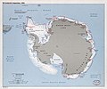
Antarctica. LOC 91682862.jpg 2,485 × 3,259; 1.28 MB
-
Antarctica. LOC 91682862.tif 2,485 × 3,259; 23.17 MB
-
Antarctica1914.jpg 2,000 × 2,128; 503 KB
-
Authorized map of the Second Byrd Antarctic Expedition. LOC 98687113.jpg 7,168 × 5,376; 7.55 MB
-
Authorized map of the Second Byrd Antarctic Expedition. LOC 98687113.tif 7,168 × 5,376; 110.25 MB
-
Chart to illustrate the paper on the drift of the "Endurance". LOC 2002624040.jpg 3,798 × 3,853; 2.23 MB
-
Chart to illustrate the paper on the drift of the "Endurance". LOC 2002624040.tif 3,798 × 3,853; 41.87 MB
-
D302- N° 474. Région polaire antarctique. - Liv4-Ch01.png 1,442 × 1,926; 265 KB
-
De Gerlache - Le premier hivernage dans les glaces antarctiques, 1902, illust - 0020.png 1,348 × 2,016; 1.8 MB
-
Deuxième expédition antarctique francaise (1908-1910) (1912) (20702389738).jpg 2,100 × 2,074; 632 KB
-
Drift of the Endurance.png 1,800 × 1,826; 2.28 MB
-
First on the Antarctic continent BHL46525839.jpg 4,296 × 3,338; 1.89 MB
-
First on the Antarctic continent BHL46525841.jpg 3,981 × 3,455; 1.28 MB
-
Flight901 1979 Detail.png 786 × 905; 315 KB
-
Frozen claims.jpg 651 × 517; 154 KB
-
Gaussberg Drygalski 14157.jpg 3,328 × 2,368; 3.31 MB
-
Gaussberg drygalski 14157.pdf 2,495 × 1,775; 681 KB
-
King George island.jpg 266 × 393; 29 KB
-
Le Tour du monde, nouvelle série-19-p026.jpg 1,535 × 2,157; 1 MB
-
Le Tour du monde, nouvelle série-20-p014.jpg 1,914 × 1,778; 1.2 MB
-
Polar Regions exploration 1911.png 3,096 × 3,106; 197 KB
-
Route and Surveys of the South Magnetic Polar Party, 1908-09. LOC 2002624043.jpg 4,499 × 6,286; 3.3 MB
-
Route and Surveys of the South Magnetic Polar Party, 1908-09. LOC 2002624043.tif 4,499 × 6,286; 80.91 MB
-
Route and Surveys of the Southern Journey Party, 1908-09. LOC 2002624044.jpg 4,954 × 7,697; 3.44 MB
-
Route and Surveys of the Southern Journey Party, 1908-09. LOC 2002624044.tif 4,954 × 7,697; 109.09 MB
-
Scott's last expedition map, 1923.jpg 1,252 × 1,598; 310 KB
-
South Magnetic Pole 1945 2000.jpg 385 × 485; 35 KB
-
Sphére terrestre - Poles and oceans.jpg 5,615 × 4,397; 2.65 MB
-
Territorial Claims in Antarctica - DPLA - 8dd337a9c7d77fdfb8e0b76d0c647778.jpg 8,674 × 8,815; 7.74 MB
-
The Antarctic Regions. LOC 2002624039.jpg 8,333 × 6,542; 5.91 MB
-
US Antarctic Inspection, 1983. LOC 84690251.jpg 7,469 × 6,221; 4.34 MB
-
US Antarctic Inspection, 1983. LOC 84690251.tif 7,469 × 6,221; 132.94 MB


