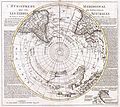
Category:18th-century maps of Antarctica
Jump to navigation
Jump to search
Temperate regions: North America · South America · Africa · Europe · Asia · Oceania – Polar regions: Antarctica · Arctic – Other regions:
Media in category "18th-century maps of Antarctica"
The following 9 files are in this category, out of 9 total.
-
Delisle 1739..jpg 998 × 858; 279 KB
-
1785 Clouet Map of North America and South America - Geographicus - Amerique-clouet-1785.jpg 3,500 × 2,044; 1.78 MB
-
Antarctica, Bouvet Island, discovery map 1739.jpg 3,836 × 2,916; 2.92 MB
-
Antarctica, Bouvet Island, discovery map 1754.jpg 3,896 × 3,088; 4.16 MB
-
Atlas Page Showing Antarctic Region - DPLA - f72fcf009cf5d29c680de69bde114324.jpg 17,324 × 12,820; 25.7 MB


