Category:2014 maps of South America
Jump to navigation
Jump to search
Temperate regions: North America · South America · Africa · Europe · Asia · Oceania – Polar regions: – Other regions:
| ← 2010 2011 2012 2013 2014 2015 2016 2017 2018 2019 → |
Subcategories
This category has the following 7 subcategories, out of 7 total.
A
- 2014 maps of Argentina (17 F)
B
C
- 2014 maps of Chile (9 F)
G
- 2014 maps of Guyana (3 F)
S
- 2014 maps of Suriname (1 F)
U
- 2014 maps of Uruguay (5 F)
V
- 2014 maps of Venezuela (5 F)
Media in category "2014 maps of South America"
The following 26 files are in this category, out of 26 total.
-
Agricultural general services support, OWID.svg 850 × 600; 139 KB
-
Agricultural producer support, OWID.svg 850 × 600; 140 KB
-
Death-rate-from-opioid-use-who,South America,2014.svg 850 × 600; 144 KB
-
Death-rate-smoking,South America,2014.svg 850 × 699; 145 KB
-
Distribution of Chagas' disease-pt.svg 1,000 × 1,250; 361 KB
-
ECHO Field Network Editable Latin America.pdf 2,100 × 1,575; 487 KB
-
ECHO Field Network Editable Latin America.png 1,344 × 1,008; 136 KB
-
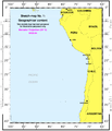
ICJ Peru Chile judgment map1.png 2,116 × 2,472; 280 KB
-
ICJ Peru Chile judgment map2.png 3,041 × 2,178; 437 KB
-
ICJ Peru Chile judgment map3.png 3,000 × 2,176; 502 KB
-
ICJ Peru Chile judgment map4 (svg version).svg 3,036 × 2,176; 2.19 MB
-
ICJ Peru Chile judgment map4.png 3,036 × 2,176; 392 KB
-
Mapa ganadero.png 355 × 480; 388 KB
-
Maritime Claims of Ecuador and Peru.svg 1,864 × 1,819; 373 KB
-
PAT - Bolivia.gif 860 × 975; 233 KB
-
PAT - Chile.gif 690 × 1,200; 178 KB
-
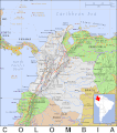
PAT - Colombia.gif 860 × 975; 168 KB
-
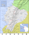
PAT - Ecuador.gif 830 × 1,000; 170 KB
-
PAT - French Guiana.gif 920 × 920; 263 KB
-
PAT - Guyana.gif 800 × 1,035; 287 KB
-
PAT - Peru.gif 800 × 1,060; 202 KB
-
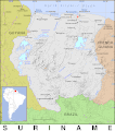
PAT - Suriname.gif 860 × 975; 293 KB
-
PAT - Trinidad-Tobago.gif 860 × 975; 77 KB
-
PAT - Uruguay.gif 860 × 975; 205 KB
-
PAT - Venezuela.gif 920 × 920; 208 KB
-
Time zone map of South America (2014).png 872 × 900; 197 KB


