Category:2010 in Hessle
Jump to navigation
Jump to search
Media in category "2010 in Hessle"
The following 25 files are in this category, out of 25 total.
-
 "RMS Vindava" passing the Humber Bridge - geograph.org.uk - 1721367.jpg 640 × 543; 315 KB
-
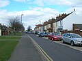
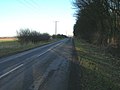
 A1105, Hessle - geograph.org.uk - 1734692.jpg 800 × 499; 105 KB
-
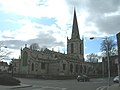 All Saints Church, Hessle - geograph.org.uk - 1774448.jpg 640 × 480; 49 KB
-
 Cycle Path beside the A15 - geograph.org.uk - 1734678.jpg 800 × 600; 169 KB
-
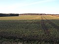 Farmland North of Jenny Brough Lane - geograph.org.uk - 1734725.jpg 800 × 600; 124 KB
-
 First Lane - geograph.org.uk - 1774456.jpg 640 × 480; 65 KB
-
 First Lane - geograph.org.uk - 1774462.jpg 640 × 480; 82 KB
-
 Footbridge at Hessle Station - geograph.org.uk - 1713335.jpg 640 × 545; 338 KB
-
 Heads Lane, Hessle Mount - geograph.org.uk - 1734703.jpg 800 × 600; 129 KB
-
 Humber Bridge at dusk - geograph.org.uk - 1713085.jpg 640 × 455; 194 KB
-
 Jenny Brough Lane, Hessle - geograph.org.uk - 1734733.jpg 800 × 600; 85 KB
-
 No. 60, Southfield, Hessle - geograph.org.uk - 1713372.jpg 1,200 × 1,069; 1.45 MB
-
 Offices on Redcliff Road, Hessle - geograph.org.uk - 1716257.jpg 1,000 × 636; 498 KB
-
 Prestongate Hessle.jpg 1,500 × 1,125; 1.25 MB
-
 Roundabout on the A15 - geograph.org.uk - 1734654.jpg 800 × 600; 103 KB
-
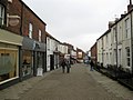
 Shops on First Lane - geograph.org.uk - 1774460.jpg 640 × 413; 70 KB
-
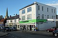 The Co-Operative, Hessle (geograph 2154155).jpg 1,280 × 839; 898 KB
-
 The Co-Operative, Hessle (geograph 2154155, cropped).jpg 790 × 612; 413 KB
-
 The Hase, Hessle - geograph.org.uk - 1774444.jpg 640 × 480; 97 KB
-
 The Humber Bridge - geograph.org.uk - 1724688.jpg 1,000 × 750; 427 KB
-

-
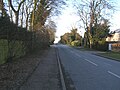
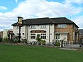 The Norland, Hull Road - geograph.org.uk - 1774454.jpg 640 × 480; 73 KB
-
 Victorian House on Southfield - geograph.org.uk - 1714741.jpg 1,200 × 800; 1.15 MB
-
 Victorian Houses, Southfield, Hessle - geograph.org.uk - 1713346.jpg 1,200 × 891; 1.09 MB
-
 View looking east along the A63 from Humber Bridge - panoramio.jpg 666 × 1,000; 371 KB


.jpg)
.jpg)


_on_its_way_to_Grimsby_-_geograph.org.uk_-_2186517.jpg)


