Category:2009 in Hessle
Jump to navigation
Jump to search
Media in category "2009 in Hessle"
The following 126 files are in this category, out of 126 total.
-
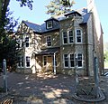
 "Huckleberry House", Tower Hill, Hessle - geograph.org.uk - 1189709.jpg 640 × 415; 107 KB
-
-
 Winter Wheat - geograph.org.uk - 1176315.jpg 640 × 480; 77 KB
-
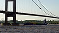
 Humber Bridge Sunset Wideshot.jpg 4,000 × 3,000; 5.15 MB
-
 Humber Bridge, driver's-eye view - geograph.org.uk - 1296073.jpg 627 × 541; 30 KB
-
-
 A15 Roundabout, Hessle - geograph.org.uk - 1461483.jpg 640 × 480; 64 KB
-
 At the Humber Bridge Viewing Area - geograph.org.uk - 1516191.jpg 640 × 345; 215 KB
-
 Barrow Lane, Hessle - geograph.org.uk - 1277777.jpg 640 × 511; 132 KB
-
 Barrow Lane. Hessle - geograph.org.uk - 1277733.jpg 530 × 640; 114 KB
-
 Barrow Lane. Hessle - geograph.org.uk - 1277750.jpg 640 × 389; 73 KB
-

-
 Beacon Garth, Hessle - geograph.org.uk - 1150737.jpg 640 × 480; 361 KB
-

-
 Chestnut Avenue, Hessle - geograph.org.uk - 1189557.jpg 608 × 640; 156 KB
-
 Cliff House - geograph.org.uk - 1158138.jpg 640 × 480; 132 KB
-
 Cliff House Hessle.jpg 640 × 480; 134 KB
-
 Cliff House, Hessle - geograph.org.uk - 1158113.jpg 640 × 438; 87 KB
-
 Cliff House, Hessle - geograph.org.uk - 1158218.jpg 640 × 480; 81 KB
-
-
 Cliff Mill, Hessle, East Yorkshire - geograph.org.uk - 1653910.jpg 480 × 640; 62 KB
-
 Cliff Mill, Hessle, East Yorkshire - geograph.org.uk - 1653947.jpg 480 × 640; 72 KB
-
 Cliff Road and Hessle Foreshore - geograph.org.uk - 1149566.jpg 640 × 406; 79 KB
-

-
 Cliff Road, Hessle - geograph.org.uk - 1148026.jpg 640 × 349; 59 KB
-
 Cliff Top Lane, Hessle - geograph.org.uk - 1158249.jpg 640 × 470; 151 KB
-
-

-
 Edwardian House Chestnut Avenue Hessle.jpg 640 × 479; 115 KB
-
 Edwardian House on Davenport Avenue Hessle.jpg 518 × 640; 119 KB
-

-
 Edwardian House, Chestnut Avenue, Hessle - geograph.org.uk - 1189543.jpg 640 × 480; 152 KB
-

-
 Edwardian Houses on Ferriby Road, Hessle - geograph.org.uk - 1181642.jpg 640 × 512; 131 KB
-

-

-
 Ferriby Road - geograph.org.uk - 1460701.jpg 640 × 480; 81 KB
-
 Ferriby Road, Hessle - geograph.org.uk - 1189614.jpg 640 × 481; 96 KB
-
 First Lane Hessle.jpg 640 × 465; 93 KB
-
 Florence Avenue, Hessle - geograph.org.uk - 1190905.jpg 640 × 495; 98 KB
-
 Footbridge over the A63 and Railway - geograph.org.uk - 1199899.jpg 489 × 640; 109 KB
-
 Footbridge over the A63.jpg 640 × 480; 106 KB
-

-
 Former Lodge of Hesslewood Hall - geograph.org.uk - 1168218.jpg 640 × 558; 154 KB
-
 Half Way Point on Humber Bridge - geograph.org.uk - 1653987.jpg 480 × 640; 42 KB
-
 War Grave in Hessle Cemetery - geograph.org.uk - 1279765.jpg 600 × 603; 524 KB
-
 Hessle Haven - geograph.org.uk - 1390910.jpg 640 × 480; 85 KB
-
 Hessle Haven - geograph.org.uk - 1473759.jpg 640 × 480; 62 KB
-
 Hessle Haven meets the River Humber - geograph.org.uk - 1460619.jpg 640 × 400; 42 KB
-
 Hessle Haven with Sunken Barge - geograph.org.uk - 1199903.jpg 640 × 480; 96 KB
-
 Hessle Haven.jpg 600 × 640; 353 KB
-
 Hessle The Square.jpg 640 × 480; 52 KB
-
-
 Hessle, parish church of All Saints - geograph.org.uk - 1293492.jpg 640 × 480; 66 KB
-
-

-
 Hessle, the Indian Hawk(e) - geograph.org.uk - 1293479.jpg 640 × 480; 62 KB
-
 Hesslewood Lodge Woodfield Lane Hessle.jpg 640 × 414; 106 KB
-
 Hull Road, Hessle - geograph.org.uk - 1190872.jpg 640 × 478; 108 KB
-
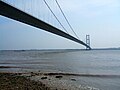
 Humber Bridge - geograph.org.uk - 1110141.jpg 640 × 552; 85 KB
-
 Humber Bridge - geograph.org.uk - 1423864.jpg 640 × 480; 102 KB
-

-
 Humber Bridge From Air.jpg 2,032 × 1,524; 382 KB
-

-
-
 Humber bridge from the south tower - geograph.org.uk - 1463752.jpg 640 × 480; 87 KB
-
 Humber Channel Marker No. 27 - geograph.org.uk - 1334736.jpg 640 × 464; 278 KB
-
 Humber foreshore - geograph.org.uk - 1115313.jpg 640 × 426; 190 KB
-
 Humber Foreshore near Hessle Haven.jpg 515 × 640; 301 KB
-
 Humber foreshore, Hessle - geograph.org.uk - 1115333.jpg 497 × 640; 217 KB
-

-
 Livingstone Road at Hessle Haven - geograph.org.uk - 1390923.jpg 595 × 640; 86 KB
-
 Livingstone Road, Hessle - geograph.org.uk - 1577498.jpg 640 × 480; 359 KB
-
 Looking East from Hessle Station - geograph.org.uk - 1710567.jpg 640 × 481; 316 KB
-
 Looking West from Hessle Station - geograph.org.uk - 1710581.jpg 640 × 481; 284 KB
-
 Low Water Flow in Barton Beck - geograph.org.uk - 1521678.jpg 640 × 480; 218 KB
-
 Modern House on Southfield - geograph.org.uk - 1158578.jpg 640 × 480; 159 KB
-
 Mortuary Chapel, Hessle Cemetery - geograph.org.uk - 1277512.jpg 545 × 640; 125 KB
-
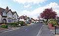
 Mount Avenue, Hessle - geograph.org.uk - 1281396.jpg 640 × 387; 72 KB
-
 National Cycle Network - Route 1 - geograph.org.uk - 1158355.jpg 640 × 480; 149 KB
-
 National Cycle Network - Route 1 - geograph.org.uk - 1165645.jpg 640 × 493; 134 KB
-
 National Cycle Network Route 1 - geograph.org.uk - 1158361.jpg 480 × 640; 124 KB
-
 Nevriye's Hair Studio, Hessle - geograph.org.uk - 1279746.jpg 640 × 428; 86 KB
-
 No. 77 Ferriby Road, Hessle - geograph.org.uk - 1183340.jpg 640 × 430; 117 KB
-
 No. 87 Ferriby Road, Hessle - geograph.org.uk - 1178604.jpg 640 × 544; 141 KB
-
 Northgate Hessle.jpg 640 × 451; 89 KB
-
 Old Jetty at Hessle Haven.jpg 640 × 480; 259 KB
-
 Playing Field, Heads Lane, Hessle - geograph.org.uk - 1451968.jpg 500 × 375; 228 KB
-
 Prestongate Hessle 1.jpg 640 × 568; 107 KB
-

-
 Redcliff Road, Hessle - geograph.org.uk - 1148066.jpg 640 × 404; 109 KB
-
 Redcliff Road, Hessle - geograph.org.uk - 1148084.jpg 640 × 402; 103 KB
-
 Redcliff Road, Hessle - geograph.org.uk - 1150759.jpg 640 × 401; 373 KB
-

-
 Reflections on the Humber - geograph.org.uk - 1361444.jpg 480 × 640; 31 KB
-
 Riverside buildings, Hessle - geograph.org.uk - 1115329.jpg 512 × 640; 219 KB
-
 Riverside Cottage Cliff Road Hessle.jpg 480 × 640; 88 KB
-
 Salisbury Street. Hessle - geograph.org.uk - 1281443.jpg 640 × 480; 137 KB
-
 Seaward Bound - geograph.org.uk - 1171256.jpg 640 × 480; 56 KB
-
 Spiral Pathway - geograph.org.uk - 1199901.jpg 640 × 503; 131 KB
-
 Suspended Lighting - geograph.org.uk - 1222075.jpg 640 × 381; 39 KB
-
 Swanland Road Roundabout, Hessle - geograph.org.uk - 1343418.jpg 640 × 360; 51 KB
-
 Swanland Road, Hessle - geograph.org.uk - 1277721.jpg 640 × 480; 140 KB
-
 Swiss Cottage Hessle.jpg 640 × 436; 74 KB
-

-
 The A63 and Main Railway Line into Hull.jpg 640 × 485; 98 KB
-

-

-
 The Humber Bridge - geograph.org.uk - 1259515.jpg 640 × 480; 70 KB
-
 The Humber Bridge - geograph.org.uk - 1460696.jpg 640 × 480; 64 KB
-
 The Humber Bridge North Tower - geograph.org.uk - 1199904.jpg 498 × 640; 67 KB
-
 The Humber Bridge's Bottom - geograph.org.uk - 1221346.jpg 640 × 486; 72 KB
-
 The Humber Foreshore at Hessle - geograph.org.uk - 1138503.jpg 480 × 640; 63 KB
-
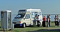
 The Humber Inshore Rescue Station - geograph.org.uk - 1259519.jpg 640 × 480; 108 KB
-
 The late "Admiral Hawke" - geograph.org.uk - 1189648.jpg 640 × 437; 83 KB
-
 The Riverside Building, Hessle - geograph.org.uk - 1115320.jpg 436 × 640; 207 KB
-
 The Toy Shop, Prestongate, Hessle - geograph.org.uk - 1189789.jpg 640 × 480; 109 KB
-
 The Wesleyan Methodist Schoolroom Hessle.jpg 640 × 513; 109 KB
-
 Victorian House on Southfield - geograph.org.uk - 1158527.jpg 640 × 629; 170 KB
-
 Victorian House, Hessle - geograph.org.uk - 1180685.jpg 640 × 467; 93 KB
-
 Victorian Houses on Southfield, Hessle - geograph.org.uk - 1168496.jpg 640 × 455; 108 KB
-
 Victorian Mortuary Chapel, Hessle Cemetery.jpg 1,932 × 2,576; 1.08 MB
-
 Wesleyan Methodist Church Hessle.jpg 425 × 640; 78 KB
-
 West Hill, Hessle - geograph.org.uk - 1212734.jpg 480 × 640; 162 KB
-
 Westbourne Grove, Hessle - geograph.org.uk - 1279777.jpg 640 × 367; 84 KB
-
 Westfield Rise, Hessle - geograph.org.uk - 1281354.jpg 640 × 358; 93 KB


_-_geograph.org.uk_-_1293479.jpg)


