Category:2006 in the Royal Borough of Greenwich
Jump to navigation
Jump to search
Boroughs of London: City of London · City of Westminster · Barking and Dagenham · Barnet · Bexley · Brent · Bromley · Camden · Croydon · Ealing · Enfield · Greenwich · Hackney · Hammersmith and Fulham · Haringey · Harrow · Havering · Hillingdon · Hounslow · Islington · Kensington and Chelsea · Kingston · Lambeth · Lewisham · Merton · Newham · Redbridge · Richmond · Southwark · Sutton · Tower Hamlets · Waltham Forest · Wandsworth
Media in category "2006 in the Royal Borough of Greenwich"
The following 85 files are in this category, out of 85 total.
-
Abbey Wood station - geograph.org.uk - 141798.jpg 640 × 480; 86 KB
-
Westcombe Park station, Greenwich - geograph.org.uk - 141650.jpg 640 × 480; 104 KB
-
Charlton Station - geograph.org.uk - 234017.jpg 640 × 480; 75 KB
-
A2 passing through Eltham - geograph.org.uk - 229091.jpg 640 × 480; 103 KB
-
Apartment blocks, Royal Arsenal site - geograph.org.uk - 198232.jpg 640 × 480; 56 KB
-
Avery Hill Park Winter Gardens - geograph.org.uk - 312648.jpg 640 × 229; 53 KB
-
Awaiting demolition - geograph.org.uk - 881038.jpg 640 × 457; 300 KB
-
Banning Street - geograph.org.uk - 881045.jpg 640 × 457; 273 KB
-
Blackwall Tunnel Northbound - geograph.org.uk - 275322.jpg 640 × 480; 54 KB
-
Braddyll Street - geograph.org.uk - 881043.jpg 640 × 457; 319 KB
-
Burnt out car in Bostall Woods - geograph.org.uk - 871596.jpg 640 × 480; 183 KB
-
Burnt out car in Bostall Woods - geograph.org.uk - 871597.jpg 640 × 480; 164 KB
-
Charlton Athletic The Valley 2006.jpg 676 × 507; 80 KB
-
Charlton Cemetery - geograph.org.uk - 262016.jpg 640 × 480; 36 KB
-
Charlton House east side - geograph.org.uk - 194036.jpg 640 × 345; 97 KB
-
Charlton Park - geograph.org.uk - 262019.jpg 640 × 480; 26 KB
-
Charlton Park Road Quaintness.jpg 600 × 800; 177 KB
-
Church of St Mark and St Margaret - geograph.org.uk - 273218.jpg 640 × 480; 41 KB
-
Closed pub - geograph.org.uk - 216523.jpg 640 × 480; 53 KB
-
Colfeian Sports Club - geograph.org.uk - 127585.jpg 640 × 480; 152 KB
-
Cutty Sark (before the Fire) , Greenwich , London , May 2006 - panoramio.jpg 2,279 × 1,502; 602 KB
-
Deer enclosure in Maryon Wilson Park - geograph.org.uk - 262008.jpg 640 × 480; 52 KB
-
DLR shaft, Royal Arsenal - geograph.org.uk - 198230.jpg 640 × 480; 40 KB
-
Dock No 3, Woolwich Dockyard - geograph.org.uk - 198241.jpg 640 × 480; 83 KB
-
Downman Road, SE9 - geograph.org.uk - 228350.jpg 640 × 480; 121 KB
-
Fungus - geograph.org.uk - 127587.jpg 640 × 480; 224 KB
-
General Gordon Place, SE18 - geograph.org.uk - 228332.jpg 640 × 480; 109 KB
-
Greenwich foot tunnel.jpg 1,555 × 1,024; 408 KB
-
Greenwich naval college dome.jpg 1,482 × 1,415; 1.44 MB
-
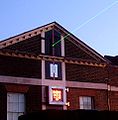
Greenwich observatory laser.jpg 945 × 965; 243 KB
-
Greenwich Park - geograph.org.uk - 240925.jpg 640 × 427; 51 KB
-
Greenwich Park Blackheath Gate Lodge - geograph.org.uk - 197224.jpg 640 × 480; 72 KB
-
Greenwich, Cutty Sark before the fire - geograph.org.uk - 491226.jpg 429 × 640; 76 KB
-
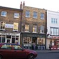
King's Arms 16 King William Walk - geograph.org.uk - 197215.jpg 640 × 480; 95 KB
-
Last riverside factories - geograph.org.uk - 216521.jpg 640 × 480; 34 KB
-
LondonCctvIrony.jpg 768 × 510; 120 KB
-
Maryon Wilson Park - geograph.org.uk - 262005.jpg 640 × 480; 38 KB
-
Mast Quay phase 1 - geograph.org.uk - 216526.jpg 640 × 480; 37 KB
-
Maze Hill station - geograph.org.uk - 123370.jpg 640 × 480; 179 KB
-
Meridian Primary School - geograph.org.uk - 407802.jpg 640 × 480; 296 KB
-
Millennium Dome - geograph.org.uk - 347011 (cropped).jpg 640 × 425; 48 KB
-
Millennium Dome - geograph.org.uk - 347011.jpg 640 × 433; 50 KB
-
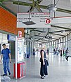
North Greenwich station geograph-3796403-by-Ben-Brooksbank.jpg 1,625 × 1,866; 3.53 MB
-
Plumstead Cemetery - geograph.org.uk - 147182.jpg 640 × 480; 122 KB
-
St John's church and hall, Earl Rise - geograph.org.uk - 273215.jpg 640 × 480; 50 KB
-
Power station - geograph.org.uk - 216519.jpg 640 × 480; 32 KB
-
Power Station Jetty - geograph.org.uk - 123358.jpg 640 × 480; 116 KB
-
Queens House 2006.jpg 2,051 × 2,734; 1.69 MB
-
Rigging on the Cutty Sark - geograph.org.uk - 1986566.jpg 960 × 1,280; 577 KB
-
Rush hour on the A102 - geograph.org.uk - 205323.jpg 618 × 445; 164 KB
-
Sam Bartram at The Valley - geograph.org.uk - 1289338.jpg 640 × 480; 95 KB
-
St Alfege Churchyard - geograph.org.uk - 197222 (cropped).jpg 640 × 360; 100 KB
-
St Alfege Churchyard - geograph.org.uk - 197222.jpg 640 × 480; 126 KB
-
Street scene in Plumstead - geograph.org.uk - 141719.jpg 640 × 480; 93 KB
-
Sunday morning Rugby. - geograph.org.uk - 127586.jpg 640 × 480; 139 KB
-
Thames Path at Ballast Quay - geograph.org.uk - 123363.jpg 640 × 480; 128 KB
-
Thamesmead brick shelter.jpg 640 × 480; 146 KB
-
The Cutty Sark - geograph.org.uk - 291546.jpg 640 × 425; 89 KB
-
The Valley East Stand.jpg 500 × 375; 155 KB
-
The Valley North and West Stands.jpg 676 × 507; 78 KB
-
The Valley South Stand.jpg 676 × 507; 100 KB
-
Trinity College - geograph.org.uk - 881064.jpg 640 × 457; 288 KB
-
Tulip stair edit 1.jpg 2,043 × 1,350; 1.57 MB
-
Tulip stair edit 2.jpg 1,800 × 1,350; 1.42 MB
-
Tulip Stairs Queens house greenwich.jpg 2,048 × 1,536; 1.22 MB
-
TulipStair QueensHouse Greenwich.jpg 2,048 × 1,536; 1.06 MB
-
University of Greenwich - geograph.org.uk - 287471.jpg 640 × 480; 37 KB
-
Urban farm, Maryon Wilson Park - geograph.org.uk - 262010.jpg 640 × 480; 61 KB
-
Urban Heron - geograph.org.uk - 194946.jpg 640 × 500; 80 KB
-
Well Hall Pleasaunce - geograph.org.uk - 229108.jpg 640 × 480; 166 KB
-
Well Hall Pleasaunce, Eltham, Kent - geograph.org.uk - 141176.jpg 640 × 480; 138 KB


