Category:2006 in the London Borough of Hillingdon
Jump to navigation
Jump to search
Boroughs of London: City of London · City of Westminster · Barking and Dagenham · Barnet · Bexley · Brent · Bromley · Camden · Croydon · Ealing · Enfield · Greenwich · Hackney · Hammersmith and Fulham · Haringey · Harrow · Havering · Hillingdon · Hounslow · Islington · Kensington and Chelsea · Kingston · Lambeth · Lewisham · Merton · Newham · Redbridge · Richmond · Southwark · Sutton · Tower Hamlets · Waltham Forest · Wandsworth
Subcategories
This category has only the following subcategory.
H
- 2006 at London Heathrow Airport (87 F)
Media in category "2006 in the London Borough of Hillingdon"
The following 67 files are in this category, out of 67 total.
-
 Arable field ready to plough, Harefield - geograph.org.uk - 116474.jpg 480 × 640; 248 KB
-
 Bank at Hatton Cross, Heathrow - geograph.org.uk - 196501.jpg 640 × 480; 84 KB
-
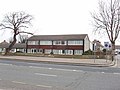
 Barra Hall, Hayes - geograph.org.uk - 153360.jpg 640 × 480; 109 KB
-
 Breakspear Crematorium - geograph.org.uk - 306521.jpg 640 × 427; 86 KB
-
 Breakspear Crematorium - geograph.org.uk - 306527.jpg 640 × 426; 98 KB
-
 Breakspear Crematorium - geograph.org.uk - 306530.jpg 640 × 480; 150 KB
-
-
-
 Civic Centre, Uxbridge - geograph.org.uk - 189483.jpg 640 × 480; 105 KB
-
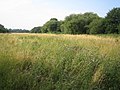
 Cranford Park - geograph.org.uk - 207177.jpg 640 × 480; 108 KB
-
 Eastcote Methodist Church - geograph.org.uk - 100339.jpg 640 × 480; 97 KB
-
 Entrance gate to St Martins - geograph.org.uk - 374479.jpg 640 × 480; 128 KB
-
 Farthings Close, Eastcote - geograph.org.uk - 100354.jpg 640 × 481; 192 KB
-
 Flag Walk, Eastcote - geograph.org.uk - 100345.jpg 640 × 480; 89 KB
-
 Flats at Ruislip Manor - geograph.org.uk - 100103.jpg 640 × 480; 190 KB
-
 Footpath at Harmondsworth - geograph.org.uk - 137620.jpg 640 × 480; 84 KB
-
 Former Regal cinema, Uxbridge - geograph.org.uk - 189501.jpg 640 × 480; 116 KB
-
 Fray's River - geograph.org.uk - 189511.jpg 640 × 480; 150 KB
-
 Georgian Lodge, Bridle Road, Eastcote - geograph.org.uk - 100104.jpg 640 × 480; 208 KB
-
 Greenway, Yeading - geograph.org.uk - 210640.jpg 640 × 480; 63 KB
-

-
 Harmondsworth Baptist Church - geograph.org.uk - 231957.jpg 640 × 480; 82 KB
-
 Hatton Cross Bus and Underground Station - geograph.org.uk - 112000.jpg 640 × 479; 167 KB
-
 Hatton Road - geograph.org.uk - 210867.jpg 640 × 480; 58 KB
-
 Hayes Bypass Channel - geograph.org.uk - 205627.jpg 640 × 480; 119 KB
-
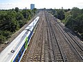 Hayes railway lines - geograph.org.uk - 217746.jpg 640 × 480; 134 KB
-

-
 Heathrow Terminal 5 - geograph.org.uk - 133458.jpg 640 × 379; 49 KB
-
 High Street Ruislip - geograph.org.uk - 306550.jpg 640 × 480; 80 KB
-
 High Street Ruislip - geograph.org.uk - 306566.jpg 640 × 427; 98 KB
-
 Houses on Bath Road, Harmondsworth - geograph.org.uk - 137613.jpg 640 × 480; 90 KB
-
 Ickenham - geograph.org.uk - 207027.jpg 640 × 480; 113 KB
-
 Ickenham Village Pump - geograph.org.uk - 207003.jpg 640 × 480; 87 KB
-
 Joel Street Farm, Eastcote - geograph.org.uk - 100107.jpg 640 × 480; 83 KB
-
 Kingswear Road - geograph.org.uk - 306789.jpg 640 × 480; 103 KB
-
 Longford Pump - geograph.org.uk - 136930.jpg 1,200 × 1,600; 407 KB
-

-
 M25 M4 interchange - geograph.org.uk - 117965.jpg 640 × 480; 66 KB
-
 M4 Motorway (Heathrow Spur) - geograph.org.uk - 231943.jpg 640 × 480; 91 KB
-

-
 Playground - Greenway, Yeading - geograph.org.uk - 210638.jpg 640 × 480; 97 KB
-
 River Crane in Cranford Park - geograph.org.uk - 207182.jpg 640 × 480; 163 KB
-
 Ruislip Manor houses - geograph.org.uk - 100255.jpg 640 × 480; 93 KB
-
 Ruislip Manor Library - geograph.org.uk - 100329.jpg 640 × 480; 94 KB
-
 Ruislip Station 1.jpg 640 × 427; 83 KB
-
 Ruslip Manor Methodist Church - geograph.org.uk - 100272.jpg 640 × 480; 77 KB
-
 Shop, Bath Road, Harmondsworth - geograph.org.uk - 137610.jpg 640 × 480; 68 KB
-
 Sipson Lane Chapel - geograph.org.uk - 231936.jpg 640 × 480; 78 KB
-
 Sipson, King William IV pub - geograph.org.uk - 231517.jpg 640 × 480; 80 KB
-
 SKYport exchange - geograph.org.uk - 137136.jpg 640 × 480; 91 KB
-
 South Ruislip (100565754).jpg 2,897 × 2,279; 2.69 MB
-
 Station Approach - Ruislip Station - geograph.org.uk - 306493.jpg 640 × 426; 82 KB
-

-
 Tattoo Parlour - geograph.org.uk - 306643.jpg 640 × 480; 95 KB
-
 The American Flag is lowered for the final time at RAF West Ruislip, United Kingdom.jpg 2,152 × 2,400; 1.76 MB
-

-
 The Plough Public House - geograph.org.uk - 306554.jpg 640 × 426; 63 KB
-
 This Isn't Anfield - geograph.org.uk - 252719.jpg 640 × 480; 89 KB
-
 Uxbridge High Street - geograph.org.uk - 195488.jpg 640 × 480; 109 KB
-
 Victoria Road - geograph.org.uk - 306644.jpg 640 × 480; 82 KB
-
 Victoria Road - geograph.org.uk - 306649.jpg 640 × 480; 100 KB
-

-
 Warehouse off Dawley Road - geograph.org.uk - 143627.jpg 640 × 480; 60 KB
-

-
 Wyvale Close, Eastcote - geograph.org.uk - 100356.jpg 640 × 480; 260 KB
-
 Yeading Marina - geograph.org.uk - 201452.jpg 640 × 480; 81 KB
-
 Yiewsley, Colham Avenue - geograph.org.uk - 206229.jpg 640 × 480; 131 KB


_-_geograph.org.uk_-_231943.jpg)


.jpg)


