Category:19th-century satirical maps
Jump to navigation
Jump to search
Media in category "19th-century satirical maps"
The following 89 files are in this category, out of 89 total.
-
A poetical description of the map (BM 1872,0113.1216).jpg 2,500 × 1,838; 952 KB
-
1859 Emrik & Binger Satirical Map of Europe.jpg 600 × 494; 42 KB
-
L'Europe comique par A. Bellogue.jpg 8,274 × 5,894; 16.73 MB
-
Prussia (8250972470).jpg 2,000 × 1,706; 2.87 MB
-
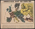
Humoristische Kaart van Europa 1870.jpg 4,995 × 4,160; 6.22 MB
-
Kaart der oneenige staten van Europa.jpg 6,719 × 5,253; 11.74 MB
-
Nieuwe kaart van Europa 1870.jpg 5,027 × 3,952; 6.03 MB
-
1872 satirical map - L'Europe en Ce Moment - Fantaise Politico-Géographique.jpg 5,500 × 3,577; 6.38 MB
-
1872 satirical map - L'Europe en Ce Moment - Fantaise Politico-Géographique.png 5,500 × 3,577; 54.23 MB
-
L'Europe en 1876 a la portée des grands esprits.jpg 7,160 × 5,078; 10.43 MB
-
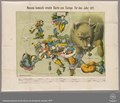
Neueste komisch-ernste Karte von Europa für das Jahr 1877.pdf 3,743 × 3,204; 7.39 MB
-
1877 allegorical map by Augusto Grossi - Il Colosso di Rodi.jpg 3,500 × 5,131; 4.98 MB
-
1877 allegorical map by Augusto Grossi - Il Colosso di Rodi.png 3,500 × 5,131; 48.48 MB
-
1878 allegorical map by Augusto Grossi - Il mondo ammalato.jpg 4,000 × 5,894; 7.72 MB
-
1878 allegorical map by Augusto Grossi - Il mondo ammalato.png 4,000 × 5,894; 59.31 MB
-
Nouvelle Géographie du Pays du Tendre. -- 2me Carte - Province du High-Life.jpg 5,800 × 3,820; 6.83 MB
-
Nouvelle Géographie du Pays du Tendre.jpg 5,700 × 3,734; 6.22 MB
-
1882 satirical map - L'Europe animale - physiologie comique.jpg 9,883 × 7,135; 19.62 MB
-
Das heutige Europa.pdf 3,279 × 2,468; 6.77 MB
-
1895 pictorial map of North America as Uncle Sam.jpg 2,703 × 3,834; 2.05 MB
-
1899 satirical map of Europe - Angling in troubled waters - by Fred W. rose.tiff 9,704 × 7,238; 200.98 MB
-
A new map designed for 1870 LCCN2003690601.jpg 8,320 × 6,998; 9.12 MB
-
A. B. Morozova - Настояшая Европа безъ потдылки.jpg 1,450 × 1,326; 937 KB
-
Aanschouwelijk Vredes-Tooneel Europa na den Vrede van Villa-Franca 1859, RP-P-1911-360.jpg 6,142 × 4,970; 3.22 MB
-
Allegoria sull'impero Inglese by Augusto Grossi.jpg 3,500 × 2,351; 3 MB
-
Angling in Troubled Waters A Serio-Comic Map of Europe.jpg 7,557 × 5,452; 9.36 MB
-
Angling in troubled waters – a serio-comic map of Europe - Kungliga Biblioteket - 2818247-thumb.png 12,010 × 9,183; 517.45 MB
-
Berendsohn Karte Europa 1854.jpg 3,015 × 2,090; 1.6 MB
-
Bernhard Gillam The Trouble In Cuba 1895 Cornell CUL PJM 1123 01.jpg 6,252 × 8,237; 10.42 MB
-
Biglietti postali - primi 900 - mappe (51171801881).jpg 1,622 × 2,169; 1.33 MB
-
Angling in troubled waters- a serio-comic map of Europe. (IA bp 14539).pdf 743 × 1,095, 3 pages; 5.23 MB
-
Ca 1875 satirical map of Europe by Yves & Barret - Carte de la Fraternite Europeenne.jpg 9,429 × 6,730; 7.72 MB
-
Carte allégorique en japonais représentant l'Extrême-Orient - btv1b8445734x.jpg 7,366 × 10,272; 12.1 MB
-
Carte des états désunis d'Europe - Kungliga Biblioteket - 10348540-thumb.png 10,307 × 7,703; 382.93 MB
-
Carte des états désunis d'Europe - Kungliga Biblioteket - 10348540.tif 10,307 × 7,703, 2 pages; 454.33 MB
-
Carte drôlatique d'Europe pour 1870.jpg 5,287 × 4,231; 5.28 MB
-
Comic map of the seat of war with entirely new features 1854.jpg 8,674 × 6,274; 9.15 MB
-
Das heutige Europa - T.B. LCCN2009631645.tif 1,536 × 1,015; 1.49 MB
-
England (8250970956).jpg 1,678 × 2,000; 3.43 MB
-
Europe comique (A. Belloguet).jpg 7,602 × 5,276; 13.56 MB
-
Französische Karte Europa 1870.jpg 1,416 × 1,023; 396 KB
-
Fred W Rose Angling in troubled waters.jpg 3,947 × 2,828; 2.97 MB
-
Fred. W. Rose The Avenger An Allegorical War Map for 1877 1877 Cornell CUL PJM 1080 01.jpg 9,002 × 7,137; 12.83 MB
-
Frederick Burr Opper, Let Them Have It All And Be Done With It! 1882 Cornell CUL PJM 1092 01.jpg 8,021 × 5,685; 11.86 MB
-
German version of the 1870 satirical map of Europe by Hadol.tif 5,757 × 4,274; 10.57 MB
-
Grasp All Lose All, 1814 Cornell CUL PJM 1036 01.jpg 5,616 × 7,917; 7.2 MB
-
Humoristische Karte Europa 1870.jpg 3,555 × 3,049; 5.61 MB
-
Illustration from the Library of Congress, digitally enhanced by rawpixel-com 53.jpg 2,500 × 1,631; 3.74 MB
-
Kaart van Europa in vogelvucht A bird's eye view (titel op object), RP-P-1954-549.jpg 7,918 × 5,236; 5.69 MB
-
Komische karte des Kriegsschauplatzes LCCN2003688898.jpg 8,519 × 6,138; 8.04 MB
-
Komische karte des Kriegsschauplatzes LCCN2003688898.tif 8,519 × 6,138; 149.63 MB
-
L'Europe animée, composition de A. Belloguet sur la topographie de l'Europe - btv1b53093117z.jpg 8,705 × 6,695; 10.16 MB
-
L'Europe comique - par A. Belloguet, cocasseris dédiée à la jeunesse... - btv1b53093097w.jpg 8,785 × 6,646; 12.02 MB
-
La piovra Russa LCCN2003688829.jpg 9,544 × 6,832; 10.89 MB
-
La piovra Russa LCCN2003688829.tif 9,544 × 6,832; 186.65 MB
-
La Prusse s'arrêtant ou La ligne exacte de Démarcation de l'Armistice - btv1b53230712n.jpg 5,594 × 4,892; 3.47 MB
-
Latest war map of Europe - as seen through French eyes LOC 2010587001.jpg 5,300 × 3,958; 3.23 MB
-
Latest war map of Europe - as seen through French eyes LOC 2010587001.tif 5,300 × 3,958; 60.02 MB
-
Latest War Map of Europe 1870.jpg 5,110 × 3,784; 6.44 MB
-
Latest war map of Europe LCCN2003663898.jpg 6,912 × 5,418; 6.86 MB
-
Latest war map of Europe LCCN2003663898.tif 6,912 × 5,418; 107.3 MB
-
Lilian Lancaster England map.jpg 1,405 × 2,000; 294 KB
-
Lilian Lancaster Russia map.jpg 748 × 900; 253 KB
-
Nouvelle carte d'Europe.jpg 1,199 × 863; 335 KB
-
Nouvelle carte d'Europe.png 9,146 × 6,583; 134.66 MB
-
Octopus in Europe. Humoristische-oorlogskaart by J.J. van Brederode, 1870.jpg 1,024 × 737; 420 KB
-
Oorlogstoneel 1859.jpg 3,075 × 2,590; 1.58 MB
-
Papagallo no 15 la piovra russa anno VI LCCN2003688829.jpg 9,496 × 6,832; 13.52 MB
-
Pictorial map of Italy 1868.jpg 1,670 × 2,000; 2.85 MB
-
Pictorial Map of Italy.1868.jpg 5,475 × 6,560; 33.5 MB
-
Political Map of 19th Century China(時局全圖).jpg 580 × 974; 259 KB
-
Politische Charte von Europa, 1848 Moldau.png 375 × 324; 114 KB
-
Politische Charte von Europa, 1848.jpg 4,340 × 3,153; 3.81 MB
-
Rusofob pic8.jpg 600 × 442; 48 KB
-
Satirical Europe in 1870.jpg 1,119 × 715; 265 KB
-
Satirical map of Europe, 1877.jpg 6,720 × 5,040; 4.32 MB
-
Satirical Map of Europe, 1887.jpg 1,479 × 921; 369 KB
-
Scotland (8250971174).jpg 1,675 × 2,000; 3.49 MB
-
Serio-comic war map for 1877.jpg 8,440 × 6,448; 13.21 MB
-
Serio-Comic War Map For The Year 1877.jpg 9,268 × 6,946; 16.15 MB
-
Tibet, Political Map of 19th Century China(時局全圖) (cropped).jpg 149 × 108; 9 KB
-
Wales (8249902781).jpg 1,681 × 2,000; 2.79 MB
-
William Mecham Modern St. George and The Dragon 1888 Cornell CUL PJM 1100 01.jpg 4,299 × 6,250; 6.98 MB
-
Yves & Barret L'Europe en ce Moment 1872 Cornell CUL PJM 2082 01.jpg 9,145 × 6,023; 12.13 MB
-
Österreich 1848.jpg 3,485 × 2,345; 2.11 MB


