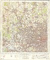
Category:1960s maps of London
Jump to navigation
Jump to search
Media in category "1960s maps of London"
The following 5 files are in this category, out of 5 total.
-
London and the Thames estuary, Pergamon World Atlas 1967.jpg 1,720 × 1,167; 1.1 MB
-
Ordnance Survey One-Inch Sheet 160 London N.W., Published 1963.jpg 8,290 × 9,967; 13.83 MB
-
Ordnance Survey One-Inch Sheet 171 London SE, Published 1964.jpg 8,317 × 9,976; 13.72 MB
-
Ordnance Survey Quarter-inch sheet 17 South-East England, published 1962.jpg 9,592 × 8,915; 12.13 MB
-
Portland Road, Notting Hill, Ordnance Survey map 1960s.jpg 6,214 × 8,572; 16.46 MB


