Category:1960s maps of England
Jump to navigation
Jump to search
Media in category "1960s maps of England"
The following 11 files are in this category, out of 11 total.
-
Ordnance Survey One-Inch Sheet 123 Spalding, Published 1963.jpg 8,232 × 9,885; 8.87 MB
-
Ordnance Survey Quarter-inch Sheet 14 East Anglia, Published 1966.jpg 9,679 × 8,895; 10.82 MB
-
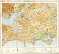
Ordnance Survey Quarter-inch Sheet 16 Southern England, Published 1966.jpg 9,646 × 8,909; 12.19 MB
-
Central and Northern England, 1967.jpg 2,130 × 2,888; 1.43 MB
-
England, Wales and Ireland, 1967.jpg 4,766 × 2,884; 3.23 MB
-
English Channel, 1967.jpg 4,053 × 2,892; 2.34 MB
-
Ministry of Defence Series 1404 sheet 171-C Birmingham, published 1967.jpg 6,936 × 5,430; 10.81 MB
-
Ordnance Survey One-Inch Sheet 134 Huntingdon & Peterborough, Published 1968 2.jpg 8,676 × 10,876; 10.56 MB
-
Ordnance Survey One-Inch Sheet 134 Huntingdon & Peterborough, Published 1968.jpg 8,341 × 9,859; 8.98 MB
-
Bootle New Strand Map c1965.jpg 784 × 606; 276 KB
-
Photo of Post Office Journal Radio telephone Map.png 573 × 785; 303 KB


