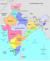
Category:1959 maps of India
Jump to navigation
Jump to search
English: 1959 maps made in India or from India or showing history of India
Media in category "1959 maps of India"
The following 10 files are in this category, out of 10 total.
-
1959 India's Frontier with China by Indian Ministry of External Affairs.jpg 4,392 × 2,514; 1.04 MB
-
1959 Political Map of India showning boundary with China.jpg 7,056 × 4,926; 3.17 MB
-
AMS Cuttack, Orissa, Golbai.jpg 813 × 649; 726 KB
-
AMS Trivandrum (cropped) now Thiruvananthapuram costal region.jpg 862 × 1,149; 305 KB
-
AMS Trivandrum.jpg 5,000 × 3,819; 4.27 MB
-
AMS-Sispara-topo.jpg 2,400 × 2,532; 2.62 MB
-
1959 North Indian Ocean cyclone season summary.jpg 3,000 × 1,854; 585 KB
-
Indien 1959-hu.svg 985 × 1,185; 342 KB
-
Indien 1959.svg 985 × 1,185; 307 KB
-
Srinagar city 1959.jpg 909 × 1,158; 142 KB


