Category:1951 maps of India
Jump to navigation
Jump to search
English: 1951 maps made in India or from India or showing history of India
Subcategories
This category has only the following subcategory.
Media in category "1951 maps of India"
The following 12 files are in this category, out of 12 total.
-
Hyderabad district map 1951.svg 587 × 521; 27 KB
-
India Administrative Divisions 1951.svg 851 × 1,188; 1.86 MB
-
Indian States 1951.svg 645 × 738; 427 KB
-
Indien 1951-hu.svg 983 × 1,182; 204 KB
-
Indien 1951.svg 983 × 1,182; 187 KB
-
Jangaon Taluk 1951.jpg 1,038 × 1,200; 281 KB
-
Jangaon Taluk.jpg 1,210 × 1,001; 318 KB
-
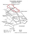
Nalgonda District 1951.jpg 991 × 1,226; 283 KB
-
National Geographic Map of Indian Subcontinent.jpg 2,060 × 1,700; 1.1 MB
-
Peninsular India - DPLA - 820bc9ac89e076e9cecdbc5f6e6192a6.jpg 9,000 × 8,723; 7.25 MB
-
Peninsular India - DPLA - df687d619d056b08fd8b5183a5d49168.jpg 9,000 × 8,727; 7 MB
-
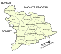
Warangal District 1951.jpg 1,232 × 1,021; 318 KB


