Category:1955 maps of the United States
Jump to navigation
Jump to search
States of the United States: California · Idaho · Illinois · Louisiana · Maryland · New York · Pennsylvania
Subcategories
This category has the following 9 subcategories, out of 9 total.
1
- 1955 Yellow Book maps (106 F)
C
- 1955 maps of California (3 F)
I
- 1955 maps of Idaho (4 F)
- 1955 maps of Illinois (1 F)
L
- 1955 maps of Louisiana (5 F)
M
- 1955 maps of Maryland (1 F)
N
P
Media in category "1955 maps of the United States"
The following 3 files are in this category, out of 3 total.
-
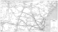 1955 Boston and Maine Railroad system map.png 4,704 × 2,588; 10.17 MB
-
 USA 55 big.jpg 2,467 × 1,788; 1.89 MB
-
 USA 55 small.jpg 1,004 × 679; 326 KB


