Category:1949 maps of the United States
Jump to navigation
Jump to search
Countries of the Americas: Brazil · Canada · United States of America · Venezuela
Other areas: Greenland · Puerto Rico
Other areas: Greenland · Puerto Rico
Subcategories
This category has the following 11 subcategories, out of 11 total.
I
- 1949 maps of Idaho (1 F)
L
- 1949 maps of Louisiana (9 F)
M
- 1949 maps of Montana (1 F)
N
- 1949 maps of Nevada (1 F)
O
- 1949 maps of Oklahoma (1 F)
P
- 1949 maps of Puerto Rico (2 F)
U
W
- 1949 maps of Wyoming (1 F)
Media in category "1949 maps of the United States"
The following 15 files are in this category, out of 15 total.
-
California (Southern part) Location of irrigated Land, 1949 - btv1b53200425b (1 of 2).jpg 9,188 × 8,374; 8.27 MB
-
California (Southern part) Location of irrigated Land, 1949 - btv1b53200425b (2 of 2).jpg 11,855 × 8,579; 10.53 MB
-
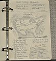
Itinerary plan of On the road by Jack Kerouac.JPG 2,608 × 2,839; 777 KB
-
Kansas Location of irrigated land, 50 miles (=81mm. ; 1 - 1 000 000 env) - btv1b53200430h.jpg 10,356 × 7,081; 7.55 MB
-
Maps and Charts - All States - DPLA - 4139b1004394869c84e908484e912841.jpg 4,997 × 3,966; 2.44 MB
-
Nebraska. Location of irrigated Land - btv1b53200428p.jpg 9,712 × 6,912; 6.99 MB
-
Oregon Location of irrigated Land - btv1b53200435r.jpg 10,000 × 8,493; 9.53 MB
-
South Dakota. Location of irrigated land. 1949 - btv1b532004203.jpg 9,853 × 6,550; 7.19 MB
-
The pictorial map, United States stamps (35048884061) (2).jpg 2,000 × 1,185; 2.59 MB
-
The pictorial map, United States stamps (35048884061).jpg 8,696 × 5,152; 11.65 MB
-
Washington. Location of irrigated Land. 1949 - btv1b53200421j.jpg 9,709 × 5,700; 6.91 MB


