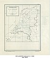
Category:1949 maps of the Netherlands
Jump to navigation
Jump to search
Provinces of the Netherlands:
Media in category "1949 maps of the Netherlands"
The following 3 files are in this category, out of 3 total.
-
Netherlands - DPLA - 47a985e942b2651398753e34d20ef8fa.jpg 3,391 × 3,915; 1.54 MB
-
Netherlands - DPLA - 619762136eb1556903959ae9b07f9143.jpg 9,258 × 6,941; 6.6 MB
-
Netherlands - DPLA - f0b66c0b4421ba7eb6f85ba719233aab.jpg 9,298 × 6,960; 6.51 MB


