Category:1949 maps of Germany
Jump to navigation
Jump to search
Federal states of Germany:
Subcategories
This category has the following 3 subcategories, out of 3 total.
Media in category "1949 maps of Germany"
The following 16 files are in this category, out of 16 total.
-
Stadtplan Gross Berlin 1949.png 19,684 × 13,636; 573.43 MB
-
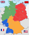
Germany location map labeled 8 Jun 1947 - 22 Apr 1949-colored.svg 1,075 × 1,273; 822 KB
-
Deutschland Besatzungszonen 8 Jun 1947 - 22 Apr 1949 britisch.svg 1,075 × 1,273; 738 KB
-
Bundestagswahl 1949 - Ergebnisse Wahlkreise.png 1,100 × 1,600; 151 KB
-
Deutschland mit Postleitgebieten und Besatzungszonen - btv1b531896061.jpg 10,442 × 8,470; 17.47 MB
-
Germany - DPLA - aaaac3bc37af11ec9183010a2bb50d1b.jpg 8,346 × 10,477; 10.44 MB
-
Germany - DPLA - afbafb002b8632ff1b968611ec46186e (page 1).jpg 3,996 × 5,173; 1.79 MB
-
Germany - DPLA - afbafb002b8632ff1b968611ec46186e (page 2).jpg 3,976 × 5,161; 2.07 MB
-
Germany - DPLA - bfe656dab6997aa5a426d3b52fe8eb5f.jpg 8,314 × 10,471; 8.52 MB
-
Germany - DPLA - f1840073cbd77aa74e92a2e4f4fd1ad8.jpg 4,008 × 5,185; 1.47 MB
-
Germany Location of Map Publishers - DPLA - 9904ee0c6a813c52ddd27ef98b407804.jpg 3,480 × 3,332; 798 KB
-
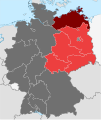
GDR location map Oct1949 - Jul1952 MV.svg 1,075 × 1,273; 742 KB
-
Soviet Zone- Germany Police Organization - DPLA - 8171351128b29df57feefbb775586b61.jpg 4,678 × 4,746; 2.44 MB
-
West German Federal Election - Party results by state - 1949.png 900 × 1,300; 51 KB
-
West’s Germany (cropped).jpg 2,899 × 3,972; 5.02 MB
-
West’s Germany.jpg 4,961 × 6,883; 8.98 MB


