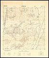
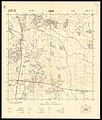
Category:1948 maps of Israel
Jump to navigation
Jump to search
Media in category "1948 maps of Israel"
The following 7 files are in this category, out of 7 total.
-
14-18-ATira-1948.jpg 7,051 × 8,326; 7.62 MB
-
14-19-Cacoun-1948.jpg 7,090 × 8,350; 7.35 MB
-
Battle for Palestine (cropped).png 1,266 × 1,749; 4.04 MB
-
DeirYassin1948.jpg 2,310 × 1,564; 980 KB
-
Green Line - Cease Fire Agreement 30 Nov 1948.jpg 3,119 × 8,630; 7.33 MB
-
Jaffa (997009322923805171.jpg 1,314 × 1,305; 1.58 MB
-
Palestine-Israel Historic Borders Over Time.png 4,849 × 2,156; 2.47 MB


