Category:1947 maps
Jump to navigation
Jump to search
| ← · 1940 · 1941 · 1942 · 1943 · 1944 · 1945 · 1946 · 1947 · 1948 · 1949 · → |
Deutsch: Karten mit Bezug zum Jahr 1947
English: Maps related to the year 1947
Español: Mapas relativos al año 1947
Français : Cartes concernant l’an 1947
Русский: Карты 1947 года
Subcategories
This category has the following 8 subcategories, out of 8 total.
Media in category "1947 maps"
The following 76 files are in this category, out of 76 total.
-
 Admiralty Chart No 3777 Magnetic Variation Sheet 3 Eastern Pacific Ocean 1947.jpg 11,058 × 16,212; 32.17 MB
-
 After Action Report - Innsbruck - NARA - 100384931.jpg 10,800 × 7,813; 9.61 MB
-
 Bell telephone magazine (1922) (14776694803).jpg 3,056 × 2,226; 1.57 MB
-
 Ben Zvi Institute, מפת איזור רחוב הנביאים ושכונת החבשים - 1947 (FL169299411 3761068).jpg 8,304 × 5,968; 57.33 MB
-
 Canal Zone and vicinity, 1-100,000. LOC 83694755.jpg 11,632 × 8,285; 10.23 MB
-
 Canal Zone and vicinity, 1-100,000. LOC 83694755.tif 11,632 × 8,285; 275.72 MB
-

-

-
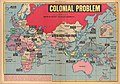 Colonial problem, 1947.jpg 1,861 × 1,301; 440 KB
-
 Department of Civil Aviation, Lydda airport (FL62290831 2647413).jpg 6,166 × 9,510; 62.16 MB
-
 El Fureidis catchment area (FL28943536 2692959).jpg 17,995 × 11,093; 202.74 MB
-
 Europa 17 u. 18 Jh.jpg 5,536 × 4,336; 10.3 MB
-
 France location map-Departements 1947.svg 2,000 × 1,922; 573 KB
-
 Great Britain army 517 Field Survey Company, Palestine (FL27968186 2701049).jpg 15,154 × 21,513; 492.43 MB
-
 Great Britain Army, Esh Sh. Nuran (FL28026066 3804832).jpg 11,721 × 14,492; 202.21 MB
-
 Great Britain Army, Khirbat el Far (FL28026058 3804835).jpg 12,007 × 14,627; 205.28 MB
-
 Great Britain Army, Khirbat Muleih (FL28026097 3804838).jpg 11,817 × 13,971; 200.65 MB
-
 Jerusalem Reproduced and printed by survey of Palestine.jpg 2,347 × 4,388; 2.61 MB
-
 Jerusalem1947.png 677 × 681; 51 KB
-
 Jewish Agency for Israel, בדיקת קרקעות המפה המשולשת 01-threefold (FL42747578 2367512).jpg 11,810 × 19,439; 277.25 MB
-
 Jewish Agency for Israel, בדיקת קרקעות המפה המשולשת 02-hygroscopic-water (FL42747583 2367512).jpg 11,912 × 19,379; 289.42 MB
-
 Jewish Agency for Israel, בדיקת קרקעות המפה המשולשת 03-depth-of-soil (FL42747585 2367512).jpg 11,991 × 18,533; 266.5 MB
-
 Jewish Agency for Israel, בדיקת קרקעות המפה המשולשת 04-lime-content (FL42747589 2367512).jpg 11,757 × 19,240; 283.44 MB
-
 Jewish Agency for Israel, בדיקת קרקעות המפה המשולשת 05-soil-types (FL42747592 2367512).jpg 11,934 × 19,379; 285.02 MB
-
 Jewish National Fund, ארץ ישראל 01 (FL184519958 2370249).jpg 2,328 × 4,321; 9.83 MB
-
 Jewish National Fund, ארץ ישראל 02 (FL184519959 2370249).jpg 2,866 × 2,351; 5.9 MB
-
 Jewish National Fund, ארץ ישראל 03 (FL184519960 2370249).jpg 2,317 × 2,781; 5.28 MB
-
 Jewish National Fund, ארץ ישראל 04 (FL184519961 2370249).jpg 2,346 × 4,345; 9.19 MB
-
 Jewish National Fund, המדינה היהודית (FL27965101 2639401).jpg 5,268 × 13,276; 93.28 MB
-
 Lajjun (Survey of Palestine map).jpg 10,843 × 8,741; 5.32 MB
-
 Map of the Caribbean Area.jpg 3,619 × 2,789; 1.06 MB
-
 Migdal (FL197694432 1134534).jpg 14,477 × 16,912; 324.61 MB
-
 Northern Hemisphere Economic Chart, 1947.jpg 4,096 × 4,076; 2.27 MB
-
 Northern Hemisphere Political and Time chart, 1947.jpg 4,091 × 4,095; 1.94 MB
-
 Northern Hemisphere Population Density chart, 1947.jpg 4,096 × 4,062; 2.04 MB
-
 Northern Hemisphere Transportation chart, 1947.jpg 4,096 × 4,091; 2.3 MB
-
 Ordnance Survey Map of Ashleyhay Location.PNG 437 × 322; 370 KB
-
 Palestine.Police boundaries (FL37665308 3926220).jpg 11,628 × 15,148; 230.04 MB
-
 Messtischblatt 2056 - Stuchowo 1947.jpg 5,711 × 6,312; 13.34 MB
-
 Stát Izrael (FL147391342 5258558).jpg 5,967 × 11,644; 76.76 MB
-
 Survey of Palestine, Edh Dhahiriya (FL173354431 2698461).jpg 15,070 × 14,560; 208.11 MB
-
 Survey of Palestine, El Buqei'a (FL32703837 2698466).jpg 15,410 × 14,286; 272.5 MB
-
 Survey of Palestine, El Buqei'a (FL32703881 2698454).jpg 17,231 × 25,451; 560.5 MB
-
 Survey of Palestine, Gaza (FL60505102 3809037).jpg 15,894 × 13,720; 235.35 MB
-
 Survey of Palestine, Haifa (FL54735273 3808397).jpg 13,238 × 11,313; 208.93 MB
-
 Survey of Palestine, Jerusalem. The Old City (FL155329635 2654902).jpg 14,549 × 17,863; 278.34 MB
-
 Survey of Palestine, Metulla (FL54735259 3808340).jpg 17,027 × 12,472; 275.51 MB
-
 Survey of Palestine, Motor map (FL25553420 2367054).jpg 9,792 × 14,929; 222.19 MB
-
 Survey of Palestine, Palestine administrative divisions (FL36381644 3436887).jpg 4,074 × 7,407; 45.56 MB
-
 Survey of Palestine, Palestine Administrative divisions. to 30.4.47 (FL83894748 3940246).jpg 8,530 × 15,046; 123.53 MB
-
 Survey of Palestine, Rafah (FL60507260 3809571).jpg 15,850 × 12,558; 223.12 MB
-
 Survey of Palestine, Ramle (FL60505001 3808942).jpg 15,182 × 12,594; 224.28 MB
-
 Survey of Palestine, Ramle 01 (FL10423171 2369382).jpg 9,004 × 7,485; 105.37 MB
-
 Survey of Palestine, Ramle 02 (FL10423172 2369382).jpg 9,121 × 7,560; 98 MB
-
 Survey of Palestine, Safad (FL54735336 3808470).jpg 14,510 × 11,596; 254.05 MB
-
 Survey of Palestine, Zikhron Ya'aqov (FL54739331 3808520).jpg 13,730 × 12,007; 237.95 MB
-
 Territorial Claims in Antarctica - DPLA - 8dd337a9c7d77fdfb8e0b76d0c647778.jpg 8,674 × 8,815; 7.74 MB
-
 Tour de France 1947.png 600 × 600; 285 KB
-
-
 United Nations, City of Jerusalem boundaries proposed (FL27965446 2661571).jpg 4,696 × 7,323; 43.33 MB
-
 United Nations, Palestine federal state plan (FL42747130 2366864).jpg 7,360 × 13,645; 137.22 MB
-
 United Nations, Palestine plan de partage (FL27974405 2921288).jpg 7,421 × 12,182; 108.85 MB
-
 United Nations, Palestine plan of partition (FL27965163 2651448).jpg 7,277 × 12,175; 112.11 MB
-
 United Nations, Palestine Plan on partition (FL25570433 2612446).jpg 7,051 × 13,354; 122.69 MB
-
 United Nations, Ville de Jerusalem limites proposees (FL27974388 2921229).jpg 4,694 × 7,247; 44.4 MB
-
-
 Washington and vicinity, Maryland, Virginia, District of Columbia. LOC 87693085.jpg 12,372 × 15,020; 36.05 MB
-
 Washington and vicinity, Maryland, Virginia, District of Columbia. LOC 87693085.tif 12,372 × 15,020; 531.66 MB
-
 Washington, D.C., and vicinity transportation map LOC 87695585.jpg 10,794 × 7,881; 9.33 MB
-
 Washington, D.C., and vicinity transportation map LOC 87695585.tif 10,794 × 7,881; 243.38 MB
-
 גבולות המדינה היהודית (FL13720988 2369398).jpg 3,894 × 8,659; 42.45 MB
-
 חולון אגרובנק בלוק 6020 (FL78830309 3148330).jpg 2,696 × 3,412; 7 MB
-
 מפת בנין עיר פתח תקוה (FL80450092 3558241).jpg 2,562 × 3,234; 6.57 MB
-
 פתח תקוה (FL80450119 3558237).jpg 3,170 × 2,539; 5.94 MB
-
 שכונת קטמון (FL66279935 2729449).jpg 5,114 × 8,154; 51.29 MB
-
 שכונת קטמון, 1947 (FL169299331 3760150).jpg 5,069 × 7,032; 32.32 MB


_(14776694803).jpg)
.jpg)


.jpg)
.jpg)


.jpg)
.jpg)
.jpg)
.jpg)


.jpg)
.jpg)
.jpg)
.jpg)
.jpg)
.jpg)
.jpg)
.jpg)
.jpg)
.jpg)

.jpg)


.jpg)

.jpg)
.jpg)
.jpg)
.jpg)
.jpg)
.jpg)
.jpg)
.jpg)
.jpg)
.jpg)
.jpg)
.jpg)
.jpg)
.jpg)
.jpg)
.jpg)
.jpg)


_-_Caucasus_Area_Telecommunications_-_DPLA_-_05f05db24ceedda1998cf488e947abe9.jpg)
.jpg)
.jpg)
.jpg)
.jpg)
.jpg)
.jpg)
_1946_-_DPLA_-_7af7a6bd2422a78083cbe5753737468a.jpg)

.jpg)
.jpg)
.jpg)
.jpg)
.jpg)
.jpg)
.jpg)