Category:1944 maps
Jump to navigation
Jump to search
| ← · 1940 · 1941 · 1942 · 1943 · 1944 · 1945 · 1946 · 1947 · 1948 · 1949 · → |
Deutsch: Karten mit Bezug zum Jahr 1944
English: Maps related to the year 1944
Español: Mapas relativos al año 1944
Français : Cartes concernant l’an 1944
Русский: Карты 1944 года
Subcategories
This category has the following 10 subcategories, out of 10 total.
Media in category "1944 maps"
The following 89 files are in this category, out of 89 total.
-
1944 Chapin map of American Progress in the Pacific during World War II for TIME Magazine.jpg 8,500 × 7,619; 19.84 MB
-
1944 Germany Population (30249096763).jpg 2,433 × 3,120; 901 KB
-
1944 one inch map showing Glen Massey branch railway.jpg 1,129 × 354; 316 KB
-
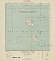
5303 Vanuatu Melanesia Eromanga Island 500K SE59-4.jpg 6,299 × 6,976; 25.33 MB
-
A-7 ALG Azeville Airfield.png 584 × 579; 268 KB
-
A. A. F. special aeronautical chart. Fiji islands - btv1b53189608x.jpg 14,864 × 11,234; 13.65 MB
-
After Action Report - Fulda - NARA - 100384481 (page 1).jpg 10,530 × 8,492; 22.46 MB
-
Alton, Alvin & Andrew Islands, Carillon Atoll - NARA - 100359977.jpg 8,292 × 5,892; 3.01 MB
-
Anthony, Anton & Archibald Islands, Carillon Atoll - NARA - 100359983.jpg 7,892 × 12,113; 3.22 MB
-
Azraq (FL197694319 0916587).jpg 11,472 × 14,469; 216.56 MB
-
Biak Island Operation May-August 1944.jpg 1,999 × 1,412; 3.31 MB
-
Bp-getto-map.jpg 971 × 653; 373 KB
-
City Plan - Diffenbach-les-hellimer - DPLA - d2bed6e2a26153ce32e3cb9e8819fe90.jpg 4,604 × 6,590; 1.74 MB
-
City Plan - Puttelange - DPLA - 9560a935996077a9b347f8abe35ad14b.jpg 8,711 × 6,600; 6.08 MB
-
City Plan - Sarre Union - DPLA - fbfdad8a9e383b65d212133153368542.jpg 6,649 × 4,448; 4.14 MB
-
City Plan - Sarreguemines - DPLA - 15b32b26c5acba8934cc6506fcb1189d.jpg 8,722 × 6,600; 6.74 MB
-
Cobourg Peninsula 1944 map nla.obj-234063743.jpg 5,000 × 3,604; 8.62 MB
-
Der Nahe Osten. LOC 2013586106.jpg 9,942 × 6,710; 13.12 MB
-
Der Nahe Osten. LOC 2013586106.tif 9,942 × 6,710; 190.86 MB
-
Ett Taibe (FL32038257 3808110).jpg 17,319 × 14,618; 348.46 MB
-
Fortification Point.PNG 1,410 × 2,345; 3.66 MB
-
French Service géographique de l'armée, Carmel East (FL79322143 3802817).jpg 15,796 × 12,640; 229.94 MB
-
French Service géographique de l'armée, Carmel west (FL79324118 3803400).jpg 15,692 × 12,416; 204.6 MB
-
French Service géographique de l'armée, Hadera (FL79324113 3803404).jpg 15,932 × 12,533; 200.93 MB
-
French Service géographique de l'armée, Mount Tabor (FL79322154 3802825).jpg 15,698 × 12,348; 220.79 MB
-
Godhavn v2 C501 map sheet.tif 5,544 × 7,390, 2 pages; 117.45 MB
-
Great Britain army 517 Field Survey Company, Ett Taïbé (FL83894889 4072666).jpg 16,924 × 15,058; 258.08 MB
-
Great Britain Army, Hebron east (FL27975725 3805124).jpg 12,453 × 14,500; 233.17 MB
-
Great Britain Geographical Section (War office, General Staff), France (FL35077021 2586255).jpg 14,721 × 18,149; 381.23 MB
-
Guadalcanal Map, 1944 (6026283464).jpg 3,624 × 2,736; 829 KB
-
Messtischblatt 4609 Hattingen 193x.jpg 10,328 × 7,948; 16 MB
-
Irrigation Department, Eretz Israel (FL24942411 2366880).jpg 12,703 × 20,554; 323.64 MB
-
Isle of Pines to Uen Island 1944 nautical chart.jpg 3,272 × 5,000; 2.47 MB
-
Henry Kendall plan for Jerusalem 1944.png 4,861 × 6,593; 50.47 MB
-
Jerusalem Old City - Plan illustrating encroachments (FL165906080 0953874).jpg 6,041 × 7,726; 32.9 MB
-
Jewish National Fund, ההתישבות החדשה 1936-1944 (FL13733962 3432179).jpg 4,924 × 7,639; 56.44 MB
-
Jouaiya (FL27979161 3807402).jpg 16,265 × 13,328; 229.43 MB
-
Location siauliai operation.png 750 × 872; 2.5 MB
-
Map, water services, Wellcome Veterinary Research Station Wellcome L0038247.jpg 21,261 × 13,033; 73.81 MB
-
Maria Atoll cropped from Raivavae 1944 nautical chart.jpg 1,146 × 1,032; 169 KB
-
New Georgia Island map 1944.jpg 3,090 × 3,654; 1.79 MB
-
Plaquemines Parish Louisiana Empire Area Map 1944.jpg 2,366 × 2,930; 2.2 MB
-
R. Feige and A. Rosenau, Average rainfall map (FL37803238 2671940).jpg 8,287 × 10,500; 112.79 MB
-
Raivavae 1944 nautical chart.jpg 7,286 × 5,489; 4.22 MB
-
Reitetō senkyō yōzu - Shō. 19. 12. matsu made happyō. LOC 2010428024.jpg 11,028 × 14,939; 16.07 MB
-
Rome2Arno1944.jpg 600 × 953; 241 KB
-
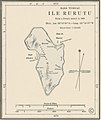
Rurutu cropped fromRaivavae 1944 nautical chart.jpg 1,074 × 1,278; 225 KB
-
Survey of Palestine, Abasan (FL28026082 3804833).jpg 12,365 × 14,611; 222.57 MB
-
Survey of Palestine, Beersheba (FL60507239 3809589).jpg 15,826 × 12,782; 226.1 MB
-
Survey of Palestine, Beit Affa (FL60915874 3520635).jpg 18,012 × 12,696; 207.25 MB
-
Survey of Palestine, Bethlehem (FL27975736 3805125).jpg 11,740 × 14,786; 201.59 MB
-
Survey of Palestine, Central Judæa (FL35058298 2366967).jpg 13,721 × 15,469; 326.17 MB
-
Survey of Palestine, Gaza (FL60505083 3809018).jpg 15,796 × 12,758; 226.55 MB
-
Survey of Palestine, Haifa (FL54735254 3808395).jpg 14,522 × 11,627; 224.68 MB
-
Survey of Palestine, Hebron (FL60505830 3809540).jpg 15,758 × 12,882; 233.16 MB
-
Survey of Palestine, Jaffa - Tel Aviv 01-map (FL37665483 3926210).jpg 5,645 × 8,230; 59.27 MB
-
Survey of Palestine, Jaffa - Tel Aviv 02-verso (FL37665484 3926210).jpg 5,714 × 8,273; 59.3 MB
-
Survey of Palestine, Jerusalem (FL60505030 3808987).jpg 15,010 × 13,048; 221.93 MB
-
Survey of Palestine, Kh. El. Adas 00-index (FL28026052 3804817).jpg 8,950 × 12,388; 39.52 MB
-
Survey of Palestine, Kh. El. Adas 01 (FL28026061 3804817).jpg 12,383 × 14,254; 170.37 MB
-
Survey of Palestine, Khan Yunis (FL28026053 3804827).jpg 12,678 × 14,566; 189.83 MB
-
Survey of Palestine, Latrun (FL28026346 3805082).jpg 11,176 × 13,606; 196.77 MB
-
Survey of Palestine, Metulla (FL54735267 3808334).jpg 17,492 × 13,199; 310.53 MB
-
Survey of Palestine, Nablus (FL60504924 3808663).jpg 15,574 × 12,884; 230.8 MB
-
Survey of Palestine, Nazareth (FL54739343 3808530).jpg 14,807 × 11,783; 248.06 MB
-
Survey of Palestine, Palestine (FL25562414 2367660).jpg 15,572 × 22,050; 491.81 MB
-
Survey of Palestine, Palestine North sheet (FL31740142 3250778).jpg 15,436 × 21,837; 458.34 MB
-
Survey of Palestine, Palestine of the Crusades (FL51320652 2367013).jpg 12,661 × 18,361; 341.65 MB
-
Survey of Palestine, Rafah (FL60507265 3809569).jpg 15,858 × 12,810; 233.69 MB
-
Survey of Palestine, Ramle (FL60505024 3808954).jpg 15,556 × 13,010; 239.59 MB
-
Survey of Palestine, Safad (FL54735303 3808468).jpg 14,407 × 11,475; 241.3 MB
-
Survey of Palestine, Yibna (FL60504973 3808682).jpg 15,576 × 12,744; 216.65 MB
-
Survey of Palestine, Zikhron Ya'aqov (FL54739316 3808474).jpg 13,797 × 11,339; 213.17 MB
-
Tiwi Melville Bathurst Islands nla.obj-234063639-1.jpg 5,000 × 3,726; 10.86 MB
-
Totoya.jpg 634 × 633; 66 KB
-
Town plan of Roma (Rome) LOC map47000177.tif 15,102 × 11,880; 513.3 MB
-
Tyr (FL27977835 3807304).jpg 16,637 × 13,731; 294.44 MB
-
Washington and vicinity, Maryland, Virginia, District of Columbia. LOC 87693081.jpg 12,778 × 15,284; 39 MB
-
Yaroslavl RSHA 1944.jpg 7,206 × 4,799; 6.75 MB
-
Zabqine (FL27977825 3807101).jpg 16,699 × 13,692; 247.94 MB


