Category:1912 U.S. presidential election maps
Jump to navigation
Jump to search
- 1789
- 1792
- 1796
- 1800
- 1804
- 1808
- 1812
- 1816
- 1820
- 1824
- 1828
- 1832
- 1836
- 1840
- 1844
- 1848
- 1852
- 1856
- 1860
- 1864
- 1868
- 1872
- 1876
- 1880
- 1884
- 1888
- 1892
- 1896
- 1900
- 1904
- 1908
- 1912
- 1916
- 1920
- 1924
- 1928
- 1932
- 1936
- 1940
- 1944
- 1948
- 1952
- 1956
- 1960
- 1964
- 1968
- 1972
- 1976
- 1980
- 1984
- 1988
- 1992
- 1996
- 2000
- 2004
- 2008
- 2012
- 2016
- 2020
- 2024
- 2028
Subcategories
This category has the following 2 subcategories, out of 2 total.
Media in category "1912 U.S. presidential election maps"
The following 11 files are in this category, out of 11 total.
-
1912 Electoral Map.png 1,182 × 635; 86 KB
-
1912 Rep Primaries.svg 1,020 × 593; 104 KB
-
1912 United States Presidential Election in Pittsburgh, Pennsylvania.svg 1,055 × 725; 39 KB
-
1912 US Presidential Election in Florida by county.svg 800 × 769; 2.02 MB
-
1912 US Presidential Election in Florida by county1.svg 800 × 769; 2.02 MB
-
Electoral Map of 1912 Election (4454344005).jpg 3,003 × 2,385; 1.9 MB
-
ElectoralCollege1912-Large.png 1,182 × 635; 105 KB
-
ElectoralCollege1912.svg 1,020 × 593; 25 KB
-
Map of USA presidential elections 1912.PNG 280 × 183; 13 KB
-
Pledged delegates June 22, 1912.jpg 1,200 × 840; 131 KB
-
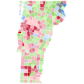
Vermont Presidential Election Results 1912 by Municipality.svg 810 × 810; 106 KB


