Category:1848 U.S. presidential election maps
Jump to navigation
Jump to search
Subcategories
This category has the following 2 subcategories, out of 2 total.
Media in category "1848 U.S. presidential election maps"
The following 20 files are in this category, out of 20 total.
-
 1848 Electoral Map.png 868 × 635; 126 KB
-
 1848DemocraticPresidentialNomination1stBallot.png 1,513 × 983; 65 KB
-
 1848DemocraticPresidentialNomination2ndBallot.png 1,513 × 983; 64 KB
-
 1848DemocraticPresidentialNomination3rdBallot.png 1,513 × 983; 60 KB
-
 1848DemocraticPresidentialNomination4thBallot.png 1,513 × 983; 61 KB
-
 1848DemocraticVicePresidentialNomination1stBallot.png 1,513 × 983; 67 KB
-
 1848DemocraticVicePresidentialNomination2ndBallotAfter.png 1,513 × 983; 45 KB
-
 1848DemocraticVicePresidentialNomination2ndBallotBefore.png 1,513 × 983; 61 KB
-
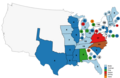
 1848IllinoisResults.png 1,136 × 2,047; 297 KB
-
 1848WhigPresidentialNomination1stBallot.png 1,513 × 983; 65 KB
-
 1848WhigPresidentialNomination2ndBallot.png 1,513 × 983; 63 KB
-
 1848WhigPresidentialNomination3rdBallot.png 1,513 × 983; 65 KB
-
 1848WhigPresidentialNomination4thBallot.png 1,513 × 983; 60 KB
-
 1848WhigVicePresidentialNomination1stBallot.png 1,513 × 983; 72 KB
-
 1848WhigVicePresidentialNomination2ndBallot.png 1,513 × 983; 64 KB
-
 ElectoralCollege1848-Large.png 868 × 635; 77 KB
-
 ElectoralCollege1848.svg 1,020 × 593; 170 KB
-
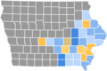 IowaCountyResults1848.png 1,280 × 858; 151 KB
-
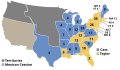
 Map of USA presidential elections 1848.PNG 280 × 183; 12 KB
-
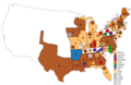
 PresidentialCounty1848.gif 2,800 × 2,200; 208 KB


