Category:1907 maps
Jump to navigation
Jump to search
| ← · 1900 · 1901 · 1902 · 1903 · 1904 · 1905 · 1906 · 1907 · 1908 · 1909 · → |
Deutsch: Karten mit Bezug zum Jahr 1907
English: Maps related to the year 1907
Español: Mapas relativos al año 1907
Français : Cartes concernant l’an 1907
Русский: Карты 1907 года
Subcategories
This category has the following 10 subcategories, out of 10 total.
Media in category "1907 maps"
The following 147 files are in this category, out of 147 total.
-
(Arlington, N.J. LOC 75694712.jpg 8,144 × 4,928; 12.86 MB
-
1907 BERy system map.jpg 2,379 × 3,500; 1.05 MB
-
1907 GPO Circulation map of Ireland.jpg 1,100 × 1,343; 348 KB
-
JOHNSTON(1907) Sketch Map of the Republik of Liberia.jpg 600 × 687; 337 KB
-
1907 Nepal with part of Tibet by Survey of India-1.jpg 10,454 × 7,302; 5.13 MB
-
Bird's eye view of Bristol, Conn. 1907. LOC 75693147.jpg 10,752 × 9,568; 18.37 MB
-
Bird's eye view of Bristol, Conn. 1907. LOC 75693147.tif 10,752 × 9,568; 294.33 MB
-
Bird's eye view of Plainville, Connecticut 1907. LOC 75693161.jpg 9,040 × 6,272; 16.8 MB
-
Bird's eye view of Rocky Mount, North Carolina 1907 LOC gm71005370.jpg 9,120 × 6,800; 17.92 MB
-
Bird's eye view of Rocky Mount, North Carolina 1907 LOC gm71005370.tif 9,120 × 6,800; 177.43 MB
-
Bird's eye view of Torrington, Connecticut 1907. LOC 75693164.jpg 11,392 × 9,120; 16.45 MB
-
Bird's-eye-view of Hickory, North Carolina. LOC gm71005334.jpg 9,048 × 6,280; 9.43 MB
-
Bird's-eye-view of Hickory, North Carolina. LOC gm71005334.tif 9,048 × 6,280; 162.57 MB
-
Bird's-eye-view of Statesville, North Carolina, LOC gm71005348.jpg 8,976 × 6,064; 8.82 MB
-
Bird's-eye-view of Statesville, North Carolina, LOC gm71005348.tif 8,976 × 6,064; 155.73 MB
-
Birds eye view of Chestertown, Kent Co., Maryland 1907. LOC 73693132.jpg 8,320 × 6,560; 13.98 MB
-
Birds eye view of Chestertown, Kent Co., Maryland 1907. LOC 73693132.tif 8,320 × 6,560; 156.15 MB
-
Birds eye view of Chestertown, Kent Co., Maryland 1907. LOC 76695287.jpg 8,652 × 6,816; 13.89 MB
-
Birds eye view of Chestertown, Kent Co., Maryland 1907. LOC 76695287.tif 8,652 × 6,816; 168.72 MB
-
Birds eye view of Emporia, Virginia 1907. LOC 75696640.jpg 8,944 × 7,200; 24.17 MB
-
Birds eye view of Emporia, Virginia 1907. LOC 75696640.tif 8,944 × 7,200; 184.24 MB
-
Birds eye view of Franklin, Southampton Co., Virginia 1907. LOC 75696641.jpg 7,608 × 5,880; 13.52 MB
-
Birds eye view of Franklin, Southampton Co., Virginia 1907. LOC 75696641.tif 7,608 × 5,880; 127.99 MB
-
Birds eye view of Havre de Grace, Maryland 1907. LOC 75694538.tif 7,024 × 6,288; 126.36 MB
-
Birds eye view of Suffolk, Nansemond Co., Va. 1907. LOC 75696652.jpg 11,535 × 8,247; 20.59 MB
-
Birds eye view of Suffolk, Nansemond Co., Va. 1907. LOC 75696652.tif 11,535 × 8,247; 272.17 MB
-
Messtischblatt 4407 Bottrop 1907 Rechteck.jpg 7,318 × 7,054; 13.7 MB
-
Messtischblatt 4407 Bottrop 1907.jpg 8,275 × 8,721; 14.84 MB
-
Brooklyn V. 9, Plate No. 13 (Map bounded by cemetery of the Evergreen, Oonway St., Broadway, Aberdeen St.) NYPL1810733.tiff 5,412 × 7,216, 2 pages; 111.79 MB
-
Bulletin (1907) (19805839274).jpg 3,376 × 2,232; 1.79 MB
-
Bulletin du Muséum d'histoire naturelle (1907) (20430990892).jpg 3,696 × 2,334; 1.66 MB
-
Buzzards Bay (2676003036).jpg 2,000 × 1,574; 3.56 MB
-
Carte de la Marne (Cahier d'écolier 1907).jpg 2,549 × 2,433; 1.26 MB
-
Chevy Chase, D.C. LOC 88690783.jpg 9,554 × 6,318; 7.11 MB
-
Chevy Chase, D.C. LOC 88690783.tif 9,554 × 6,318; 172.7 MB
-
Chippewa-Falls, Wisonsin (sic) county-seat of Chippewa County 1907. LOC 75696706.jpg 9,616 × 6,256; 11 MB
-
Chippewa-Falls, Wisonsin (sic) county-seat of Chippewa County 1907. LOC 75696706.tif 9,616 × 6,256; 172.11 MB
-
Cimislia 1907.png 855 × 698; 1.29 MB
-
Messtischblatt 4410 Dortmund 1907.jpg 1,654 × 1,735; 976 KB
-
Messtischblatt 4506 Duisburg 1907.jpg 8,268 × 8,687; 13.52 MB
-
Electric railway review (1906) (14758398932).jpg 1,860 × 2,830; 972 KB
-
Electric Railway Review-New York, Auburn and Lansing Railroad map.png 526 × 528; 156 KB
-
Elementary physical geography (1907) (14748948196).jpg 1,710 × 2,012; 456 KB
-
Messtischblatt 4408 Gelsenkirchen 1907 Rechteck.jpg 7,318 × 7,054; 15.43 MB
-
Ideal map of Gettysburg battlefield LOC 99448793.jpg 6,263 × 6,524; 6.33 MB
-
Ideal map of Gettysburg battlefield LOC 99448793.tif 6,263 × 6,524; 116.9 MB
-
Italy (1907) (14764224574).jpg 1,882 × 2,046; 364 KB
-
Jarvis' Pictorial map of Washington, D.C. LOC 87693423.jpg 7,816 × 3,773; 4.5 MB
-
Jarvis' Pictorial map of Washington, D.C. LOC 87693423.tif 7,816 × 3,773; 84.37 MB
-
Jerusalem (FL198245530 1143541).jpg 4,653 × 3,608; 16.03 MB
-
Jerusalem (FL4536122 2367055).jpg 6,744 × 5,416; 49.44 MB
-
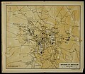
John Bartholomew & Co., Environs of Jerusalem (FL173354572 0991247).jpg 3,869 × 3,381; 13.05 MB
-
John Bartholomew & Co., Plan of Jerusalem (FL10527164 3446900).jpg 5,169 × 2,694; 21.01 MB
-
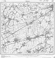
Messtischblatt 4411 Kamen 1907.jpg 1,654 × 1,763; 933 KB
-
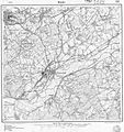
Messtischblatt 4511 Hoerde 1907.jpg 1,654 × 1,763; 1,008 KB
-
Kushunkotan Map of 1907.jpg 1,683 × 1,073; 598 KB
-
Land south of squares 1131 etc. - (S.E. Washington D.C.) LOC 88690698.jpg 8,138 × 5,296; 8.29 MB
-
Land south of squares 1131 etc. - (S.E. Washington D.C.) LOC 88690698.tif 8,138 × 5,296; 123.31 MB
-
Lev S. Berg - Ethnographic map of Bessarabia.jpg 4,556 × 6,816; 12.53 MB
-
Linguistic families of American Indians north of Mexico. NYPL55114.tiff 4,896 × 5,251; 73.56 MB
-
Messtischblatt 4210 Luedinghausen 1907 Rechteck.jpg 6,705 × 6,463; 10.1 MB
-
Messtischblatt 4210 Luedinghausen 1907.jpg 7,279 × 7,634; 11.95 MB
-
Messtischblatt 4311 Luenen 1907.jpg 8,305 × 8,713; 13.19 MB
-
Luristan in Russo-British Pact in 1907.jpg 803 × 651; 175 KB
-
Map of Alexandria County, Virginia - formerly part of the District of Columbia LOC 89692766.tif 6,951 × 8,248; 164.03 MB
-
Map of Fort Leavenworth, Kas. and vicinity (8347346472).jpg 686 × 800; 162 KB
-
Map of Manitoba shewing provincial government lands for sale (14304159767).jpg 2,000 × 1,275; 3 MB
-
Map of Shoshone County, Idaho LOC 2011593043.jpg 11,089 × 13,779; 12.72 MB
-
Map of West Palm Beach, Lake Worth, and Palm Beach, Florida. LOC 2003627031.jpg 8,805 × 6,571; 8.82 MB
-
Map of West Palm Beach, Lake Worth, and Palm Beach, Florida. LOC 2003627031.tif 8,805 × 6,571; 165.53 MB
-
Mariana Trench Map 1907.jpg 2,915 × 2,321; 2.48 MB
-
Messtischblatt 4308 Marl 1907 Rechteck.jpg 7,318 × 7,054; 11.17 MB
-
Messtischblatt 4308 Marl 1907.jpg 8,427 × 8,862; 14.37 MB
-
Mende Großer Verkehrs-Plan Berlin und seine Vororte 1907.jpg 7,050 × 5,400; 19.01 MB
-
Messtischblatt 4507 Muelheim 1907 Rechteck.jpg 7,318 × 7,054; 12.86 MB
-
Messtischblatt 4507 Muelheim 1907.jpg 8,123 × 8,693; 14.1 MB
-
National Forests and National Parks in California (1907).jpg 4,248 × 5,232; 3.03 MB
-
Nice from Baedeker.jpg 2,000 × 1,514; 5.27 MB
-
Organisation militaire françaises 1907.png 1,247 × 1,169; 3.73 MB
-
Planta da Cidade de São Paulo - 1 (4), Acervo do Museu Paulista da USP.jpg 7,216 × 5,412; 29.53 MB
-
Queensland published by Geo. F. Cram.jpg 3,923 × 6,000; 3.55 MB
-
Messtischblatt 25 Horneburger Strasse 1907 vs 2013.png 5,329 × 2,027; 20.19 MB
-
Messtischblatt 25 Horneburger Strasse Uebersicht.png 5,329 × 2,027; 2.2 MB
-
Messtischblatt 25 Oer-Erkenschwick 1907 vs 2013.pdf 1,752 × 1,595, 2 pages; 13.58 MB
-
Messtischblatt 25 Recklinghausen-Innenstadt 1907 vs 2013.png 2,120 × 2,003; 7.84 MB
-
Messtischblatt 25 Recklinghausen-Innenstadt Stadtplan 1907 vs 2015.png 1,370 × 1,233; 2.98 MB
-
Messtischblatt 25 Recklinghausen-Innenstadt Stadtplan.png 1,370 × 1,233; 808 KB
-
Messtischblatt 25 Recklinghausen-Innenstadt Uebersicht.png 2,120 × 2,003; 1,021 KB
-
Messtischblatt 25 Recklinghausen-Oststadt 1907 vs 2013.png 2,536 × 2,734; 12.59 MB
-
Messtischblatt 25 Recklinghausen-Oststadt Uebersicht.png 2,536 × 2,734; 1.37 MB
-
Messtischblatt 25 Recklinghausen-Ostviertel 1907 vs 2013.png 2,539 × 2,587; 11.84 MB
-
Messtischblatt 25 Recklinghausen-Ostviertel Uebersicht.png 2,539 × 2,587; 1.26 MB
-
Messtischblatt 25 Recklinghausen-Paulusviertel 1907 vs 2013.png 2,195 × 1,412; 5.68 MB
-
Messtischblatt 25 Recklinghausen-Paulusviertel Uebersicht.png 2,195 × 1,412; 815 KB
-
Messtischblatt 25 Recklinghausen-Suderwich 1907 vs 2013.png 3,025 × 2,347; 12.79 MB
-
Messtischblatt 25 Recklinghausen-Suderwich Uebersicht.png 3,025 × 2,347; 1.34 MB
-
Messtischblatt 25 Recklinghausen-Weststadt 1907 vs 2013.png 2,207 × 2,735; 11.04 MB
-
Messtischblatt 25 Recklinghausen-Weststadt Uebersicht.png 2,207 × 2,735; 1.39 MB
-
Messtischblatt 4309 Recklinghausen 1907 Rechteck.jpg 7,318 × 7,054; 12 MB
-
Messtischblatt 4309 Recklinghausen 1907 vs 2013.png 6,130 × 6,174; 73.25 MB
-
Messtischblatt 4309 Recklinghausen 1907.jpg 8,417 × 8,850; 13.48 MB
-
Messtischblatt 4309 Recklinghausen Uebersicht.png 6,130 × 6,174; 6.24 MB
-
Reno, the commercial center of Nevada LOC 2010587480.jpg 15,925 × 10,765; 24.67 MB
-
RMNCPanoramicMap1907.jpg 1,024 × 763; 660 KB
-
Shell Keys Reservation EO 682 illustration.jpg 2,082 × 2,853; 558 KB
-
Spezialkarte der Österreichisch-ungarischen Monarchie - Radmannsdorf 1907.jpg 12,564 × 9,171; 31.72 MB
-
Sydney Mines LOC 2017585995.jpg 4,968 × 6,462; 2.54 MB
-
Sydney Mines LOC 2017585995.tif 4,968 × 6,462; 91.85 MB
-
Tern Islands Reservation EO 675 illustration.jpg 1,834 × 2,892; 659 KB
-
The birds of Tierra del Fuego (1907) (20198647949).jpg 3,782 × 2,512; 2.08 MB
-
The British warblers (Pl. 15) (9200917186).jpg 2,176 × 1,436; 333 KB
-
The greater Washington's Garden City, Fairfax Co., Virginia, 1907. LOC 89692727.jpg 7,538 × 9,688; 4.91 MB
-
The greater Washington's Garden City, Fairfax Co., Virginia, 1907. LOC 89692727.tif 7,538 × 9,688; 208.94 MB
-
The heart of St. Louis. LOC 75694666.jpg 7,696 × 6,064; 10.64 MB
-
The heart of St. Louis. LOC 75694666.tif 7,696 × 6,064; 133.52 MB
-
The Post-Office annual Glasgow directory (1907) (14779523691).jpg 1,566 × 3,050; 1.09 MB
-
Topographische Karte 1 25000 Blatt 177 (8225) Kisslegg 1907.jpg 8,304 × 7,616; 78.13 MB
-
Tour de France 1907 map-fr.svg 1,796 × 1,797; 292 KB
-
Tour de France 1907.png 599 × 599; 314 KB
-
Utica and vicinity LOC 2007625777.jpg 15,411 × 11,191; 18.96 MB
-
View of Elkton, Maryland 1907. LOC 73693109.jpg 7,120 × 5,440; 10.36 MB
-
View of Elkton, Maryland 1907. LOC 73693109.tif 7,120 × 5,440; 110.82 MB
-
View of Elkton, Maryland. LOC 76695286.jpg 8,480 × 6,684; 11.16 MB
-
View of Elkton, Maryland. LOC 76695286.tif 8,480 × 6,684; 162.16 MB
-
View of the city of New York and vicinity LOC 78692903.jpg 12,720 × 9,136; 25.74 MB
-
View of the city of New York and vicinity LOC 78692903.tif 12,720 × 9,136; 332.48 MB
-
Messtischblaetter 4309-4410 Altbuergermeisterei Castrop um 1910.jpg 10,793 × 8,016; 20.85 MB
-
Messtischblaetter 4309-4410 Altbuergermeisterei Castrop um 1910.pdf 1,754 × 1,302; 15.49 MB
-
Messtischblatt 4310 Waltrop 1907 Rechteck.jpg 7,318 × 7,054; 12.24 MB
-
Messtischblatt 4310 Waltrop 1907.jpg 8,100 × 8,545; 13.11 MB
-
Messtischblatt 4208 Wulfen 1907.jpg 8,355 × 8,778; 14.22 MB
-
יצחק בן אליהו פסח גולדהר, רושם דכל ארץ ישראל (FL199993514 2369239).jpg 10,183 × 13,626; 183.53 MB
-
ראשון לציון בשנת תרמב (FL17237368 2709042).jpg 5,552 × 6,280; 52.89 MB


