Category:1900s maps of Canada
Jump to navigation
Jump to search
Subcategories
This category has the following 14 subcategories, out of 14 total.
Media in category "1900s maps of Canada"
The following 11 files are in this category, out of 11 total.
-
HO -2570, Moresby Passage to Gabriola Pass - NARA - 84785960.jpg 24,892 × 18,624; 60.7 MB
-
A history of Canada for high schools and academies (1905) (14767426702).jpg 2,208 × 1,384; 352 KB
-
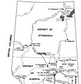
Alberta During the Territorial Period.jpg 442 × 457; 23 KB
-
Canada provinces 1901-1905.png 1,000 × 864; 61 KB
-
Manitoba and Northwest Territories (1900).jpg 3,510 × 2,550; 9.76 MB
-
Map of Canada's Arctic Archipelago, circa 1903.jpg 2,000 × 2,654; 4.63 MB


