
Category:18th-century maps of the Iberian Peninsula
Subcategories
This category has the following 14 subcategories, out of 14 total.
*
Media in category "18th-century maps of the Iberian Peninsula"
The following 30 files are in this category, out of 30 total.
-
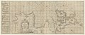 A chart of the sea coasts of England...and part of Barbary - btv1b53009614s.jpg 21,352 × 8,979; 27.58 MB
-
 Mercator's Orbis Antiqui Tabulae Geographicae Secundum Cl. Ptolemaeum (1730) 24.jpg 6,644 × 5,182; 5.24 MB
-
 Typus Hispaniae veteris - btv1b53226974j (1 of 2).jpg 2,226 × 1,452; 441 KB
-

-

-

-
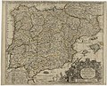 Carte générale des royaumes d'Espagne et de Portugal... - btv1b8442434z.jpg 9,897 × 7,968; 13.85 MB
-
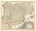
 Cartografie in Nederland, kaart van Spanje en Portugal, NG-501-48.jpg 5,754 × 4,886; 5.86 MB
-

-

-
 Hispania Augustiniana - Matthaeus Seutter, S. C. M. Geogr. - btv1b530570598.jpg 7,864 × 6,024; 7.72 MB
-

-
 Kaart van het zuiden van Spanje en Portugal, RP-P-1896-A-19368-3004.jpg 6,602 × 5,448; 6.43 MB
-
-
 Kaart van Spanje, objectnr A 16213.jpg 7,991 × 6,698; 40.3 MB
-
 Kaart van Spanje, RP-P-1938-1301.jpg 6,304 × 4,490; 4.03 MB
-

-
 L'Espagne dressée sur la Description qui en a été faite par Rodrigo Mendez Sylva.jpg 9,098 × 6,704; 18.34 MB
-

-

-
 Map - Special Collections University of Amsterdam - OTM- HB-KZL 32.21.39.tif 7,193 × 5,975; 122.96 MB
-
 Map - Special Collections University of Amsterdam - OTM- HB-KZL 32.21.43.tif 7,120 × 5,857; 119.31 MB
-
 Map - Special Collections University of Amsterdam - OTM- HB-KZL 32.22.44.tif 7,329 × 6,442; 135.08 MB
-
 Map - Special Collections University of Amsterdam - OTM- HB-KZL 32.22.64.tif 7,320 × 6,294; 131.81 MB
-

-

-
 Péninsule ibérique. Espagne et Portugal - partie occidentale - btv1b530937768.jpg 7,823 × 10,943; 15.73 MB
-
 Reino de leon.jpg 740 × 511; 416 KB
-
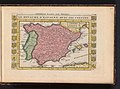
 Spain and Portugal, from the best authorities (3045239243).jpg 2,000 × 1,672; 3.31 MB
-


_24.jpg)
.jpg)


.jpg)


,_BI-B-FM-090-59.jpg)


.jpg)
