Category:1894 maps
Jump to navigation
Jump to search
| ← · 1890 · 1891 · 1892 · 1893 · 1894 · 1895 · 1896 · 1897 · 1898 · 1899 · → |
Deutsch: Karten mit Bezug zum Jahr 1894
English: Maps related to the year 1894
Español: Mapas relativos al año 1894
Français : Cartes concernant l’an 1894
Русский: Карты 1894 года
Subcategories
This category has the following 11 subcategories, out of 11 total.
Media in category "1894 maps"
The following 163 files are in this category, out of 163 total.
-
CUINET(1894) 3.348 Smyrne Vilayet.jpg 3,445 × 3,045; 6.03 MB
-
CUINET(1894) 3.704 Mutessariflik Bigha.jpg 3,431 × 2,769; 6.41 MB
-
GRUNDY(1894) p089 MAP OF PLATEA.jpg 2,504 × 3,782; 4.09 MB
-
KÖBRICH(1894) Karte vom Amt Hallenberg.jpg 2,277 × 1,533; 2.95 MB
-
(1894) THE GRAND DUCHY OF FINLAND.jpg 2,313 × 3,417; 4.35 MB
-
(1894) MAP OF THE SAIMA LAKE SYSTEM.jpg 2,343 × 3,699; 5.94 MB
-
1894 map of Antactica.jpg 824 × 1,358; 541 KB
-
1894 Weddell Map.jpg 335 × 234; 24 KB
-
Map of the FARÖE ISLANDS (1894).jpg 4,225 × 5,473; 9.48 MB
-
20 of '(North Sea Pilot.)' (11225286036).jpg 1,554 × 2,589; 1.05 MB
-
583 of 'Neumanns Orts-Lexikon des Deutschen Reichs' (11229364174).jpg 3,937 × 2,724; 2.59 MB
-
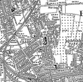
Acton Green OS map 1894.png 260 × 256; 84 KB
-
Adam Reusner, Jerusalem, die heilige Stadt (FL173354551 0989898).jpg 7,283 × 5,601; 43.37 MB
-
Admiralty Chart No 383 Thursday Island chart 701068131, Published 1894.jpg 7,000 × 5,242; 6.45 MB
-
Anales de la Sociedad Española de Historia Natural (1894) (17979043138).jpg 3,470 × 2,610; 1.08 MB
-
Arlo und K.Terenne (Ungarn). NYPL1226539.tiff 4,384 × 5,339; 66.97 MB
-
Asch. NYPL1226307.tiff 4,808 × 5,635; 77.52 MB
-
Messtischblatt 4211 Ascheberg 1894.jpg 8,279 × 7,881; 12.28 MB
-
Atascosa Co. LOC 2012592001.jpg 12,781 × 14,459; 22.94 MB
-
Atascosa Co. LOC 2012592001.tif 12,781 × 14,459; 528.72 MB
-
Atlantic Highlands, New Jersey 1894. LOC 75694718.jpg 9,936 × 6,992; 19.31 MB
-
Auspitz und Nikolsburg. NYPL1226447.tiff 4,560 × 5,515; 71.96 MB
-
Austerlitz. NYPL1226422.tiff 4,552 × 5,411; 70.48 MB
-
Bajmok und Bacs-Topolya. NYPL1226826.tiff 4,496 × 5,379; 69.2 MB
-
Berezna und Szinever. NYPL1226518.tiff 4,504 × 5,403; 69.63 MB
-
Bilke. NYPL1226517.tiff 4,504 × 5,403; 69.63 MB
-
Bolechow. NYPL1226436.tiff 4,536 × 5,355; 69.5 MB
-
Caslau und Chrudim. NYPL1226338.tiff 4,760 × 5,507; 75 MB
-
China LOC 2006458438.jpg 9,633 × 7,142; 11.78 MB
-
China LOC 2006458438.tif 9,633 × 7,142; 196.84 MB
-
Chōsen oyobi Bokkai kinbō - karisei Tōa yochizu. LOC 2006629017.jpg 17,450 × 14,818; 36.07 MB
-
Cooperage 1894.jpg 1,600 × 1,200; 1.62 MB
-
Crockett Co. LOC 2012592047.jpg 13,105 × 10,069; 15.47 MB
-
Crockett Co. LOC 2012592047.tif 13,105 × 10,069; 377.52 MB
-
Daruvar. NYPL1226850.tiff 4,600 × 5,435; 71.53 MB
-
Detail from Upper Sydenham 1894 OS map.png 842 × 823; 286 KB
-
Deutschbrod. NYPL1226364.tiff 4,760 × 5,627; 76.64 MB
-
Dimmit County. LOC 2012590152.jpg 14,013 × 11,935; 24.41 MB
-
Dolina. NYPL1226463.tiff 4,560 × 5,515; 71.96 MB
-
Messtischblatt 4307 Dorsten 1894 Rechteck.jpg 7,318 × 7,054; 12.33 MB
-
Messtischblatt 4307 Dorsten 1894.jpg 8,247 × 8,702; 13.46 MB
-
EastToronto1894.jpg 481 × 324; 42 KB
-
Erlau und Mezo-Keresztes.. NYPL1226567.tiff 4,384 × 5,339; 66.97 MB
-
Messtischblatt 4508 Essen 1894 (Eiberg).jpg 1,775 × 1,421; 653 KB
-
Messtischblatt 4508 Essen 1894.jpg 7,261 × 7,427; 13.22 MB
-
Freiwaldeau. NYPL1226317.tiff 4,808 × 5,539; 76.2 MB
-
Freudenthal. NYPL1226342.tiff 4,760 × 5,507; 75 MB
-
Gaming und Mariazell. NYPL1226556.tiff 4,384 × 5,339; 66.97 MB
-
Messtischblatt 4408 Gelsenkirchen 1894.jpg 1,654 × 1,778; 962 KB
-
Gmunden und Schafberg. NYPL1226553.tiff 4,384 × 5,339; 66.97 MB
-
Gold mysore.jpg 3,063 × 2,156; 6.93 MB
-
Altona Bf 1894 Ausschnitt.jpg 3,951 × 5,786; 5.13 MB
-
Hood Co. - General Land Office, May 1894 LOC 2009583513.jpg 7,022 × 7,372; 5.37 MB
-
Hood Co. - General Land Office, May 1894 LOC 2009583513.tif 7,022 × 7,372; 148.1 MB
-
Horn (Nieder-Osterreich). NYPL1226472.tiff 4,536 × 5,347; 69.4 MB
-
Hotzenplotz und Zuckmantel. NYPL1226297.tiff 4,792 × 5,467; 74.96 MB
-
Hunt Co., Texas LOC 2012592063.jpg 9,062 × 14,578; 16.94 MB
-
Iglau. NYPL1226392.tiff 4,552 × 5,347; 69.64 MB
-
Ivoi-LesCinqSousDeLavarede-Carte.jpg 5,266 × 3,486; 1.55 MB
-
Jamena und Bijeljina. NYPL1226925.tiff 4,640 × 5,475; 72.69 MB
-
Jank. NYPL1226571.tiff 4,384 × 5,339; 66.97 MB
-
Jauernig und Weidenau. NYPL1226296.tiff 4,792 × 5,467; 74.96 MB
-
Josefstadt und Nachod. NYPL1226294.tiff 4,792 × 5,467; 74.96 MB
-
Kamenitz a.-d. Linde (Bohmen). NYPL1226391.tiff 4,552 × 5,347; 69.64 MB
-
Kis-Varda und Vasaros-Nameny. NYPL1226543.tiff 4,384 × 5,339; 66.97 MB
-
Klausen. -10149(Large) NYPL1226717.tiff 4,440 × 5,219; 66.3 MB
-
Konigsberg und Szt. Beneder. NYPL1226508.tiff 4,504 × 5,403; 69.63 MB
-
Kralowitz und Bras. NYPL1226334.tiff 4,760 × 5,507; 75 MB
-
Kronstadt a.d. Wilden Adler. NYPL1226295.tiff 4,792 × 5,467; 74.96 MB
-
Kuttenberg und Kohljanowitz. NYPL1226337.tiff 4,760 × 5,507; 75 MB
-
Library of Israel, Malkov Map - Derech Emeth Map - detail Pal0649 1.jpg 3,072 × 1,767; 1.02 MB
-
Map of Berkeley County, West Virginia LOC 2012593054.jpg 10,662 × 12,779; 15.04 MB
-
Map of Berkeley County, West Virginia LOC 2012593054.tif 10,662 × 12,779; 389.81 MB
-
Map of Bible Lands (FL49973633 4073169).jpg 6,783 × 15,834; 148.08 MB
-
Map of Harrisburg City, Dauphin Co. Pa. LOC 2011593714.jpg 7,161 × 4,850; 5.11 MB
-
Map of Harrisburg City, Dauphin Co. Pa. LOC 2011593714.tif 7,161 × 4,850; 99.37 MB
-
Map of Leavenwoth County, Kansas LOC 2013593248.jpg 14,220 × 20,306; 30.96 MB
-
Map of northern Virginia LOC lva0000043.jpg 15,996 × 8,846; 25.68 MB
-
Map of Oglethorpe County, Georgia LOC 2012593669.jpg 12,702 × 9,161; 13.88 MB
-
Map of Oglethorpe County, Georgia LOC 2012593669.tif 12,702 × 9,161; 332.92 MB
-
Map of the battlefield of Gettysburg LOC 99447503.jpg 8,814 × 10,321; 11.47 MB
-
Map of the battlefield of Gettysburg LOC 99447503.tif 8,814 × 10,321; 260.27 MB
-
Map of the east part of Tom Green County. LOC 2012592089.jpg 6,993 × 6,655; 6.35 MB
-
Map of the east part of Tom Green County. LOC 2012592089.tif 6,993 × 6,655; 133.15 MB
-
Mapa Diocese Macau 1894.jpg 1,910 × 1,474; 518 KB
-
Messtischblatt 4507 Muelheim 1894.jpg 3,920 × 4,186; 3.54 MB
-
Nyitra-Zsambokret und Pistyan-Teplitz. NYPL1226477.tiff 4,536 × 5,491; 71.27 MB
-
Pen Argyl, Pennsylvania 1894. LOC 75696515.jpg 8,504 × 5,632; 9.81 MB
-
Pen Argyl, Pennsylvania 1894. LOC 75696515.tif 8,504 × 5,632; 137.03 MB
-
Pennsylvania. LOC 2009584530.tif 4,437 × 3,026; 38.41 MB
-
Perkasie, Pennsylvania, Bucks County, 1894. LOC 75693033.jpg 7,192 × 5,344; 8.64 MB
-
Perkasie, Pennsylvania, Bucks County, 1894. LOC 75693033.tif 7,192 × 5,344; 109.96 MB
-
Plan de Nancy en 1894.jpg 8,827 × 7,032; 11.05 MB
-
Plan of Acre. After a Drawing by Marino Sanuto (11229880494).jpg 1,923 × 1,278; 732 KB
-
Plano de la ciudad de Monterrey, 1894.jpg 5,978 × 6,997; 9.38 MB
-
Prag LOC 2010587008.jpg 3,779 × 2,496; 1.75 MB
-
Prag LOC 2010587008.tif 3,779 × 2,496; 26.99 MB
-
Provnoordholland.gif 1,580 × 2,304; 469 KB
-
PSM V44 D830 Territorial limits of the beaver and beaver eaters.jpg 1,454 × 1,339; 183 KB
-
PSM V45 D482 St clair tunnel route between us and canada.jpg 2,002 × 999; 568 KB
-
PSM V47 D195 Diagram showing relation of streams in two ocean pass.jpg 1,597 × 1,166; 150 KB
-
Raudnitz und Juncferteinitz. NYPL1226290.tiff 5,467 × 4,792; 55.26 MB
-
Rima-Szombat (Ungran). NYPL1226511.tiff 4,504 × 5,403; 69.63 MB
-
Saaz und Komotau. NYPL1226289.tiff 4,792 × 5,467; 74.96 MB
-
Salzburg. NYPL1226552.tiff 4,384 × 5,339; 66.97 MB
-
Samaria, George Adam Smith.jpg 2,165 × 1,587; 1.18 MB
-
Sanborn Fire Insurance Map from Wharton, Wharton County, Texas. LOC sanborn08813 001.tif 6,450 × 7,650; 141.17 MB
-
Schneeberg und St. Aegyd. NYPL1226557.tiff 4,384 × 5,339; 66.97 MB
-
Schuttenhofen und Winterberg. NYPL1226415.tiff 4,552 × 5,347; 69.64 MB
-
Senftenberg. NYPL1226316.tiff 4,808 × 5,539; 76.2 MB
-
Skole (Galizien). NYPL1226435.tiff 4,536 × 5,387; 69.92 MB
-
Smorze und Also-Verecke. NYPL1226461.tiff 4,560 × 5,515; 71.96 MB
-
Spezialkarte der Österreichisch-ungarischen Monarchie - Radkersburg und Luttenberg 1894.jpg 14,488 × 11,335; 29.11 MB
-
Stadtplan-DO-1894-IMG 2727.jpg 2,570 × 2,003; 4.78 MB
-
Stanislau (Galizien). NYPL1226464.tiff 4,560 × 5,515; 71.96 MB
-
Stary Sambor (Galizien). NYPL1226407.tiff 4,552 × 5,347; 69.64 MB
-
Szendro und Putnok (Ungarn). NYPL1226512.tiff 4,504 × 5,403; 69.63 MB
-
Tabor. NYPL1226390.tiff 4,552 × 5,347; 69.64 MB
-
Teschen, Mistek und Jablunkau. NYPL1226370.tiff 4,760 × 5,627; 76.64 MB
-
The book of antelopes (1894) (14595766738).jpg 1,938 × 1,818; 1.03 MB
-
Theodor Sandel, Environs of Yafa (FL45595731 3932425).jpg 2,488 × 1,879; 1.33 MB
-
Tittmoning. NYPL1226524.tiff 4,472 × 5,251; 67.19 MB
-
Tokai. NYPL1226542.tiff 4,384 × 5,339; 66.97 MB
-
Travis Co. LOC 2012592086.jpg 14,210 × 12,215; 26.63 MB
-
Travis Co. LOC 2012592086.tif 14,210 × 12,215; 496.6 MB
-
Treaty map of India.tif 2,546 × 4,193; 983 KB
-
Trebitsch und Mhr. Kromau. NYPL1226420.tiff 4,552 × 5,347; 69.64 MB
-
Tschernhausen und Preuss. Corlitz. NYPL1226268.tiff 4,872 × 5,659; 78.89 MB
-
Tuchla. NYPL1226462.tiff 4,560 × 5,515; 71.96 MB
-
Turdossin an der Arva. NYPL1226400.tiff 4,552 × 5,347; 69.64 MB
-
Turka. NYPL1226434.tiff 4,536 × 5,355; 69.5 MB
-
Turnau. NYPL1226278.tiff 4,792 × 5,571; 76.38 MB
-
Ujsoly und Stara-Bistrica. NYPL1226399.tiff 4,552 × 5,347; 69.64 MB
-
Ung. Altenburg. NYPL1226560.tiff 4,384 × 5,339; 66.97 MB
-
Vaskoh und Nagy-Halmagy. NYPL1226772.tiff 4,344 × 5,211; 64.77 MB
-
Weyer. NYPL1226555.tiff 4,384 × 5,339; 66.97 MB
-
Wittincau und Moldauthein. NYPL1226417.tiff 4,552 × 5,347; 69.64 MB
-
Zwenkau Messtischblatt df dk 0010001 4739 1894.jpg 8,218 × 8,106; 9.38 MB
-
Zydaczow und Stryj. NYPL1226409.tiff 4,552 × 5,347; 69.64 MB
-
Древній и Современный Іерусалимъ (FL6882353 2383285).jpg 1,820 × 3,365; 7 MB
-
План города Москвы 1894 (FL39696805 3446028).jpg 15,786 × 20,665; 448.14 MB


