Category:1892 maps
Jump to navigation
Jump to search
| ← · 1890 · 1891 · 1892 · 1893 · 1894 · 1895 · 1896 · 1897 · 1898 · 1899 · → |
Deutsch: Karten mit Bezug zum Jahr 1892
English: Maps related to the year 1892
Español: Mapas relativos al año 1892
Français : Cartes concernant l’an 1892
Русский: Карты 1892 года
Subcategories
This category has the following 11 subcategories, out of 11 total.
Media in category "1892 maps"
The following 200 files are in this category, out of 329 total.
(previous page) (next page)-
'Claudius Bombarnac' by Léon Benett 14.jpg 1,512 × 1,071; 595 KB
-
'Claudius Bombarnac' by Léon Benett 37.jpg 1,506 × 1,065; 688 KB
-
Pg147 Kintampo.jpg 1,487 × 1,018; 778 KB
-
CUINET(1892) 2.017 Adana Vilayet.jpg 3,413 × 2,245; 4.02 MB
-
CUINET(1892) 2.126 Aleppo Vilayet.jpg 3,491 × 2,930; 5.37 MB
-
CUINET(1892) 2.294 Deir ez-Zor Vilayet.jpg 3,438 × 2,971; 4.29 MB
-
CUINET(1892) 2.339 Mamuret-ul-Aziz Vilayet.jpg 2,465 × 2,799; 3.54 MB
-
CUINET(1892) 2.434 Diyarbekir Vilayet enhanced.png 3,481 × 2,838; 11.67 MB
-
CUINET(1892) 2.434 Diyarbekir Vilayet.jpg 3,481 × 2,838; 4.69 MB
-
CUINET(1892) 2.552 Bitlis Vilayet.jpg 3,464 × 2,834; 4.76 MB
-
CUINET(1892) 2.664 Van Vilayet.jpg 3,345 × 2,778; 5.17 MB
-
CUINET(1892) 2.800 Mosul Vilayet.jpg 3,634 × 2,821; 4.93 MB
-
LERP(1892) Karte zur Verbreitung der Hermunduren und Alt-Thüringer.jpg 3,136 × 3,943; 7.43 MB
-
HAZELIUS(1892) Vol.5, p561 Karta.jpg 1,983 × 3,251; 4.41 MB
-
Ausschnitt aus dem Stadtplan von Eisenach mit Hausnummern (1892).jpg 1,357 × 704; 317 KB
-
1892 Electoral and Political Reference Map of New South Wales.jpg 5,849 × 3,600; 3.29 MB
-
1892 IC.jpg 7,744 × 11,264; 13.47 MB
-
1892 Smith's Pocket Map of London, England - Geographicus - London-smith-1892.jpg 5,000 × 3,429; 5.13 MB
-
1892 Tourist's New Map of Scotland - Geographicus - Scotland-bartholomew-1892.jpg 3,500 × 4,567; 4.73 MB
-
2fi561 Plan du palais du commerce à Rennes.jpg 8,262 × 5,857; 1.65 MB
-
BarmerWasserwerkSituationsplan1892.jpg 640 × 487; 52 KB
-
Battlefield of Chatanooga. (October-November 1863). LOC 99448837.jpg 1,354 × 2,227; 745 KB
-
Battlefield of Chatanooga. (October-November 1863). LOC 99448837.tif 1,354 × 2,227; 8.63 MB
-
Belle vue zoological gardens plan 1892.jpg 3,872 × 2,747; 3.65 MB
-
BRAILA 1892.JPG 4,325 × 3,075; 3.05 MB
-
Buffalo Street Map, 1892.jpg 2,602 × 3,971; 4.96 MB
-
Burlington Route Map 1892.png 3,500 × 2,546; 15.62 MB
-
Cape Cod Bay, Massachusetts (8249864115).jpg 2,000 × 1,500; 2.08 MB
-
Carte de l'Afrique à l'échelle (...)Régnauld de btv1b59697438.jpg 1,313 × 1,053; 310 KB
-
Chamonix and Mont-Blanc map 1892.jpg 3,535 × 5,071; 8.04 MB
-
Childress Co. LOC 2012592035.jpg 5,890 × 7,496; 6.29 MB
-
Childress Co. LOC 2012592035.tif 5,890 × 7,496; 126.32 MB
-
Cromartyshire 1892.jpg 1,243 × 729; 537 KB
-
Crosby County - General Land Office, April 1892 LOC 2009583805.jpg 7,618 × 9,570; 8.13 MB
-
Crosby County - General Land Office, April 1892 LOC 2009583805.tif 7,618 × 9,570; 208.58 MB
-
DanelawEngland.jpg 3,940 × 5,165; 8.87 MB
-
Dawson County LOC 2009583505.jpg 7,548 × 9,517; 7.39 MB
-
Dawson County LOC 2009583505.tif 7,548 × 9,517; 205.52 MB
-
De Ruyter, N.Y. LOC 91684103.tif 7,216 × 4,800; 99.1 MB
-
Deutsch Ost-Afrika,1892.jpg 3,503 × 4,498; 10.38 MB
-
EB9 Holland RSP.png 2,600 × 3,500; 8.95 MB
-
EB9 Hungary RSP.png 3,590 × 2,515; 14.08 MB
-
EB9 Iceland RSP.png 2,850 × 1,857; 9.05 MB
-
Edward Stanford, Palestine or the Holy Land (FL37116823 3892383).jpg 2,009 × 2,424; 1.65 MB
-
FIGUEIRA(1892) Mapa etnografíco de la Republica Oriental del Uruguay.jpg 541 × 755; 347 KB
-
FMIB 39499 Map showing the effect of the glacial dam at Cincinnati.jpeg 1,339 × 863; 253 KB
-
FMIB 39519 -Malaspina Strait-.jpeg 732 × 719; 155 KB
-
Galveston Co. LOC 2005625375.jpg 7,342 × 5,801; 3.2 MB
-
Galveston Co. LOC 2005625375.tif 7,342 × 5,801; 121.85 MB
-
Heinrich Kiepert, Asia citerior (FL36009854 2663765).jpg 11,358 × 8,939; 146.73 MB
-
Image from page 210 of "The Encyclopedia britannica" (1892).jpg 1,724 × 1,302; 487 KB
-
Istrien 1892.jpg 3,595 × 2,583; 8.77 MB
-
Karte Baden Hohenzollern Wuerttemberg 1892.jpg 2,000 × 2,636; 4.35 MB
-
Konrad Furrer, Biblisch topographische Karte von Palästina (FL37105273 3886651).jpg 11,115 × 13,596; 201.02 MB
-
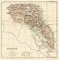
Kurdistan map 1892.jpg 953 × 960; 179 KB
-
Landkreis Berchtesgaden Gemeindegrenzen - cropped from Bayern Gemeindegrenzen 1892.jpg 1,166 × 1,361; 427 KB
-
Landkreis Dingolfing Gemeindegrenzen 1892 (cropped).jpg 842 × 953; 249 KB
-
Landron.svg 586 × 362; 15 KB
-
Map of Illinois Central R.R. LOC 98688682.jpg 7,699 × 11,146; 14.53 MB
-
Map of land-grant and bond-aided railroads of the United States. LOC 98688343.tif 11,556 × 8,238; 272.36 MB
-
Map of Milwaukee County and plans of Pewaukee, Oconomowoc, Wauwatosa, Waukesha LOC 2015593101.tif 5,219 × 6,758; 100.91 MB
-
Map of Odessa from German edition of Baedeker's Russland, 1892.jpg 1,180 × 1,600; 687 KB
-
Map of Prairie County, Arkansas LOC 2011589608.jpg 12,188 × 20,132; 29.66 MB
-
Map of the Holy Land (FL6880506 2367686).jpg 1,900 × 3,233; 3.57 MB
-
Map of the Indian and Oklahoma territories. LOC 98687110.jpg 9,774 × 7,200; 14.92 MB
-
Map of the Indian and Oklahoma territories. LOC 98687110.tif 9,774 × 7,200; 201.34 MB
-
Map of Tom Green County LOC 2012592088.jpg 14,170 × 13,091; 23.07 MB
-
Map of Tom Green County LOC 2012592088.tif 14,170 × 13,091; 530.72 MB
-
Map showing Indian reservations within the limits of the United States LOC 2009579467.jpg 10,486 × 6,705; 9.7 MB
-
Map showing Indian reservations within the limits of the United States LOC 2009579467.tif 10,486 × 6,705; 201.15 MB
-
Map showing M. Bonvalot's route LOC 2007629490.jpg 7,949 × 6,374; 8.43 MB
-
Map showing M. Bonvalot's route LOC 2007629490.tif 7,949 × 6,374; 144.96 MB
-
Map showing route of District of Columbia Suburban Railway - Sept. 1892 LOC 87695720.jpg 3,837 × 9,614; 5.07 MB
-
Map showing route of District of Columbia Suburban Railway - Sept. 1892 LOC 87695720.tif 3,837 × 9,614; 105.54 MB
-
Map showing the location of battle fields of Virginia (10089635013).jpg 800 × 678; 173 KB
-
Map showing the location of battle fields of Virginia LOC 99448893.jpg 7,387 × 6,077; 8.87 MB
-
Map showing the location of battle fields of Virginia LOC 99448893.tif 7,387 × 6,077; 128.43 MB
-
Map showing the location of battle fields of Virginia LOC lva0000098.jpg 7,756 × 6,554; 11.29 MB
-
Map showing the location of battle fields of Virginia LOC lva0000098.tif 7,756 × 6,554; 145.43 MB
-
Map showing the location of the "Herr" lands, Grant County, W. Va. LOC 2005625206.jpg 4,650 × 3,246; 1.41 MB
-
Map showing the location of the "Herr" lands, Grant County, W. Va. LOC 2005625206.tif 4,650 × 3,246; 43.18 MB
-
Mapa de Francisco J. San Roman 1892.jpg 2,400 × 3,632; 2.55 MB
-
Mapa-san-roman-MP0002046.pdf 4,316 × 6,402; 9.87 MB
-
Milwaukee 1892.jpg 9,424 × 6,288; 11.78 MB
-
Miner's Mills and Mill Creek, Luzerne County, Pa. 1892. LOC 75696502.jpg 6,968 × 5,272; 7.95 MB
-
Miner's Mills and Mill Creek, Luzerne County, Pa. 1892. LOC 75696502.tif 6,968 × 5,272; 105.1 MB
-
Moosic, Pennsylvania 1892 LOC gm71005378.jpg 6,928 × 4,960; 7.03 MB
-
Moosic, Pennsylvania 1892 LOC gm71005378.tif 6,928 × 4,960; 98.31 MB
-
Niesten Mars globe segments.jpg 4,705 × 2,817; 2.58 MB
-
Palestine (FL37116939 3893220).jpg 2,936 × 3,493; 3.89 MB
-
Panorama of Norfolk and surroundings 1892. LOC 75696649.jpg 12,576 × 7,664; 19.28 MB
-
Peckville, Lackawanna County, Pa. 1892. LOC 76693068.jpg 7,742 × 5,242; 12.11 MB
-
Peckville, Lackawanna County, Pa. 1892. LOC 76693068.tif 7,742 × 5,242; 116.11 MB
-
Perspective map of the city of Laredo, Texas, the Gateway to and from Mexico. LOC 75696601.jpg 10,576 × 6,912; 15.81 MB
-
Perspective map of the city of Laredo, Texas, the Gateway to and from Mexico. LOC 75696601.tif 10,576 × 6,912; 209.14 MB
-
Pittston and West Pittston, Pennsylvania. LOC 76695127.jpg 8,792 × 5,616; 9.75 MB
-
Pittston and West Pittston, Pennsylvania. LOC 76695127.tif 8,792 × 5,616; 141.27 MB
-
Plains, Luzerne County, Pa. LOC 76695129.jpg 8,272 × 5,664; 10.45 MB
-
Plains, Luzerne County, Pa. LOC 76695129.tif 8,272 × 5,664; 134.05 MB
-
Plan de Paris, Hachette 1892 - Rocbo.jpg 6,300 × 5,337; 22.86 MB
-
Planta das Terras Medidas pelo Banco Evolucionista, Acervo do Museu Paulista da USP.jpg 7,216 × 5,412; 16.33 MB
-
Pommern 1892.jpg 3,504 × 2,544; 2.78 MB
-
Providence, Pennsylvania 1892. LOC gm71005369.jpg 10,688 × 6,832; 10.96 MB
-
Providence, Pennsylvania 1892. LOC gm71005369.tif 10,688 × 6,832; 208.91 MB
-
PSM V40 D381 Map showing the southern range limit of the musk ox.jpg 1,609 × 1,068; 235 KB
-
PSM V40 D797 Kingston harbor jamaica.jpg 981 × 656; 51 KB
-
Puits Saint-Auguste - concessions des Touches.JPG 1,042 × 684; 101 KB
-
Puyallup Reservation map 1892.png 1,275 × 1,646; 1.31 MB
-
Rand, McNally & Co., indexed atlas of the world map of Palestine (FL37825667 3923239).jpg 9,189 × 13,491; 170.29 MB
-
Rue de Vouillé 1892 Hachette.jpg 979 × 610; 400 KB
-
San Agustin Historical District in 1892.png 2,885 × 2,097; 9.89 MB
-
Sanborn Fire Insurance Map from La Camas, Clark County, Washington. LOC sanborn09215 002.jpg 6,450 × 7,650; 3.59 MB
-
Sanborn Fire Insurance Map from La Camas, Clark County, Washington. LOC sanborn09215 002.tif 6,450 × 7,650; 141.17 MB
-
Sanborn Fire Insurance Map from Lafayette, Yamhill County, Oregon. LOC sanborn07394 002.jpg 6,450 × 7,650; 3.37 MB
-
Sanborn Fire Insurance Map from Lafayette, Yamhill County, Oregon. LOC sanborn07394 002.tif 6,450 × 7,650; 141.17 MB
-
Sanborn Fire Insurance Map from Lathrop, Clinton County, Missouri. LOC sanborn04739 002.jpg 6,450 × 7,650; 3.53 MB
-
Sanborn Fire Insurance Map from Lathrop, Clinton County, Missouri. LOC sanborn04739 002.tif 6,450 × 7,650; 141.17 MB
-
Sanborn Fire Insurance Map from Lexington, Holmes County, Mississippi. LOC sanborn04482 002.tif 6,450 × 7,650; 141.17 MB
-
Sanborn Fire Insurance Map from Linesville, Crawford County, Pennsylvania. LOC sanborn07772 003.tif 6,450 × 7,650; 141.17 MB
-
Sanborn Fire Insurance Map from Lonaconing, Allegany County, Maryland. LOC sanborn03623 001.tif 6,450 × 7,650; 141.17 MB
-
Sanborn Fire Insurance Map from Madison, Madison County, Nebraska. LOC sanborn05213 002.jpg 6,450 × 7,650; 3.44 MB
-
Sanborn Fire Insurance Map from Madison, Madison County, Nebraska. LOC sanborn05213 002.tif 6,450 × 7,650; 141.17 MB
-
Sanborn Fire Insurance Map from Madrid, St. Lawrence County, New York. LOC sanborn06055 002.tif 6,450 × 7,650; 141.17 MB
-
Sanborn Fire Insurance Map from Marianna, Lee County, Arkansas. LOC sanborn00299 001.jpg 8,600 × 10,200; 5.81 MB
-
Sanborn Fire Insurance Map from Marianna, Lee County, Arkansas. LOC sanborn00299 001.tif 8,600 × 10,200; 250.97 MB
-
Sanborn Fire Insurance Map from Marshfield, Webster County, Missouri. LOC sanborn04768 002.tif 6,450 × 7,650; 141.17 MB
-
Sanborn Fire Insurance Map from Marysville, Snohomish County, Washington. LOC sanborn09239 001.tif 6,450 × 7,650; 141.17 MB
-
Sanborn Fire Insurance Map from Maryville, Blount County, Tennessee. LOC sanborn08346 002.tif 6,450 × 7,650; 141.17 MB
-
Sanborn Fire Insurance Map from Mazomanie, Dane County, Wisconsin. LOC sanborn09612 002.jpg 6,406 × 7,547; 4.09 MB
-
Sanborn Fire Insurance Map from Mazomanie, Dane County, Wisconsin. LOC sanborn09612 002.tif 6,406 × 7,547; 138.32 MB
-
Sanborn Fire Insurance Map from Milford, Seward County, Nebraska. LOC sanborn05214 002.tif 6,450 × 7,650; 141.17 MB
-
Sanborn Fire Insurance Map from Muscoda, Grant County, Wisconsin. LOC sanborn09633 001.jpg 6,450 × 7,650; 3.72 MB
-
Sanborn Fire Insurance Map from Muscoda, Grant County, Wisconsin. LOC sanborn09633 001.tif 6,450 × 7,650; 141.17 MB
-
Sanborn Fire Insurance Map from Nelson, Nuckolls County, Nebraska. LOC sanborn05222 001.jpg 6,450 × 7,650; 3.12 MB
-
Sanborn Fire Insurance Map from Nelson, Nuckolls County, Nebraska. LOC sanborn05222 001.tif 6,450 × 7,650; 141.17 MB
-
Sanborn Fire Insurance Map from New Cambria, Macon County, Missouri. LOC sanborn04797 001.tif 6,450 × 7,650; 141.17 MB
-
Sanborn Fire Insurance Map from New Gloucester, Cumberland County, Maine. LOC sanborn03510 001.tif 6,450 × 7,650; 141.17 MB
-
Sanborn Fire Insurance Map from New Lisbon, Juneau County, Wisconsin. LOC sanborn09640 002.tif 6,450 × 7,650; 141.17 MB
-
Sanborn Fire Insurance Map from Newburgh, Warrick County, Indiana. LOC sanborn02442 002.jpg 6,450 × 7,650; 3.71 MB
-
Sanborn Fire Insurance Map from Newburgh, Warrick County, Indiana. LOC sanborn02442 002.tif 6,450 × 7,650; 141.17 MB
-
Sanborn Fire Insurance Map from Newhall, Los Angeles County, California. LOC sanborn00715 001.tif 6,450 × 7,650; 141.17 MB
-
Sanborn Fire Insurance Map from Newport, Cocke County, Tennessee. LOC sanborn08358 002.jpg 6,450 × 7,650; 3.36 MB
-
Sanborn Fire Insurance Map from Newport, Cocke County, Tennessee. LOC sanborn08358 002.tif 6,450 × 7,650; 141.17 MB
-
Sanborn Fire Insurance Map from Nicholson, Wyoming County, Pennsylvania. LOC sanborn07874 002.tif 6,450 × 7,650; 141.17 MB
-
Sanborn Fire Insurance Map from Oakdale, Antelope County, Nebraska. LOC sanborn05226 002.jpg 6,450 × 7,650; 3.31 MB
-
Sanborn Fire Insurance Map from Oakdale, Antelope County, Nebraska. LOC sanborn05226 002.tif 6,450 × 7,650; 141.17 MB
-
Sanborn Fire Insurance Map from Oakland, Douglas County, Oregon. LOC sanborn07428 004.jpg 6,450 × 7,650; 3.39 MB


