Category:1888 maps
Jump to navigation
Jump to search
| ← · 1880 · 1881 · 1882 · 1883 · 1884 · 1885 · 1886 · 1887 · 1888 · 1889 · → |
Deutsch: Karten mit Bezug zum Jahr 1888
English: Maps related to the year 1888
Español: Mapas relativos al año 1888
Français : Cartes concernant l’an 1888
Русский: Карты 1888 года
Subcategories
This category has the following 8 subcategories, out of 8 total.
Media in category "1888 maps"
The following 122 files are in this category, out of 122 total.
-
HERTZBG(1) p559 Plan der Umgegend von Halle an der Saale im Mittelalter.jpg 3,129 × 3,693; 5.02 MB
-
HERTZBG(1) p561 Plan der Stadt Halle an der Saale im Mittelalter.jpg 3,081 × 3,809; 6.08 MB
-
Accélération des voyages en France depuis 200 ans.png 480 × 598; 320 KB
-
District map of the Archdeaconry of New York. LOC 76692291.tif 17,416 × 4,770; 237.68 MB
-
EB9 Tigris.jpg 1,268 × 999; 173 KB
-
EB9 Vichy.jpg 806 × 995; 449 KB
-
EB9 Worcester (city) - plan.jpg 820 × 996; 323 KB
-
EB9 Yemen.png 2,520 × 2,540; 2.05 MB
-
Ermete Pierotti, Croquis de Nazareth en arabe en Nasrah (FL199398120 2540371).jpg 7,048 × 9,000; 107.75 MB
-
Ermete Pierotti, Excursion de Jerusalem aux bassins de Salomon (FL6881550 2368150).jpg 5,336 × 7,104; 56.96 MB
-
Ermete Pierotti, Judee et Galilee (FL6879996 2368872).jpg 2,193 × 2,800; 3.8 MB
-
Ermete Pierotti, Plan de Jerusalem ancienne et moderne (1888) (FL6880779 2368151).jpg 2,150 × 2,843; 2.8 MB
-
Etat-Major 1888 Ligne des Coquetiers.jpg 1,858 × 2,062; 1.23 MB
-
Ewe-Gebiet 1888.jpg 3,323 × 3,820; 2.37 MB
-
Expeditionsskizze Kund1888.jpg 1,182 × 1,614; 1.13 MB
-
Flammarion - La planète Mars, Tome 2-f022.jpg 1,180 × 1,180; 313 KB
-
Grabstaetten-Karte der Steiermark.jpg 3,864 × 4,014; 10.43 MB
-
Historische Karte von den Nordfriesischen Inseln - Franz Geerz 1888-2 (cropped Föhr).jpg 1,812 × 1,407; 3.45 MB
-
Historische Karte von den Nordfriesischen Inseln - Franz Geerz 1888-2.jpg 7,552 × 10,288; 65.69 MB
-
Historische Karte von den Nordfriesischen Inseln - Franz Geerz 1888.jpg 7,552 × 10,288; 15.6 MB
-
Historische Karte von den Nordfriesischen Inseln - Franz Geerz 1888.tif 7,552 × 10,288; 167.68 MB
-
Horbat Kanef in Schumacher's map of the Golan.jpg 806 × 573; 263 KB
-
Index NYPL3905014.tiff 6,400 × 7,919, 2 pages; 145.27 MB
-
Islas Marianas Palaos y Carolinas.JPG 902 × 489; 184 KB
-
Kaart van Guiana - Engelsch, Nederlandsch en Fransch (1888).jpg 5,500 × 3,948; 1.68 MB
-
Karte Madeira MKL1888.png 365 × 233; 25 KB
-
Karte Strassburg MK1888.png 2,634 × 1,760; 9.91 MB
-
Karte von Camerun.jpg 728 × 707; 96 KB
-
Karte Zypern MKL1888.png 743 × 489; 74 KB
-
Krain-Istrien 1888.jpg 7,034 × 5,623; 18.14 MB
-
Laizhou Fu Changyi Xian cheng yuan tu. LOC gm71005051.jpg 5,744 × 5,169; 3.17 MB
-
Laizhou Fu Changyi Xian cheng yuan tu. LOC gm71005051.tif 5,744 × 5,169; 84.95 MB
-
Lange Mauern.png 655 × 422; 600 KB
-
Liavågen.jpg 1,201 × 1,196; 2.17 MB
-
Little Cadogan Place on George Bacon's map of 1888.jpg 1,267 × 1,574; 984 KB
-
Londres1888.jpg 4,132 × 2,909; 1.85 MB
-
Lonsdale, Rhode Island (2675917212).jpg 2,000 × 1,615; 2.79 MB
-
Lutonmap1888.jpg 2,666 × 1,786; 1.43 MB
-
Map of 11,000 acres of iron and coal lands in Wythe Co., Va. LOC 2005625157.jpg 4,391 × 3,372; 1.53 MB
-
Map of 11,000 acres of iron and coal lands in Wythe Co., Va. LOC 2005625157.tif 4,391 × 3,372; 42.36 MB
-
Map of British North Borneo, 1888.png 840 × 640; 798 KB
-
Map of Lee County LOC 2008621664.jpg 11,758 × 12,410; 16.15 MB
-
Map of Lee County LOC 2008621664.tif 11,758 × 12,410; 417.47 MB
-
Map of Rosslynn. LOC 89692737.jpg 7,806 × 6,635; 7.79 MB
-
Map of Rosslynn. LOC 89692737.tif 7,806 × 6,635; 148.18 MB
-
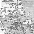
Map of Singapore.jpg 353 × 354; 43 KB
-
Map of the proposed town of Beverly Farms, Mass. (3120134413).jpg 2,000 × 1,353; 2.97 MB
-
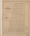
Map of Trinidad, Washington, D.C. - 1888 LOC 88693178.jpg 5,058 × 6,026; 3.14 MB
-
Map of Trinidad, Washington, D.C. - 1888 LOC 88693178.tif 5,058 × 6,026; 87.2 MB
-
Map of Washington County LOC 94680867.jpg 6,083 × 6,096; 5.4 MB
-
Map of Washington County LOC 94680867.tif 6,083 × 6,096; 106.09 MB
-
Map showing the Union Pacific Railway and branch lines. LOC 98688839.jpg 10,035 × 3,524; 9.1 MB
-
Map showing the Union Pacific Railway and branch lines. LOC 98688839.tif 10,035 × 3,524; 101.18 MB
-
Map Ubangi-Uelle 1888 cropped to Zongo region.png 773 × 703; 108 KB
-
Map Ubangi-Uelle 1888.png 3,980 × 3,144; 2.62 MB
-
Mapa buenosaires 1888 pazsoldan.jpg 1,484 × 978; 294 KB
-
Mars with Lines.jpg 610 × 838; 188 KB
-
Memorias de la Real Academia de la Historia (1796) (14590508287).jpg 4,882 × 3,278; 2.53 MB
-
Meyers b11 s0042.jpg 800 × 1,275; 439 KB
-
Meyers b14 s0276.jpg 800 × 1,275; 396 KB
-
MIlano - Piano regolatore del circondario interno della città (1888) 01.jpg 1,500 × 887; 147 KB
-
MIlano - Piano regolatore del circondario interno della città (1888) 02.jpg 1,500 × 1,125; 185 KB
-
Montagnes-europe.JPG 1,471 × 1,281; 512 KB
-
Morrison's map of the country about Washington. LOC 88693407.jpg 9,678 × 6,522; 7.23 MB
-
Morrison's map of the country about Washington. LOC 88693407.tif 9,678 × 6,522; 180.59 MB
-
Mount Vernon Brewery Plan - 1888.png 1,845 × 2,670; 6.51 MB
-
Narragansett Pier, Rhode Island (2675104357).jpg 2,000 × 1,573; 2.42 MB
-
New and correct map of the Chicago, Kansas & Nebraska Ry. Rock Island Route. LOC 98688628.jpg 11,859 × 4,858; 9.03 MB
-
New and correct map of the Chicago, Kansas & Nebraska Ry. Rock Island Route. LOC 98688628.tif 11,859 × 4,858; 164.83 MB
-
Outline and Index map of the Rochester NYPL3905013.tiff 8,585 × 6,154, 2 pages; 151.42 MB
-
Palestine (FL35090329 3892023).jpg 4,305 × 5,184; 34.68 MB
-
Palestine (FL37825689 3923246).jpg 8,549 × 12,910; 161.04 MB
-
Part of Ward 8. (Plate I.) NYPL1582647.tiff 7,230 × 4,944; 102.27 MB
-
Plan der Stadt Hagen 1888 - Ausschnitt Wehringhausen.jpg 1,781 × 1,161; 1.15 MB
-
Plan der Stadt Hagen 1888.jpg 6,237 × 4,072; 11.06 MB
-
Plan du bombardement du fort de Saint Jean d Ulloa en 1838.jpg 2,750 × 2,546; 741 KB
-
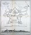
Plan du fort de Saint Jean d'Ulloa et vue panoramique 1838.jpg 2,265 × 2,569; 650 KB
-
Plan du Parc des Buttes-Chaumont (1888).jpg 1,203 × 1,802; 1.05 MB
-
Plan of Cadiz.jpg 495 × 600; 101 KB
-
Plano de la ciudad de Mayagüez y sus contornos. LOC 98687141.jpg 7,613 × 8,247; 13.58 MB
-
Plano de la ciudad de Mayagüez y sus contornos. LOC 98687141.tif 7,613 × 8,247; 179.63 MB
-
Plat of the Bladensburg Turnpike and old road to Carrollsburg. LOC 88690706.jpg 6,152 × 4,380; 2.5 MB
-
Plat of the Bladensburg Turnpike and old road to Carrollsburg. LOC 88690706.tif 6,152 × 4,380; 77.09 MB
-
PSM V32 D471 Reversed color image of the Panama canal route.jpg 3,529 × 1,516; 552 KB
-
Quincy in 1888 (2673794099).jpg 2,000 × 1,455; 3.15 MB
-
Railroad commissioner's map of Mississippi. LOC 98688503.jpg 4,152 × 6,280; 5.67 MB
-
Railroad commissioner's map of Mississippi. LOC 98688503.tif 4,152 × 6,280; 74.6 MB
-
Rains Co. LOC 2012590074.jpg 8,319 × 7,877; 7.99 MB
-
Rains Co. LOC 2012590074.tif 8,319 × 7,877; 187.48 MB
-
Richard Carnac Temple, The city of Jerusalem (Modern) (FL45611957 3952068).jpg 2,005 × 3,030; 2.32 MB
-
Roads in the Tranaki District. ATLIB 292354.png 5,425 × 6,909; 26.73 MB
-
Simon's 1888 Gothenburg map.jpg 13,780 × 6,439; 37.78 MB
-
Situationsplan von Buenos Ayres.jpg 357 × 492; 77 KB
-
Situationsplan von Cadiz.jpg 500 × 606; 97 KB
-
TabulaPeutingeriana - Gensis.jpg 1,244 × 600; 631 KB
-
Karte Venedig MK1888.png 800 × 517; 1.01 MB
-
Wakefield and Peace Dale, Rhode Island (2675922098).jpg 2,000 × 1,628; 2.71 MB
-
Washington, Rhode Island (2675923986).jpg 2,000 × 1,406; 2.21 MB
-
Wickford, Rhode Island, 1888. LOC 2010589385.tif 10,094 × 7,077; 204.38 MB
-
Williamson County - compiled and drawn by Herman Pressler. LOC 2012592141.jpg 16,511 × 11,622; 34.77 MB
-
Williamson County - compiled and drawn by Herman Pressler. LOC 2012592141.tif 16,511 × 11,622; 549 MB
-
Wilmart.svg 586 × 362; 504 KB
-
World according to Herodotus (1888) crop.JPG 1,434 × 1,022; 223 KB


