Category:1880s maps of Paraguay
Jump to navigation
Jump to search
Countries of the Americas: Argentina · The Bahamas · Barbados · Belize · Bolivia · Brazil · Canada · Chile · Colombia · Costa Rica · Cuba · Ecuador · Guatemala · Haiti · Jamaica · Mexico · Panama · Paraguay · Peru · Saint Kitts and Nevis · United States of America · Uruguay · Venezuela
Other areas: Aruba · Puerto Rico
Other areas: Aruba · Puerto Rico
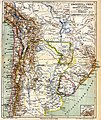
Media in category "1880s maps of Paraguay"
The following 4 files are in this category, out of 4 total.
-

-
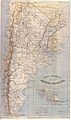 Latzina1888.jpg 3,190 × 5,403; 3.32 MB
-
 Meyers b1 s0790a.jpg 1,720 × 2,048; 800 KB
-
 Meyers b3 s0333a.jpg 1,732 × 2,048; 842 KB


