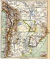
Category:1880s maps of Brazil
Jump to navigation
Jump to search
Countries of the Americas: Argentina · The Bahamas · Barbados · Belize · Bolivia · Brazil · Canada · Chile · Colombia · Costa Rica · Cuba · Ecuador · Guatemala · Haiti · Jamaica · Mexico · Panama · Paraguay · Peru · Saint Kitts and Nevis · United States · Uruguay · Venezuela
Other areas: Aruba · Greenland · Puerto Rico
Other areas: Aruba · Greenland · Puerto Rico
Subcategories
This category has the following 11 subcategories, out of 11 total.
- 1880 maps of Brazil (2 F)
- 1883 maps of Brazil (1 F)
- 1884 maps of Brazil (4 F)
- 1885 maps of Brazil (2 F)
- 1887 maps of Brazil (11 F)
- 1888 maps of Brazil (16 F)
- 1889 maps of Brazil (4 F)
.
- 1880s maps of Paraná (1 F)
- 1880s maps of Pernambuco (7 F)
Media in category "1880s maps of Brazil"
The following 5 files are in this category, out of 5 total.
-
Carta corographica da província do Ceará-Araujo-1881.jpg 1,603 × 1,973; 542 KB
-
19 of 'Part I. Third edition. (Supplement. 1890.)' (11180770153).jpg 1,672 × 2,542; 793 KB
-
Porto Alegre Planta com Arraiais 1888.jpg 800 × 527; 96 KB
-
Meyers b1 s0790a.jpg 1,720 × 2,048; 800 KB


