Category:1866 maps
Jump to navigation
Jump to search
| ← · 1860 · 1861 · 1862 · 1863 · 1864 · 1865 · 1866 · 1867 · 1868 · 1869 · → |
Deutsch: Karten mit Bezug zum Jahr 1866
English: Maps related to the year 1866
Español: Mapas relativos al año 1866
Français : Cartes concernant l’an 1866
Русский: Карты 1866 года
Subcategories
This category has the following 7 subcategories, out of 7 total.
Media in category "1866 maps"
The following 198 files are in this category, out of 198 total.
-
(1866) Plan der Altstadt von Jerusalem (in russisch).jpg 2,380 × 2,723; 2.36 MB
-
1866 map of Central America from Une voie nouvelle à tavers l'Amérique Centrale.jpg 3,365 × 3,071; 1.74 MB
-
1866 Black Holstein.jpg 940 × 705; 327 KB
-
1866 Boston horsecar map.png 3,500 × 3,195; 29.26 MB
-
1866 Fornari Pocket Map or Case Map of Rome Italy - Geographicus - Rome-fornari-1866.jpg 6,000 × 4,299; 9.48 MB
-
1866 Johnson Map of Central America - Geographicus - CentralAmerica-johnson-1866.jpg 3,500 × 2,790; 3.17 MB
-
1866 Johnson Map of New York City and Brooklyn - Geographicus - NewYorkCity-johnson-1866.jpg 3,620 × 5,000; 6.72 MB
-
1866 Johnson Map of Prussia and Germany - Geographicus - Germany-johnson-1866.jpg 3,592 × 5,000; 6.51 MB
-
1866 Johnson Map of Scotland and Ireland - Geographicus - ScotlandIreland-johnson-1866.jpg 4,000 × 2,629; 3.65 MB
-
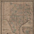
1866 Johnson Map of Texas - Geographicus - Texas-johnson-1866.jpg 5,000 × 3,490; 4.87 MB
-
1866 Johnson's Map of Missouri and Kansas - Geographicus - MIKA-j-64.jpg 4,000 × 3,011; 3.4 MB
-
1866 Mitchell Map of Texas - Geographicus - Texas-mitchell-1866.jpg 3,500 × 2,838; 3.15 MB
-
1866 Mitchell Map of Washington D.C. - Geographicus - WashingtonDC-mitchell-1866.jpg 3,500 × 2,880; 2.98 MB
-
Admiralty Chart No 1241 Ice Chart of the Southern Hemisphere, Pupblished 1866.jpg 10,530 × 11,574; 17.78 MB
-
Adolf Stieler, Paris und seine Umgebungen, 1866 - David Rumsey.jpg 3,650 × 2,859; 7.54 MB
-
Adolf Stieler, Sudwestliches Frankreich, 1866 - David Rumsey.jpg 10,314 × 7,597; 16.48 MB
-
Adrian, Michigan 1866. LOC 73693418.jpg 10,912 × 7,104; 16.82 MB
-
Amboise - Carte d'État major 1866.jpg 1,926 × 1,427; 2 MB
-
American Central Railway, 1866. LOC 98688576.jpg 14,031 × 5,093; 7.95 MB
-
American Central Railway, 1866. LOC 98688576.tif 14,031 × 5,093; 204.45 MB
-
Amherst (Township) NYPL1576124.tiff 5,428 × 6,508; 101.07 MB
-
August Heinrich Petermann, Das mittelländische Meer und Nord - Afrika (FL33142067 3881504).jpg 10,728 × 8,995; 152.92 MB
-
Aurora (Township) NYPL1576126.tiff 5,428 × 6,508; 101.07 MB
-
Aurora Woolen Mills, Torry and Bartlett Bro's. NYPL1576119.tiff 5,428 × 6,508; 101.07 MB
-
Battle of Pittsburgh Landing (i.e., Shiloh) LOC 99448456.jpg 1,444 × 2,664; 914 KB
-
Battle of Pittsburgh Landing (i.e., Shiloh) LOC 99448456.tif 1,444 × 2,664; 11.01 MB
-
Bern. (Township) NYPL1582614.tiff 4,940 × 5,550; 78.44 MB
-
Bethlehem (Township) NYPL1582616.tiff 5,124 × 5,512; 80.81 MB
-
Biographical. (cont.) NYPL1602864.tiff 5,404 × 6,896; 106.62 MB
-
Biographical. (cont.) NYPL1602865.tiff 5,404 × 6,896; 106.62 MB
-
Biographical. NYPL1602863.tiff 5,404 × 6,896; 106.62 MB
-
Blenheim (Township) NYPL1602923.tiff 5,396 × 6,808; 105.1 MB
-
Bombardeo 02.jpg 2,771 × 3,323; 7.96 MB
-
Boston (Township) NYPL1576128.tiff 5,428 × 6,508; 101.07 MB
-
Bowmansville (Village); Lancaster (Township); NYPL1576153.tiff 5,428 × 6,508; 101.07 MB
-
Brant (Township) NYPL1576129.tiff 6,508 × 5,428; 101.07 MB
-
Broome (Township) NYPL1602925.tiff 5,396 × 6,808; 105.1 MB
-
Brétigny - Carte d'État-major de la France 1866.jpg 2,775 × 2,220; 4.06 MB
-
Buffalo Business Directory. (cont.) NYPL1576132.tiff 5,428 × 6,508; 101.07 MB
-
Buffalo Business Directory. (cont.) NYPL1576133.tiff 6,292 × 5,428; 97.71 MB
-
Buffalo Business Directory. NYPL1576131.tiff 5,428 × 6,508; 101.07 MB
-
Carlisie (Township) NYPL1602926.tiff 5,396 × 6,808; 105.1 MB
-
Caroline (Township) NYPL1602866.tiff 5,404 × 6,896; 106.62 MB
-
Carte d'État-major de la France, Feuille Melun S.E - Villabé.jpg 2,559 × 1,706; 3.01 MB
-
Carte générale du département des Alpes-Maritimes - 1866.jpg 8,490 × 11,032; 20.23 MB
-
Charles William Meredith van de Velde, Kaart van het Heilige Land (FL199992273 2369096).jpg 9,877 × 14,737; 70.08 MB
-
Charles William Meredith van de Velde, Karte von Palaestina (FL199420775 2369098).jpg 10,559 × 16,188; 93.5 MB
-
Cheektowaga (Township) NYPL1576135.tiff 5,428 × 6,508; 101.07 MB
-
City of Buffalo (Township) NYPL1576130.tiff 5,428 × 6,508; 101.07 MB
-
Clarence (Township) NYPL1576136.tiff 5,428 × 6,508; 101.07 MB
-
Cobleskill (Township) NYPL1602928.tiff 5,396 × 6,808; 105.1 MB
-
Coexistence lignes ferroviaires Aix-les-Bains 1866 (carte état-major).jpg 1,848 × 5,752; 3.41 MB
-
Coeymans (Village); Indian Fields Business Directory. NYPL1582617.tiff 5,158 × 5,502; 81.2 MB
-
Cohoes (Village); Cohoes Business Directory. NYPL1582625.tiff 6,764 × 3,476; 67.27 MB
-
Colden (Village); Colden (Township); Colden Business Directory. NYPL1576138.tiff 5,428 × 6,508; 101.07 MB
-
Collins Center (Village); Collins Center Business Directory; Collins (Township) NYPL1576139.tiff 6,508 × 5,428; 101.07 MB
-
Colton, The Environs of Paris, 1866 - David Rumsey.jpg 6,111 × 4,980; 14.8 MB
-
Cordova's map of Texas.jpg 598 × 599; 133 KB
-
County of Bourke 1866 zoom elgars special section zoom.jpg 802 × 803; 180 KB
-
Dépot général de la Marine, Baie de Saint Jean d'Acre (FL36012368 3911463).jpg 11,621 × 16,277; 243.9 MB
-
Faubourg de Paris-Rennes-1866.PNG 1,020 × 747; 666 KB
-
Fermanville – Carte d'État-major de la France, Feuille Cherbourg N.O.png 4,688 × 3,763; 34.12 MB
-
Gare de Brétigny - Carte d'État-major de la France 1866.jpg 1,352 × 1,014; 868 KB
-
Habana 1866 guanabacoa.jpg 1,406 × 1,073; 543 KB
-
Habana 1866 Vieja.jpg 1,878 × 2,709; 1.38 MB
-
HMS Canopus (ex Franklin captured at Battle of Nile 1798) RMG PW7991.tiff 4,800 × 3,213; 44.12 MB
-
Index. NYPL1576120.tiff 5,428 × 6,508; 101.07 MB
-
Index. NYPL1582610.tiff 5,052 × 5,548; 80.19 MB
-
Index. NYPL1602854.tiff 5,404 × 6,896; 106.62 MB
-
Index. NYPL1602920.tiff 5,396 × 6,808; 105.1 MB
-
Indian Territory, with part of the adjoining state of Kansas, etc. LOC 2011590003.tif 10,770 × 8,148; 251.07 MB
-
Isla-de-pascua-3.jpg 2,480 × 1,950; 378 KB
-
Langtree's new sectional map of the state of Arkansas LOC 2009579453.jpg 12,519 × 11,302; 23.41 MB
-
Map of Arkansas LOC 2009579451.jpg 6,287 × 4,944; 2.95 MB
-
Map of Arkansas LOC 2009579451.tif 6,287 × 4,944; 88.93 MB
-
Map of Erie County NYPL1576165.tiff 5,428 × 6,508; 101.07 MB
-
Map of Salem Village.jpg 2,592 × 1,830; 1.06 MB
-
Map of Schenectady County NYPL1582636.tiff 5,090 × 5,508; 80.21 MB
-
Map of Shenandoah & Page counties and part of Warren County, Virginia (5960824689).jpg 1,789 × 2,000; 3.5 MB
-
Map of the Atlantic and Great Western Railway, with its connections, 1866. LOC 98688584.tif 9,834 × 6,801; 191.35 MB
-
Map of the battle field of Fredericksburg, Dec. 13, 1862 LOC lva0000049.jpg 7,663 × 6,107; 7.31 MB
-
Map of the defences of the city of Mobile. (1862-64) LOC 99447254.jpg 4,646 × 3,370; 2.29 MB
-
Map of the defences of the city of Mobile. (1862-64) LOC 99447254.tif 4,646 × 3,370; 44.8 MB
-
Map of the seat of war (5960832199).jpg 2,000 × 1,472; 2.93 MB
-
Map of the seat of war. To accompany the American Conflict. LOC 99447168.jpg 11,419 × 8,174; 19.91 MB
-
Map of the seat of war. To accompany the American Conflict. LOC 99447168.tif 11,419 × 8,174; 267.05 MB
-
Map of the State of Nevada LOC 2014589396.jpg 8,821 × 10,290; 12.05 MB
-
Map of the State of Nevada LOC 2014589396.tif 8,821 × 10,290; 259.69 MB
-
Map of the United Cities cottage sites LOC 84697268.jpg 11,049 × 6,978; 9.12 MB
-
Map of the United Cities cottage sites LOC 84697268.tif 11,049 × 6,978; 220.58 MB
-
Mississippi RIver From source to Delta.jpg 863 × 26,410; 4.31 MB
-
Nepal mandala map.jpg 829 × 379; 477 KB
-
Neuester Situations-Plan von Berlin 1866 (cropped 1).jpg 880 × 649; 245 KB
-
Neuester Situations-Plan von Berlin 1866 (cropped).jpg 1,118 × 663; 320 KB
-
Neuester Situations-Plan von Berlin 1866.jpg 7,836 × 5,779; 15.28 MB
-
New Topographical Atlas of Erie Co., New York NYPL1576117.tiff 5,428 × 6,508; 101.07 MB
-
New topographical atlas of Tompkins County, New York. NYPL1602851.tiff 5,404 × 6,896; 106.62 MB
-
New York State Inebriate Asylum. Binghamtom. NYPL1602852.tiff 5,404 × 6,896; 106.62 MB
-
Palestine According to Its Ancient divisions (FL35084133 3890568).jpg 6,465 × 7,929; 70.44 MB
-
Plan for enlarging the grounds around the U.S. Capitol LOC 88690771.jpg 4,960 × 6,144; 3.29 MB
-
Plan for enlarging the grounds around the U.S. Capitol LOC 88690771.tif 4,960 × 6,144; 87.19 MB
-
Plano de Madrid de 1866, de José Pilar Morales.jpg 6,648 × 4,824; 3.25 MB
-
Plano de Madrid en 1866.jpg 4,970 × 3,441; 8.73 MB
-
Plano del Ferrocarril de circunvalación de Madrid en 1866.jpg 2,272 × 1,678; 2.47 MB
-
Plate2-isla-de-pascua-3.jpg 558 × 768; 195 KB
-
Position of troops at sunset August 28th, 1862. (Second Manassas battle) LOC 99439172.tif 2,678 × 2,198; 16.84 MB
-
Ribbon map of the (Fa)ther of Waters. LOC 86691596.jpg 1,038 × 39,692; 4.43 MB
-
Saint-Antoine EM 1866 small.jpg 2,064 × 2,972; 8.1 MB
-
Sardinia (Township) NYPL1576159.tiff 5,428 × 6,508; 101.07 MB
-
Saxe, Silésie, Bohême et Moravie (FL36554762 2526567).jpg 9,060 × 7,514; 98.88 MB
-
Schenectady (Township); Ward no.1, 2, 3, and 4; Schenectady Business Directory. NYPL1582635.tiff 6,994 × 3,516; 70.36 MB
-
Schoharie (Township) NYPL1602941.tiff 5,396 × 6,808; 105.1 MB
-
Schoharie Co., N.Y. Table of Distances NYPL1602921.tiff 5,396 × 6,808; 105.1 MB
-
Schönberg's map of Texas. LOC 2002622346.jpg 4,015 × 3,438; 2.6 MB
-
Schönberg's map of Texas. LOC 2002622346.tif 4,015 × 3,438; 39.49 MB
-
Sketch showing route pursued in the advance to Goldsboro, N.C., in Dec. 1862 LOC 99447472.tif 2,410 × 3,235; 22.31 MB
-
Springville (Village); Springville Business Directory. NYPL1576141.tiff 5,428 × 6,508; 101.07 MB
-
State Capitol, Albany N.Y. NYPL1582609.tiff 5,074 × 5,560; 80.72 MB
-
State Capitol, Albany, N.Y. NYPL1602919.tiff 5,396 × 6,808; 105.1 MB
-
Sudwest-Asien - possessions of European Powers LOC 2013593017.jpg 6,404 × 5,156; 5.53 MB
-
Sudwest-Asien - possessions of European Powers LOC 2013593017.tif 6,404 × 5,156; 94.47 MB
-
Summit (Township) NYPL1602946.tiff 5,396 × 6,808; 105.1 MB
-
Table of Distances NYPL1576121.tiff 5,428 × 6,508; 101.07 MB
-
Table of Distances NYPL1602855.tiff 5,404 × 6,896; 106.62 MB
-
Tompkins County NYPL1602883.tiff 3,985 × 5,010; 57.13 MB
-
Tonawanda (Township) NYPL1576160.tiff 7,230 × 4,452; 92.09 MB
-
Ulysses (Township) NYPL1602881.tiff 6,896 × 5,404; 106.62 MB
-
Val de Saire – Carte d'État-major de la France, Feuilles Cherbourg et SO.png 11,252 × 8,815; 221.09 MB
-
Veigné - Etat-major val de l'Indre.jpg 722 × 596; 263 KB
-
Virginia, Bland County. LOC 2012592111.jpg 5,684 × 3,972; 2.04 MB
-
Virginia, Bland County. LOC 2012592111.tif 5,684 × 3,972; 64.59 MB
-
Waterford (Township) NYPL1602954.tiff 5,484 × 7,320, 2 pages; 115.12 MB
-
West Troy (Village); West Troy Business Directory. NYPL1582624.tiff 6,764 × 3,476; 67.27 MB
-
Westerlo (Township) NYPL1582627.tiff 5,174 × 5,428; 80.35 MB
-
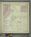
Williamsville (Village); Williamsville Business Directory. NYPL1576125.tiff 6,508 × 5,428; 101.07 MB
-
Wright (Township) NYPL1602947.tiff 7,230 × 5,194; 107.44 MB


