Category:1865 maps
Jump to navigation
Jump to search
| ← · 1860 · 1861 · 1862 · 1863 · 1864 · 1865 · 1866 · 1867 · 1868 · 1869 · → |
Deutsch: Karten mit Bezug zum Jahr 1865
English: Maps related to the year 1865
Español: Mapas relativos al año 1865
Français : Cartes concernant l’an 1865
Русский: Карты 1865 года
Subcategories
This category has the following 10 subcategories, out of 10 total.
Pages in category "1865 maps"
This category contains only the following page.
Media in category "1865 maps"
The following 200 files are in this category, out of 373 total.
(previous page) (next page)-
121 of 'History of the American War' (11069134774).jpg 1,395 × 1,632; 335 KB
-
185 of 'History of the American War' (11070476325).jpg 2,448 × 1,538; 571 KB
-
1865 Dripps Map of New York City - Geographicus - NewYork-dripps-1865.jpg 3,076 × 5,000; 3.96 MB
-
1865 Johnson Map of France, Spain and Portugal - Geographicus - FranceSpain-johnson-1865.jpg 3,751 × 5,000; 6.98 MB
-
1865 Johnson Map of Sweden, Norway and Denmark - Geographicus - SwedenDenmark-j-65.jpg 4,000 × 2,958; 3.19 MB
-
1865 Spruner Map of France or Gallia in Roman Times - Geographicus - Gallia-spruner-1865.jpg 3,500 × 2,799; 2.51 MB
-
1865 Spruner Map of Germany in Antiquity - Geographicus - Germania-spruner-1865.jpg 3,500 × 2,900; 2.28 MB
-
1865 Spruner Map of Persia in Antiquity - Geographicus - Persia-spruner-1865.jpg 3,500 × 2,717; 2.26 MB
-
1865 Spruner Map of the Balkans - Geographicus - Pannonia-spruner-1865.jpg 3,500 × 2,923; 3.15 MB
-
1865 West Barnstable to Woods Hole rail line map.jpg 10,760 × 3,959; 3.99 MB
-
26 of 'History of the American War' (11069728356).jpg 2,437 × 2,478; 1.08 MB
-
289 of 'History of the American War' (11070780995).jpg 1,574 × 2,519; 515 KB
-
296 of 'History of the American War' (11069888066).jpg 2,400 × 1,395; 564 KB
-
327 of 'History of the American War' (11069262185).jpg 1,356 × 1,830; 355 KB
-
39 of 'History of the American War' (11068626574).jpg 1,618 × 2,372; 575 KB
-
393 of 'History of the American War' (11070626604).jpg 1,309 × 2,272; 392 KB
-
449 of 'History of the American War' (11069775623).jpg 2,352 × 1,561; 412 KB
-
75 of 'History of the American War' (11069113066).jpg 1,570 × 2,369; 630 KB
-
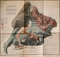
Abhandlungen der Königlichen Akademie der Wissenschaften in Berlin (1865) (14595417679).jpg 3,622 × 3,006; 3.02 MB
-
Abhandlungen der Königlichen Akademie der Wissenschaften in Berlin (1865) (14595422409).jpg 1,924 × 2,992; 1.32 MB
-
Abhandlungen der Königlichen Akademie der Wissenschaften in Berlin (1865) (14782093045).jpg 2,802 × 2,696; 1.09 MB
-
Alexander Keith Johnston, Palestine (FL36012634 3912043).jpg 10,498 × 17,370; 278.31 MB
-
Battle grounds in Missouri during Price's raid in the fall 1864 LOC 99447438.jpg 3,511 × 4,238; 1.79 MB
-
Battle grounds in Missouri during Price's raid in the fall 1864 LOC 99447438.tif 3,511 × 4,238; 42.57 MB
-
Battle of Stirling's Plantation.jpg 3,270 × 2,472; 1.68 MB
-
Bird's eye view of New York and environs. LOC 75693052.jpg 6,080 × 4,432; 5.1 MB
-
Birds eye view of Egg Harbor City, N.J. LOC 75694721.jpg 8,512 × 6,768; 14.13 MB
-
Birds eye view of Egg Harbor City, N.J. LOC 75694721.tif 8,512 × 6,768; 164.82 MB
-
Bouillet - Atlas universel, Carte 1.png 3,425 × 2,674; 26.21 MB
-
Bouillet - Atlas universel, Carte 2.png 3,425 × 2,674; 6.2 MB
-
Bouillet - Atlas universel, Carte 21.png 3,425 × 2,704; 26.51 MB
-
Bouillet - Atlas universel, Carte 22.png 3,425 × 2,674; 26.21 MB
-
Bouillet - Atlas universel, Carte 23.png 3,425 × 2,704; 26.51 MB
-
Bouillet - Atlas universel, Carte 3.png 1,748 × 2,711; 18.09 MB
-
Bouillet - Atlas universel, Carte 4.png 1,747 × 2,709; 18.06 MB
-
Calhoun County, Arknasas LOC 2011590023.jpg 9,066 × 12,615; 14.08 MB
-
Campaigns of the Civil War in the East. LOC 99447179.jpg 1,381 × 2,145; 438 KB
-
Campaigns of the Civil War in the East. LOC 99447179.tif 1,381 × 2,145; 8.48 MB
-
Campaigns of the Civil War in the West. LOC 2008627952.jpg 1,717 × 2,540; 455 KB
-
Campaigns of the Civil War in the West. LOC 2008627952.tif 1,717 × 2,540; 12.48 MB
-
Canton (Township) NYPL1601919.tiff 6,178 × 5,428; 95.94 MB
-
Canton Village Directory.; Canton (Village) NYPL1601920.tiff 6,178 × 5,428; 95.94 MB
-
Carta di Milano di Giovanni Brenna (1865) - Musocco.jpg 2,378 × 1,922; 2.5 MB
-
Carte de l'isthme de Suez (FL155340109 3373443).jpg 3,675 × 3,174; 7.92 MB
-
Carte du département de la Savoie - 1865.jpg 9,699 × 7,660; 14.49 MB
-
Catalogue of points of historic interest - (Washington D.C. and metropolitan area) LOC 87694061.tif 8,912 × 6,284; 160.23 MB
-
Charles William Meredith van de Velde, Map of the Holy Land (FL199992278 2369097).jpg 10,417 × 16,081; 85.72 MB
-
Charles William Wilson, Ordnance Survey of Jerusalem (FL47890604 2368217).jpg 12,631 × 16,702; 263.88 MB
-
Charles William Wilson. Ordnance Survey of Jerusalem. 1865. II.jpg 14,636 × 10,210; 16.63 MB
-
Charles William Wilson. Ordnance Survey of Jerusalem. 1865.jpg 14,571 × 10,210; 16.46 MB
-
Chattanooga and its defences, LOC 99448360.jpg 2,487 × 3,097; 1.01 MB
-
Chattanooga and its defences, LOC 99448360.tif 2,487 × 3,097; 22.04 MB
-
Colton's China. LOC 2006629376.jpg 6,900 × 5,719; 7.94 MB
-
Colton's China. LOC 2006629376.tif 6,900 × 5,719; 112.9 MB
-
Colton's Persia Arabia etc. LOC 2013593024.jpg 5,274 × 4,384; 3.62 MB
-
Colton's Persia Arabia etc. LOC 2013593024.tif 5,274 × 4,384; 66.15 MB
-
Colton, The Environs of Paris, 1865 - David Rumsey.jpg 6,152 × 4,939; 14.99 MB
-
Dekalb (Village); Dekalb Business Directory.; Dekalb (Township) NYPL1601923.tiff 6,178 × 5,428; 95.94 MB
-
Depeyster (Village); De Peyster Business Directory.; De Peyster (Township) NYPL1601925.tiff 5,428 × 6,194; 96.19 MB
-
Dépot général de la Marine, Jaffa autrefois Joppé ou Japho (FL36012330 3911459).jpg 11,568 × 16,230; 259.94 MB
-
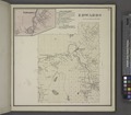
Edwards (Village); Edwards Business Directory.; Edwards (Township) NYPL1601926.tiff 6,178 × 5,428; 95.94 MB
-
Fauvel. Le Choléra. - Carte indiquant la marche du Choléra en 1865 - btv1b55010879z.jpg 10,429 × 4,669; 4.38 MB
-
Fullerville (Village); Fowler (Township) NYPL1601928.tiff 6,178 × 5,428; 95.94 MB
-
Gouverneur. (Township) NYPL1601929.tiff 6,178 × 5,428; 95.94 MB
-
Greece at the time of the Dorian Migration (Spruner-Menke, Atlas Antiquus, 1865).jpg 6,935 × 5,554; 28.82 MB
-
Greece, Epirus after the Persian War (Spruner-Menke, Atlas Antiquus, 1865).jpg 5,674 × 6,439; 26.18 MB
-
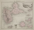
Guadeloupe1865.jpg 737 × 656; 121 KB
-
Hartley's map of Arizona. LOC 98687199.tif 11,180 × 9,362; 299.46 MB
-
Henry Baker Tristram, Routes in the Holy Land (FL25570542 2557192).jpg 4,799 × 11,879; 72.14 MB
-
Hodskin House. Canton, St. Lawrence Co. N.Y. NYPL1601914.tiff 6,178 × 5,428; 95.94 MB
-
Hunt's improved map of Wetzel County, W. V. LOC 2012593056.jpg 9,626 × 7,818; 8.84 MB
-
Hunt's improved map of Wetzel County, W. V. LOC 2012593056.tif 9,626 × 7,818; 215.31 MB
-
Index. NYPL1601916.tiff 6,178 × 5,428; 95.94 MB
-
Investment of Petersburg by Genl. Grant 1865 LOC gvhs01.vhs00186.jpg 1,837 × 2,206; 855 KB
-
Investment of Petersburg by Genl. Grant 1865 LOC gvhs01.vhs00186.tif 1,837 × 2,206; 11.59 MB
-
IQUIQUE PLANO 1861.JPG 1,445 × 1,055; 674 KB
-
Jan Mayen map 1865.jpg 2,308 × 1,566; 287 KB
-
Konrad Furrer, Plan von Jerusalem nach Tobler u. Van de Velde (FL45588697 3930576).jpg 2,958 × 2,606; 1.61 MB
-
Louis Vignes, Carte du cours inférieur du Jourdain de la Mer Morte (FL6882825 2633902).jpg 7,718 × 10,477; 106.76 MB
-
Louis Vignes, Carte du Wady Arabah (FL6879386 2640580).jpg 7,728 × 10,464; 115.41 MB
-
Louisville and its defences LOC 2008621650.jpg 13,989 × 9,605; 16.48 MB
-
Louisville and its defences LOC 2008621650.tif 13,989 × 9,605; 384.42 MB
-
Map of Botetourt County LOC 2012591107.jpg 9,215 × 7,885; 10.89 MB
-
Map of Botetourt County LOC 2012591107.tif 9,215 × 7,885; 207.88 MB
-
Map of fortifications and defenses of Washington. LOC 88690671.jpg 1,832 × 2,464; 928 KB
-
Map of fortifications and defenses of Washington. LOC 88690671.tif 1,832 × 2,464; 12.92 MB
-
Map of Kansas and Nebraska. LOC 98688397.tif 8,719 × 6,964; 173.72 MB
-
Map of King William County LOC 2012589213.jpg 9,991 × 6,698; 8.08 MB
-
Map of King William County LOC 2012589213.tif 9,991 × 6,698; 191.46 MB
-
Map of Pr. George, Surry, Sussex, and Southampton counties LOC 2005625082.jpg 4,807 × 5,914; 3.95 MB
-
Map of Pr. George, Surry, Sussex, and Southampton counties LOC 2005625082.tif 4,807 × 5,914; 81.34 MB
-
Map of St. Lawrence County. NYPL1601912.tiff 6,178 × 5,428; 95.94 MB
-
Map of the battlefield of Five-Forks. (March 30-April 1, 1865) LOC 99439141.jpg 9,042 × 13,828; 34.79 MB
-
Map of the battlefield of Five-Forks. (March 30-April 1, 1865) LOC 99439141.tif 9,042 × 13,828; 357.72 MB
-
Map of the battlefield of Five-Forks. (March 30-April 1, 1865) LOC 99439146.jpg 8,977 × 15,620; 38.74 MB
-
Map of the battlefield of Five-Forks. (March 30-April 1, 1865) LOC 99439146.tif 8,977 × 15,620; 401.18 MB
-
Map of the city of Brooklyn. LOC 2015585148.jpg 5,640 × 4,648; 4.21 MB
-
Map of the city of Brooklyn. LOC 2015585148.tif 5,640 × 4,648; 75 MB
-
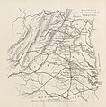
Map of the seat of war in Virginia. LOC 84692056.jpg 5,256 × 3,726; 3.13 MB
-
Map of the seat of war in Virginia. LOC 84692056.tif 5,256 × 3,726; 56.03 MB
-
Map of the siege of Petersburg, 1864-5 LOC 2001622369.jpg 9,185 × 8,727; 8.74 MB
-
Map of the siege of Petersburg, 1864-5 LOC 2001622369.tif 9,185 × 8,727; 229.33 MB
-
Map of the town of Morrisania, Westchester Co. N.Y. LOC 2004625898.jpg 13,640 × 15,303; 33.66 MB
-
Map of the vicinity of Strasburg and Fisher's Hill LOC 2005625096.jpg 7,585 × 4,321; 6.13 MB
-
Map of the vicinity of Strasburg and Fisher's Hill LOC 2005625096.tif 7,585 × 4,321; 93.77 MB
-
Map of Virginia and North Carolina from the coast to the Blue Ridge LOC 2006627684.jpg 10,496 × 7,435; 13.91 MB
-
Map of Virginia and North Carolina from the coast to the Blue Ridge LOC 2006627684.tif 10,496 × 7,435; 223.27 MB
-
Map of Yates Co., New York - from actual surveys LOC 2013593242.jpg 15,093 × 13,658; 28.49 MB


