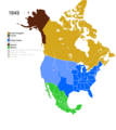
Category:1849 maps of North America
Jump to navigation
Jump to search
Temperate regions: North America · South America · Africa · Europe · Asia · – Polar regions: – Other regions:
English: 1849 maps of North America
Subcategories
This category has the following 2 subcategories, out of 2 total.
Media in category "1849 maps of North America"
The following 20 files are in this category, out of 20 total.
-
Large-scale-old-map-of-the-united-states-the-british-provinces-and-mexico-1849.jpg 7,485 × 5,645; 13.14 MB
-
Map of North America. LOC 2002628196.jpg 7,852 × 10,002; 12.6 MB
-
Map of North America. LOC 2002628196.tif 7,852 × 10,002; 224.69 MB
-
Map of the United States, the British provinces, Mexico etc. LOC 98685369.jpg 7,487 × 5,647; 9.65 MB
-
Map of the United States, the British provinces, Mexico etc. LOC 98685369.tif 7,487 × 5,647; 120.96 MB
-
Meyer‘s Zeitungsatlas 005 – Britisches Nord-America.jpg 7,323 × 6,293; 14.21 MB
-
Non-Native American Nations Control over N America 1849.png 800 × 895; 199 KB
-
Map of North America (NYPL Hades-293021-1260991).jpg 4,800 × 5,280; 7.37 MB
-
Map of North America (NYPL Hades-293021-1260991).tiff 4,808 × 5,291; 72.79 MB
-
The Alaska frontier (1903) (14592841290).jpg 2,400 × 3,877; 853 KB
-
Vereinigte Staaten Von Nordamerika (3120220625).jpg 2,000 × 1,577; 3.14 MB


