Category:1849 maps
Jump to navigation
Jump to search
| ← · 1840 · 1841 · 1842 · 1843 · 1844 · 1845 · 1846 · 1847 · 1848 · 1849 · → |
Deutsch: Karten mit Bezug zum Jahr 1849
English: Maps related to the year 1849
Español: Mapas relativos al año 1849
Français : Cartes concernant l’an 1849
Русский: Карты 1849 года
Subcategories
This category has the following 10 subcategories, out of 10 total.
Media in category "1849 maps"
The following 100 files are in this category, out of 100 total.
-
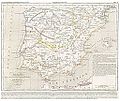
(1849) España y Portugal.jpg 5,294 × 3,777; 8.9 MB
-
CHAO(1849) Atlas Historico Geografico de España - Mapa 1 (409).jpg 4,462 × 3,750; 7.4 MB
-
CHAO(1849) Atlas Historico Geografico de España - Mapa 2 (409-585).jpg 4,521 × 3,790; 7.74 MB
-
CHAO(1849) Atlas Historico Geografico de España - Mapa 4 (756-1030).jpg 4,420 × 3,684; 7.53 MB
-
CHAO(1849) Atlas Historico Geografico de España - Mapa 6 (1214-1492).jpg 4,430 × 3,769; 8.02 MB
-
1849 Japanese Map of Edo or Tokyo, Japan - Geographicus - Edo-tokyo-1849.jpg 6,000 × 4,892; 9.26 MB
-
1849 Land Survey Map of Michigan Upper Peninsula - Geographicus - Michigan-ls-1850.jpg 3,000 × 1,810; 964 KB
-
1849 Munich public libraries map HouseOfCommonsSelectCommittee.jpg 606 × 363; 140 KB
-
1849 Railroad Map of New England & Eastern New York.jpg 7,882 × 9,884; 19.41 MB
-
60 of 'Historia de Méjico, etc' (11030031305).jpg 2,432 × 1,460; 990 KB
-
A Map of Lewisburg, West Virginia - DPLA - d638b6df3de4e3c062332dff1dd5e8ca.jpg 8,820 × 6,200; 2.68 MB
-
A map of the counties of Salem and Gloucester, New Jersey - from actual surveys LOC 2012586902.jpg 17,080 × 11,507; 26.48 MB
-
A map of the counties of Salem and Gloucester, New Jersey - from actual surveys LOC 2012586902.tif 17,080 × 11,507; 562.3 MB
-
Admiralty Chart No 1654 File-J. & C. Walker, The Archipelago (FL37663320 3370988), Published 1849.jpg 12,425 × 16,384; 278.21 MB
-
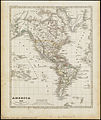
America (3121047664).jpg 1,678 × 2,000; 3.24 MB
-
Asia minor 1140-es.svg 932 × 1,008; 978 KB
-
Badische Hauptbahn aus Bahnkarte Deutschland 1849.png 814 × 1,100; 1.77 MB
-
China. LOC 2006629389.tif 6,835 × 5,333; 104.29 MB
-
City of Washington. LOC 88694047.jpg 5,131 × 4,057; 3.57 MB
-
City of Washington. LOC 88694047.tif 5,131 × 4,057; 59.56 MB
-
Detailed map of the eight provinces of the Kantō region (14961991615).jpg 2,271 × 2,000; 1.87 MB
-
Diagram of the south part of Shaker Village, Canterbury, NH. LOC 00552211.jpg 3,709 × 4,839; 2.27 MB
-
Diagram of the south part of Shaker Village, Canterbury, NH. LOC 00552211.tif 3,709 × 4,839; 51.35 MB
-
Distance map of the state of New York - containing all the towns in the state. LOC 2009584046.tif 8,921 × 6,563; 167.51 MB
-
Eduard Kretzschmar, Das Heilige Land aus der Vogelschau (FL199985561 2368690).jpg 8,620 × 6,620; 31.77 MB
-
Edward Aldrich, Plan of the town and environs of Jerusalem (FL10521888 2810420).jpg 7,488 × 6,922; 53.46 MB
-
Edward Gennys Fanshawe, Chart of the harbour of Rio de Janeiro, Brazil.jpg 995 × 1,280; 919 KB
-
Head of navigation of the Potomac River LOC 87695757.jpg 15,202 × 9,015; 17.53 MB
-
Head of navigation of the Potomac River LOC 87695757.tif 15,202 × 9,015; 392.09 MB
-
Himalayas 1849.jpg 3,468 × 1,792; 1.71 MB
-
John Relly Beard, Sketch of the Lake of Galilee (FL45582603 3924391).jpg 1,622 × 2,619; 959 KB
-
John Seaton Warburton, Palestine or the Holy Land (FL37121891 3898137).jpg 2,431 × 3,768; 6.07 MB
-
Karte Provinz Schlesien 1849 (ziemia prudnicka).jpg 758 × 418; 119 KB
-
Karte Provinz Schlesien 1849.jpg 8,273 × 6,616; 11.75 MB
-
KulikovoPole.jpg 14,084 × 16,414; 15.54 MB
-
Lake Erie LOC 2017588900.jpg 12,001 × 7,533; 10.6 MB
-
Lake Erie LOC 2017588900.tif 12,001 × 7,533; 258.65 MB
-
Map of Burlington County LOC 2012586251.jpg 19,864 × 10,194; 24.54 MB
-
Map of Győr and its fortifications from February 1849.png 8,346 × 5,970; 82.49 MB
-
Map of Mercer County, New Jersey LOC 2004629246.jpg 12,507 × 9,611; 17.95 MB
-
Map of New Castle County, Delaware - from original surveys LOC 2013593084.jpg 10,802 × 15,122; 26.83 MB
-
Map of the battleground of the Battle of Ihász (1849).jpg 3,850 × 2,850; 2.53 MB
-
Map of the city of Trenton, New Jersey LOC 2010592395.jpg 11,304 × 8,162; 10.68 MB
-
Map of the city of Trenton, New Jersey LOC 2010592395.tif 11,304 × 8,162; 263.97 MB
-
Map of the emigrant road from Independence Mo. to St. Francisco, California LOC 2005627024.jpg 25,436 × 8,401; 16.66 MB
-
Map of the town of Northbridge (3720895814).jpg 1,024 × 902; 779 KB
-
MAPA DE AVILA EN 1849.jpg 3,251 × 4,967; 1.92 MB
-
Meyer‘s Zeitungsatlas 064 – Das System unserer Sonne.jpg 7,379 × 6,265; 10.59 MB
-
NewCityWeeklyTimes Extra 1849.jpg 4,398 × 6,919; 7.61 MB
-
NormanPlanNOLA1849statelaus.jpg 600 × 434; 90 KB
-
Paper-Mill tract - (on Rock Creek, N.W. Washington D.C.). LOC 88693009.jpg 5,305 × 6,786; 3.14 MB
-
Paper-Mill tract - (on Rock Creek, N.W. Washington D.C.). LOC 88693009.tif 5,305 × 6,786; 103 MB
-
Plan and profile of the Androscoggin & Kennebec Railroad LOC 79693205.jpg 19,419 × 7,143; 11.28 MB
-
Plan and profile of the Androscoggin & Kennebec Railroad LOC 79693205.tif 19,419 × 7,143; 396.85 MB
-
Rail road map of New England and eastern New York (10839204275).jpg 6,429 × 7,706; 11.37 MB
-
S. Western route ; Northern route ; Way routes (9471623021).jpg 800 × 529; 113 KB
-
Sjøkart over den nordlige delen av Nordsjøen, fra 1849.png 4,292 × 2,864; 19.5 MB
-
South Eastern Asia.png 8,160 × 6,570; 52.12 MB
-
Spain 1849.jpg 1,810 × 1,502; 603 KB
-
Tableau orographique... de la chaîne des Pyrénées - Frossard, Emilien - btv1b105677251.jpg 9,024 × 3,798; 3.59 MB
-
The hymenial expositor, or, matrimonial chart (35015060082).jpg 2,000 × 1,679; 3.07 MB
-
Thomas-Shapter-HistoryOfCholeraInExeter1832-map.jpg 1,280 × 1,168; 384 KB
-
West end of Lake Erie and Detroit River LOC 2017588902.jpg 8,721 × 11,099; 10.77 MB
-
West end of Lake Erie and Detroit River LOC 2017588902.tif 8,721 × 11,099; 276.93 MB
-
West Indien und Mittel America (3120220075).jpg 2,000 × 1,656; 3.16 MB
-
William Francis Lynch, Map of the River Jordan & Dead Sea (FL6881003 3426908).jpg 8,080 × 14,254; 140.41 MB
-
William Francis Lynch, Sketch map of the Dead Sea (FL25570575 3468188).jpg 5,688 × 10,096; 81.74 MB
-
William Hughes, Plan of Jerusalem (after Schultz and Kiepert) (FL49973282 4073123).jpg 3,951 × 5,378; 20.06 MB


