Category:1823 maps
Jump to navigation
Jump to search
| ← · 1820 · 1821 · 1822 · 1823 · 1824 · 1825 · 1826 · 1827 · 1828 · 1829 · → |
Deutsch: Karten mit Bezug zum Jahr 1823
English: Maps related to the year 1823
Español: Mapas relativos al año 1823
Français : Cartes concernant l’an 1823
Русский: Карты 1823 года
Subcategories
This category has the following 7 subcategories, out of 7 total.
Media in category "1823 maps"
The following 71 files are in this category, out of 71 total.
-
BENN(1823) p167 PARISH OF BELFAST.jpg 2,389 × 3,503; 3.84 MB
-
IRBY(1823) p123 GROUND PLAN OF THE GREAT TEMPLE OF EBSAMBAL.jpg 2,223 × 2,137; 2.06 MB
-
IRBY(1823) p470 SKETCH OF THE GROUND PLAN OF PETRA.jpg 2,227 × 2,135; 2.02 MB
-
KWIATKOWSKI(1823) p099 Map of the Battle of Smolensk (1634).jpg 4,294 × 2,412; 3.63 MB
-
1823 Mont Blanc 1.jpg 1,065 × 795; 743 KB
-
Aaron Arrowsmith, Map of Syria (FL6880898 2640493).jpg 10,301 × 15,865; 240.01 MB
-
Aepfelgschwendt-Franzkat-1823.JPG 1,917 × 1,025; 393 KB
-
Baindt Urkataster 1823.jpg 3,361 × 2,325; 4.01 MB
-
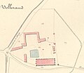
Cadastre Vaulerent 1823.jpg 980 × 852; 390 KB
-
Canaan or Judæa (FL37119375 3897514).jpg 2,720 × 3,380; 5.48 MB
-
Charte der Österreichischen monarchie 1823.jpg 3,012 × 2,413; 1.16 MB
-
Country drained by the Mississippi LOC 2007630425.jpg 3,600 × 5,366; 3.35 MB
-
Country drained by the Mississippi LOC 2007630425.tif 3,600 × 5,366; 55.27 MB
-
Franz Sieber, Karte von Jerusalem und seiner naechsten Umgebungen (FL31740081 2368185).jpg 14,604 × 11,075; 220.48 MB
-
Historische Karte von Gansheim.jpg 465 × 399; 64 KB
-
Gorenje Blato FK.jpg 1,091 × 867; 135 KB
-
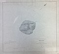
Halul Island 1823 chart.jpg 1,647 × 1,520; 1.24 MB
-
Irby mangles map petra 1823.jpg 739 × 716; 121 KB
-
Karte Florida 1823 9157.jpg 2,575 × 2,940; 1.58 MB
-
Karte von America (3121046728).jpg 1,450 × 2,000; 2.88 MB
-
Khanate of Karabakh in 1823.JPG 875 × 840; 154 KB
-
Krumau 1823 detail.jpg 4,785 × 2,411; 18.46 MB
-
Krumau 1823.jpg 8,333 × 8,151; 90.71 MB
-
Landschaftspark, Messtischblatt 1823.JPG 2,018 × 1,810; 1.16 MB
-
Plan cadastrale du château de Pont-Muzard.png 1,723 × 795; 1.81 MB
-
Plan of the Quarantine district of Feodosia.jpg 9,560 × 7,138; 5.31 MB
-
Plattegrond Maastricht, 1823 (GAM1120).jpg 2,755 × 2,274; 3.16 MB
-
Richard Palmer, Half Tribe of Manasseh (FL45582467 3918693).jpg 2,141 × 1,553; 1.01 MB
-
Richard Palmer, Manasseh beyond Jordan (FL45582443 3918630).jpg 1,573 × 2,150; 786 KB
-
Richard Palmer, Tribe of Asher (FL45582499 3918700).jpg 1,377 × 2,153; 1.29 MB
-
Richard Palmer, Tribe of Benjamin (FL45582464 3918635).jpg 2,047 × 1,507; 665 KB
-
Richard Palmer, Tribe of Dan (FL45582488 3918634).jpg 1,610 × 2,202; 727 KB
-
Richard Palmer, Tribe of Ephraim (FL45582486 3918638).jpg 2,164 × 1,527; 782 KB
-
Richard Palmer, Tribe of Gad (FL45582440 3918628).jpg 1,579 × 2,177; 736 KB
-
Richard Palmer, Tribe of Issachar (FL45582478 3918695).jpg 2,117 × 1,644; 1.36 MB
-
Richard Palmer, Tribe of Judah (FL45582461 3918632).jpg 2,183 × 2,607; 1.33 MB
-
Richard Palmer, Tribe of Naphtali (FL45582520 3918702).jpg 1,377 × 2,190; 662 KB
-
Richard Palmer, Tribe of Reuben (FL45582454 3918627).jpg 2,073 × 1,559; 838 KB
-
Richard Palmer, Tribe of Simeon (FL45582502 3918633).jpg 1,341 × 2,164; 602 KB
-
Richard Palmer, Tribe of Zebulon (FL45582517 3918696).jpg 2,135 × 1,570; 731 KB
-
Samuel John Neele, Persia (FL33249928 2517549).jpg 6,477 × 5,289; 49.75 MB
-
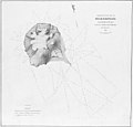
Sir Abu Nuayr 1823 (retouched).jpg 1,552 × 1,488; 1.01 MB
-
Sir Abu Nuayr 1823.map.jpg 2,000 × 1,855; 1.03 MB
-
Virginia. NYPL976276.tiff 4,352 × 5,418; 67.47 MB
-
Woodbridge isothermal chart.jpg 3,360 × 2,636; 4.57 MB
-
Woodbridge isothermal chart2.jpg 3,357 × 2,628; 6.24 MB
-
Woodbridge isothermal chart3.jpg 3,338 × 2,413; 6.24 MB
-
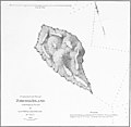
Zirku 1825 map (retouched).jpg 1,304 × 1,272; 641 KB
-
Zirku 1825 map.jpg 1,970 × 2,000; 821 KB
-
אי איסטו איס לה צורה די לוס טירימינוס די ארץ ישראל (FL6882874 2630531).jpg 2,398 × 3,624; 12.76 MB


