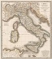
Category:1810s maps of Italy
Jump to navigation
Jump to search
- Regions of Italy: Emilia-Romagna · Lazio · Liguria · Lombardy · Marche · Trentino-South Tyrol · Tuscany · Umbria ·
Subcategories
This category has the following 13 subcategories, out of 13 total.
.
Media in category "1810s maps of Italy"
The following 7 files are in this category, out of 7 total.
-
1810 map of Northern Italy.jpg 15,572 × 12,177; 40.55 MB
-
Carte de l'Empire francais et des états limitrophes (15569005).jpg 23,598 × 15,794; 136.7 MB
-
A new and elegent general atlas - Italy.jpg 3,743 × 4,320; 2.39 MB
-
Italy, 1815 (Wyld).jpg 7,077 × 8,112; 9.39 MB
-
Upravni zemljevid Ilirskega kraljestva leta 1817.jpg 7,365 × 9,760; 9.56 MB


