Category:17th-century maps of Peru
Jump to navigation
Jump to search
Media in category "17th-century maps of Peru"
The following 29 files are in this category, out of 29 total.
-
Peru - btv1b550049639.jpg 6,921 × 5,226; 3.93 MB
-
Atlas ou Representation du Monde Universel t. 2. 1633 (110103062).jpg 16,609 × 12,126; 35.56 MB
-
Peru - btv1b8596500c (1 of 2).jpg 9,120 × 7,820; 11.22 MB
-
Detalle mapa de Peru de Blauew.jpg 737 × 553; 73 KB
-
Péru - btv1b8446682z.jpg 8,876 × 7,007; 8.7 MB
-
Mapa Perú Ioannem Ianssonium.JPG 2,304 × 1,848; 3.08 MB
-
Mapa Perú Ioannem Ianssonium.jpg 2,304 × 1,848; 1.72 MB
-
Peru - btv1b85964995.jpg 8,360 × 6,490; 8.92 MB
-
Mapa de la Mar del Sur y el Virreinato del Perú con sus jurisdicciones - AHG.jpg 4,632 × 3,534; 15.6 MB
-
Peru (NYPL b14467885-1505046).jpg 8,080 × 7,812; 13.6 MB
-
Peru (NYPL b14467885-1505046).tiff 8,080 × 7,812; 180.61 MB
-
Peru - btv1b53196873m (2 of 3).jpg 8,753 × 6,459; 8.16 MB
-
Peru - CBT 6621130.jpg 5,555 × 4,313; 5.64 MB
-
Bahia de San Nicolas and San Juan RMG F1493.tiff 6,744 × 5,281; 101.9 MB
-
Bahia de San Nicolas and San Juan RMG L6957-158.jpg 1,280 × 1,031; 355 KB
-
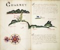
Guarmey RMG F1888.tiff 6,509 × 5,432; 101.16 MB
-
Le Perou (4587182588).jpg 2,000 × 1,483; 2.97 MB
-
MapaPeruMannessonMallet1683.JPG 1,677 × 2,284; 2.03 MB
-
MapaPeruMannessonMallet1683fr.JPG 1,496 × 2,146; 1.72 MB
-
MapaPerú.Sanson1.JPG 2,116 × 1,580; 2.8 MB
-
Novae Hispaniae Chili Peruviae et Guatimalae Littorae.jpg 629 × 548; 110 KB
-
Peru - descriptore Joanne Baptista Nicolosio... - btv1b84699100 (4 of 4).jpg 8,974 × 6,956; 7.69 MB
-
Peru. R 2= 22. Pièce 86.jpg 8,576 × 6,792; 9.16 MB
-
Peru. R 2= 22. Pièce 87.jpg 6,736 × 4,800; 6.34 MB
-
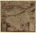
Planta de la muy yllustre ciudad de los reyes corte del reino del Peru - (Lima) LOC 2010592749.jpg 13,140 × 11,874; 14.82 MB
-
Planta de la muy yllustre ciudad de los reyes corte del reino del Peru - (Lima) LOC 2010592749.tif 13,140 × 11,874; 446.39 MB


