Category:1797 maps
Jump to navigation
Jump to search
| ← · 1790 · 1791 · 1792 · 1793 · 1794 · 1795 · 1796 · 1797 · 1798 · 1799 · → |
Deutsch: Karten mit Bezug zum Jahr 1797
English: Maps related to the year 1797
Español: Mapas relativos al año 1797
Français : Cartes concernant l’an 1797
Русский: Карты 1797 года
Subcategories
This category has the following 8 subcategories, out of 8 total.
Media in category "1797 maps"
The following 50 files are in this category, out of 50 total.
-
1797 chart of Marquesas by James Wilson explorer.jpg 2,962 × 3,796; 772 KB
-
1797 Jean Map of Paris and the Faubourgs, France - Geographicus - Paris-jean-1797.jpg 6,000 × 3,938; 9.78 MB
-
1797 map of Fiji by James Wilson explorer.jpg 3,633 × 4,601; 1.06 MB
-
1797-map-of-Dublin.jpg 9,945 × 6,846; 16.01 MB
-
A new and correct chart from the Isle of Dogs, to Prittlewell, and the Nore RMG F8050.tiff 4,989 × 3,597; 51.34 MB
-
A new chart of the Atlantic or Western Ocean (8345826935).jpg 799 × 606; 113 KB
-
A new chart of the Mediterranean Sea LOC 2012593220.jpg 22,819 × 9,546; 28.28 MB
-
A plan of the action at Breeds Hill, on the 17th of June 1775 (2675628160).jpg 1,785 × 2,000; 3.12 MB
-
America or The New World.jpg 1,024 × 901; 1.2 MB
-
Benjamin Baker, Palestina seu Terra Sancta (FL37105380 3886809).jpg 5,051 × 6,102; 41.09 MB
-
Caesarea 1797 1.jpg 2,282 × 1,863; 3.76 MB
-
Carta dell'Istria 1797.jpg 11,161 × 14,884; 24.3 MB
-
Duff Islands map 1797 (retouched).jpg 3,160 × 2,045; 3.35 MB
-
Duff Islands map 1797.jpg 3,467 × 2,373; 480 KB
-
Easter Island map by La Perouse 1797.jpg 8,037 × 5,888; 8.53 MB
-
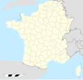
France location map-Departements 1797.svg 2,000 × 1,922; 603 KB
-
Friedrich Gottlieb Canzler, Karte von Fes und Marócos (FL13727050 2496897).jpg 6,051 × 6,536; 58.67 MB
-
Giovanni Maria Cassini, L'Arabia delineata sulle ultime osservazioni (FL35865379 2491676).jpg 13,891 × 10,212; 191.84 MB
-
Giovanni Maria Cassini, La Persia Delineata (FL35061657 2516878).jpg 14,265 × 10,961; 192.03 MB
-
Giovanni Maria Cassini, La Turchia Asiatica (FL35866805 2714568).jpg 13,634 × 10,294; 193.34 MB
-
Herzogthum Krain 1797.jpg 10,055 × 7,548; 10.58 MB
-
Jing ban tian wen quan tu. LOC 92682866.jpg 8,903 × 14,676; 22.77 MB
-
Jing ban tian wen quan tu. LOC 92682866.tif 8,903 × 14,676; 373.82 MB
-
Johann Jahn, Oberflaeche von Palaestina (FL6881916 2368645).jpg 1,935 × 2,377; 7.13 MB
-
Johann Jahn, Schauplatz der Bibel (FL6881691 2368642).jpg 5,838 × 4,408; 40.22 MB
-
Nieuwe Kaart van het inkoomen van de Ooster en Wester Eemze en het Hommegat RMG K1114.jpg 1,280 × 1,108; 1.24 MB
-
Oberkrain oder der Laybacher Kreis 1797.jpg 8,611 × 7,115; 8.8 MB
-
Partie de la mer du sud comprise entre les Philippines et la Californie (FL37817159 3242434).jpg 18,389 × 13,887; 333.36 MB
-
Plan de l'Isle de Paque (1797).jpg 4,002 × 5,698; 16.01 MB
-
Plan de la Baie de Cook (1797).jpg 4,024 × 5,744; 20.13 MB
-
Plan Géométral De Paris Et De Ses Fauxbourgs.jpg 11,941 × 8,264; 22.8 MB
-
Pregledni zemljevid Istre leta 1797.jpg 12,733 × 18,155; 34.91 MB
-
Samuel van Emdre, Het Hedendaagsch Jerusalem (FL6881706 2368058).jpg 2,800 × 2,191; 1.67 MB
-
Selenographia RMG D7960-6.tiff 4,000 × 2,661; 30.45 MB
-
Sketch of the Duff group Islands 1797.jpg 3,369 × 2,237; 454 KB
-
The Dermott or tin case map of Washington 1797-8. LOC 88694114.jpg 16,469 × 19,670; 21.21 MB
-
Venäläinen Viipurin piirikunnan kartta 1797.jpg 14,029 × 8,505; 8.37 MB
-
Wallis, Futuna, Niuas islands on a 1797 French map.jpg 960 × 626; 230 KB


