Category:1790 maps
Jump to navigation
Jump to search
| ← · 1790 · 1791 · 1792 · 1793 · 1794 · 1795 · 1796 · 1797 · 1798 · 1799 · → |
Deutsch: Karten mit Bezug zum Jahr 1790
English: Maps related to the year 1790
Español: Mapas relativos al año 1790
Français : Cartes concernant l’an 1790
Русский: Карты 1790 года
Subcategories
This category has the following 7 subcategories, out of 7 total.
Media in category "1790 maps"
The following 97 files are in this category, out of 97 total.
-
 1790 Bauerschaft Stüter-Elfringhausen.png 1,056 × 673; 1.73 MB
-
 A Chart of the Mediterranean (FL13732034 3370769).jpg 8,341 × 10,266; 115.1 MB
-

-

-

-

-
 A plan of part of His Majesty's Province of Quebec RMG K1013.jpg 1,280 × 769; 835 KB
-
 Ager Mediolanensis Medii Aevi (detail).jpg 600 × 798; 127 KB
-
-

-
 Benz Karte 1790.jpg 1,735 × 1,259; 1.06 MB
-

-
 Carte de la France divisée en ses 83 Départemens - 1790 - btv1b8493178s.jpg 10,143 × 8,044; 14.85 MB
-

-
 Carte des Isles de la Societé 1790.jpg 2,048 × 1,152; 265 KB
-
 Cawanesque. LOC 86694761.jpg 12,382 × 6,228; 10.91 MB
-
 Cawanesque. LOC 86694761.tif 12,382 × 6,228; 220.63 MB
-

-
-

-

-

-
 Didier Robert de Vaugondy, Judee ou Terre Sainte 01 (FL199985978 2368991).jpg 6,188 × 4,195; 38.21 MB
-
 Didier Robert de Vaugondy, Judee ou Terre Sainte 02 (FL199985979 2368991).jpg 6,032 × 4,232; 36.76 MB
-
 Didier Robert de Vaugondy, Judee ou Terre Sainte 03 (FL199985980 2368991).jpg 6,161 × 4,281; 38.46 MB
-
 Didier Robert de Vaugondy, Judee ou Terre Sainte Sous les Turcs (FL199985881 2368993).jpg 5,937 × 4,216; 35.58 MB
-
 Didier Robert de Vaugondy, La Judée ou Terre Sainte divisée en ses douze Tribus (FL33250742 3887576).jpg 16,563 × 13,453; 291.92 MB
-
 Die Dardanellen hürme (FL167486055 3769428).jpg 3,099 × 3,707; 9.08 MB
-
 E. Sugar Creek, Bradford Co. LOC 86694775.jpg 12,356 × 4,858; 7.33 MB
-

-
-

-

-
 Fr-83-dep.jpg 647 × 512; 265 KB
-
 France location map-Departements 1790.svg 2,000 × 1,922; 581 KB
-
 Globo terrestre LOC 2004626115.jpg 5,267 × 6,988; 4.41 MB
-
 Globo terrestre LOC 2004626115.tif 5,267 × 6,988; 105.3 MB
-
 Golfe de Naples Joseph Roux.jpg 700 × 492; 426 KB
-
 Goose Creek - (Washington D.C.) LOC 88693174.jpg 8,791 × 6,495; 4.59 MB
-
 Goose Creek - (Washington D.C.) LOC 88693174.tif 8,791 × 6,495; 163.36 MB
-
 Hamburgh in red, the city in green - (Washington D.C.). LOC 88690863.jpg 15,224 × 10,722; 17.47 MB
-
 Hamburgh in red, the city in green - (Washington D.C.). LOC 88690863.tif 15,224 × 10,722; 467.01 MB
-
 Hochstift Passau 1790.jpg 600 × 744; 576 KB
-
 Hotel-de-Blossac---1790.svg 311 × 320; 235 KB
-

-

-
 James Bruce, Itinerary from Gondar to the source of the Nile (FL35470317 2512903).jpg 9,115 × 13,851; 155.17 MB
-
 Jean Baptiste Bourguignon d'Anville, A New Map of Arabia (FL35865409 2492225).jpg 16,974 × 13,024; 302.23 MB
-
 Jefferson, Venango & Armstrong. LOC 86694763.jpg 7,373 × 10,431; 11 MB
-
 Jefferson, Venango & Armstrong. LOC 86694763.tif 7,373 × 10,431; 220.04 MB
-
 Jing ban tian wen quan tu LOC gm71005137.jpg 8,980 × 16,687; 23.33 MB
-
 Jing ban tian wen quan tu LOC gm71005137.tif 8,980 × 16,687; 428.72 MB
-
 Johann Adam Philipp Stößel, Asien (FL191783158 2561032).jpg 9,080 × 5,778; 67.05 MB
-
 Johann Berka, Loca Terrae Sanctae quorum fit mentio in Evangeliis (FL200878636 2368357).jpg 3,408 × 3,416; 5.95 MB
-
 Kaart van de Expeditie naa de rivier Marawyne en derzelver districten (4.VEL 2130).jpg 11,076 × 15,643; 31.13 MB
-

-
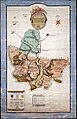
 L Isola di Sicilia divisa nelle sue valli (5375433151).jpg 1,024 × 735; 617 KB
-
 La Campagna di Roma il Patrimonio di S. Pietro e la Sabina (5375434615).jpg 1,024 × 747; 608 KB
-
 Le Royaume de France divisé en 83 départements - 1790 - btv1b53028979x.jpg 8,762 × 6,700; 13.07 MB
-
 Loca Terrae Sanctae quorum fit mentio in Evangeliis (FL200878612 2369543).jpg 2,226 × 2,259; 2.32 MB
-

-

-

-
 Map of the early settlements of Delaware County, Penna. LOC 2012593312.jpg 5,668 × 5,256; 3.79 MB
-
 Map of the early settlements of Delaware County, Penna. LOC 2012593312.tif 5,668 × 5,256; 85.23 MB
-
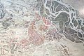 Map of Vienna ca. 1790.jpg 5,472 × 3,648; 10.24 MB
-
 McKean Co. LOC 86694769.jpg 4,589 × 8,318; 4.96 MB
-
 McKean Co. LOC 86694769.tif 4,589 × 8,318; 109.21 MB
-
 New World, or, Western Hemisphere; Old World, or, Eastern Hemisphere. NYPL478201.tiff 4,592 × 5,947; 78.14 MB
-
 Northern Hemisphere; Southern Hemisphere. NYPL478200.tiff 4,592 × 5,947; 78.14 MB
-
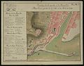
 Plan du canton de Plimouth et partie des Baradéres. LOC gm71002302.jpg 10,525 × 7,754; 11.83 MB
-
-
 Plano de Cartagena de Yndyas LOC 90682782.jpg 5,505 × 4,104; 2.49 MB
-
 Plano de Cartagena de Yndyas LOC 90682782.tif 5,505 × 4,104; 64.64 MB
-

-

-

-

-

-

-

-
 Rigobert Bonne, Carte Moderne de la Perse (FL33249852 2516919).jpg 6,263 × 8,788; 77.15 MB
-
 Rigobert Bonne, Carte Moderne de la Perse (FL33249855 2516923).jpg 5,728 × 8,311; 68.39 MB
-
 Schwarzenberg Meilenblatt 1790.jpg 1,168 × 756; 311 KB
-

-

-
 Susquehanna & Sinnemahoning. LOC 86694771.jpg 9,344 × 4,862; 6.12 MB
-
 Susquehanna & Sinnemahoning. LOC 86694771.tif 9,344 × 4,862; 129.98 MB
-
 Thanner Thal Jagdbezirk.jpg 2,651 × 4,101; 1.75 MB
-
 The plot of Carroll'sburgh - (part of Washington D.C.). LOC 88690858.jpg 7,060 × 4,416; 3.54 MB
-
 The plot of Carroll'sburgh - (part of Washington D.C.). LOC 88690858.tif 7,060 × 4,416; 89.2 MB
-
 Venango Co. LOC 86694766.jpg 8,682 × 4,975; 5.67 MB
-
 Venango Co. LOC 86694766.tif 8,682 × 4,975; 123.58 MB
-
 1790 Plan de Verniquet.jpg 6,179 × 4,849; 6.98 MB
-
 W. Su(q.?) Cr., Bradford Co. LOC 86694765.jpg 5,825 × 9,933; 8.06 MB
-
 W. Su(q.?) Cr., Bradford Co. LOC 86694765.tif 5,825 × 9,933; 165.54 MB
-
 Westbourne-route-1790.jpg 393 × 804; 108 KB

.jpg)

.jpg)


.jpg)
.jpg)


.jpg)

.jpg)


.jpg)
.jpg)
.jpg)
.jpg)
.jpg)
.jpg)
.jpg)
.jpg)
.jpg)


_LOC_88693174.jpg)
._LOC_88690863.jpg)


.jpg)
.jpg)


.jpg)
.jpg)
.jpg)
_(titel_op_object),_RP-P-1905-6615.jpg)
.jpg)
.jpg)

.jpg)
.jpg)


acas._LOC_90683662.jpg)

.jpg)
.jpg)


._LOC_88690858.jpg)


_Cr.,_Bradford_Co._LOC_86694765.jpg)
