Category:1786 maps
Jump to navigation
Jump to search
| ← · 1780 · 1781 · 1782 · 1783 · 1784 · 1785 · 1786 · 1787 · 1788 · 1789 · → |
Deutsch: Karten mit Bezug zum Jahr 1786
English: Maps related to the year 1786
Español: Mapas relativos al año 1786
Français : Cartes concernant l’an 1786
Русский: Карты 1786 года
Subcategories
This category has the following 8 subcategories, out of 8 total.
Media in category "1786 maps"
The following 62 files are in this category, out of 62 total.
-
(Map showing coast of northwestern portion of Vancouver Island). LOC 91683690.jpg 5,290 × 6,643; 3.27 MB
-
1786 Bocage Map of Messenia in Ancient Greece - Geographicus - Messemoa-white-1793.jpg 1,200 × 1,053; 310 KB
-
1786 Straße Sundernhof-Limburg-Elsey.jpg 5,217 × 3,934; 3.94 MB
-
1786年中国往琉球海路图2.jpg 2,130 × 1,450; 325 KB
-
1786年仙台林子平中国往琉球海路图1.jpg 2,592 × 1,728; 261 KB
-
A chart of the Gulf Stream LOC 2004627238.jpg 5,090 × 3,161; 2.58 MB
-
A chart of the Gulf Stream LOC 2004627238.tif 5,090 × 3,161; 46.03 MB
-
AMH-5577-NA Map of north eastern India.jpg 2,400 × 1,621; 837 KB
-
AMH-6896-KB Map of the world.jpg 2,400 × 1,957; 1.23 MB
-
Annual passage of the herrings. NYPL434479.tiff 4,009 × 3,847; 44.13 MB
-
Chili, Paraguay, Bresil, Amazones et Perou NYPL1621540.tiff 7,230 × 5,428; 112.28 MB
-
Guyane, Terra ferme, Isles antilles, et Nlle. Espagne. NYPL478191.tiff 6,510 × 4,888; 91.04 MB
-
Güssefeld, Karte der Braunschweigischen Lande, 1786.jpg 2,924 × 2,316; 4.72 MB
-
JefferyJohnson161A 1786.jpg 180 × 139; 9 KB
-
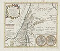
Joseph-Romain Joly, Carte des villes episcopales de la Palestine (FL199985487 2368676).jpg 3,494 × 4,904; 25.02 MB
-
Kaart van de Colonie Demerary 1786 extract.jpg 1,705 × 746; 640 KB
-
Kaart van de Colonie Demerary 1786.jpg 1,674 × 2,046; 744 KB
-
New Holland incldg NSW.jpg 2,275 × 2,000; 540 KB
-
Numazuhon-machi, Higashimakado-mura, tou-son ohayashi ōzakai ezu. LOC 80691946.jpg 12,252 × 6,864; 6.98 MB
-
Numazuhon-machi, Higashimakado-mura, tou-son ohayashi ōzakai ezu. LOC 80691946.tif 12,252 × 6,864; 240.61 MB
-
Ockham, Wisley and Hatchford in 1786.jpg 6,808 × 5,019; 7.7 MB
-
Pianta di Ravenna di Lalande 1786.jpg 1,661 × 1,082; 1.38 MB
-
Plan de la plaine du Cap François en l'Isle St. Domingue, LOC 73695940.jpg 14,124 × 11,480; 23.29 MB
-
Plan Toul 1786.JPG 675 × 519; 590 KB
-
Samuel Dunn, A map of the Countries and Places mentioned in the New Testament (FL49973441 4073142).jpg 13,699 × 11,337; 211.44 MB
-
Somersetshire map 1786.jpg 1,600 × 1,163; 823 KB
-
StBart map 1786 by Wilmans.jpg 6,968 × 5,655; 4.31 MB
-
UBBasel Map Basel 1786 Kartenslg Schw Ml 10c.tif 8,324 × 7,121, 2 pages; 169.61 MB
-
UBBasel Map Basel 1786 Kartenslg Schw Ml 10d.tif 8,067 × 7,399, 2 pages; 170.79 MB
-
UBBasel Map Basel 1786 Kartenslg Schw Ml 10e.tif 6,706 × 6,527, 2 pages; 125.25 MB
-
UBBasel Map Basel 1786 Kartenslg Schw Ml 10f.tif 7,584 × 6,901, 2 pages; 149.76 MB
-
UBBasel Map Basel 1786 VB A2-2-37.tif 6,652 × 6,615, 2 pages; 125.92 MB
-
Western New World or Hemisphere. Eastern Old World or Hemisphere. LOC 98687103.jpg 4,448 × 6,384; 4.29 MB
-
Western New World or Hemisphere. Eastern Old World or Hemisphere. LOC 98687103.tif 4,448 × 6,384; 81.24 MB


