Category:16th-century maps of Switzerland
Jump to navigation
Jump to search
Subcategories
This category has the following 7 subcategories, out of 7 total.
Media in category "16th-century maps of Switzerland"
The following 47 files are in this category, out of 47 total.
-
 Print, book-illustration, map (BM 1982,U.2435).jpg 1,883 × 1,801; 1.01 MB
-
 Print, book-illustration, map (BM 1982,U.2436).jpg 1,895 × 1,757; 995 KB
-
 Print, book-illustration, map (BM 1982,U.2437).jpg 1,565 × 2,500; 1.24 MB
-
 Cosmographia (Sebastian Münster) p 078.jpg 2,000 × 1,525; 556 KB
-
 Cosmographia - Beschreibung aller Lender durch Sebastianum Munsterum (1545) 10.jpg 11,110 × 7,078; 7.32 MB
-
 Cosmographia - Beschreibung aller Lender durch Sebastianum Munsterum (1545) 11.jpg 11,095 × 7,083; 7.36 MB
-
 Cosmographia - Beschreibung aller Lender durch Sebastianum Munsterum (1545) 12.jpg 11,094 × 7,034; 8.55 MB
-
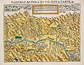 Karte Wallis 1545.jpg 1,104 × 851; 505 KB
-
 Germania Teütschland - Helvetia.jpg 815 × 546; 106 KB
-
 1566 map of Zurich and surroundings by Jodocus Murer.jpg 29,747 × 25,428; 183.36 MB
-

-
 UBBasel Map 1578 Kartenslg Schw A 71 Helvetia Alsatia.tiff 9,685 × 5,141, 2 pages; 142.48 MB
-
 Aegidius Tschschudi - Schweizerkarte - 1538.jpg 2,500 × 1,888; 3.74 MB
-
 ETH-BIB-Stumpf's Eydgenossenschaft (1552) (Mittelstück)-Dia 247-13207.tif 3,593 × 2,857; 29.52 MB
-
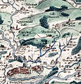
 Geneva 1552.jpg 2,881 × 1,866; 1.07 MB
-
 Helvetia - a Paulo de Forlanis - btv1b53223568c.jpg 7,546 × 5,474; 7.48 MB
-

-
 Helvetios olim uir clariss. nuc Suiceros - Dominicus Zenoi v. excudebat - btv1b53042962x.jpg 7,914 × 6,032; 7.56 MB
-

-
 Helvetios olim uir clariss. nunc Suiceros... - btv1b55000097j.jpg 8,309 × 5,987; 6.38 MB
-

-
-
 Lacus Constantiensis 1540.jpg 1,266 × 1,048; 676 KB
-
 Schöpfkarte 1580 - area around Englisberg.jpg 500 × 519; 194 KB
-
 UBBasel Map 1500-1599 Kartenslg Schw A 57.tif 11,715 × 9,038, 2 pages; 302.95 MB
-
 UBBasel Map 1500-1599 Kartenslg Schw A 58.tif 9,542 × 6,432, 2 pages; 175.62 MB
-
 UBBasel Map 1538 Kartenslg AA 123.tif 17,049 × 11,969, 2 pages; 583.84 MB
-
 UBBasel Map 1545 Kartenslg Schw Cu 6.tif 5,028 × 3,704, 5 pages; 266.56 MB
-
 UBBasel Map 1548 Kartenslg Schw A 55 Helvetia.tiff 10,051 × 8,884, 2 pages; 255.49 MB
-
 UBBasel Map 1548 Kartenslg Schw A 56 Helvetia.tiff 9,810 × 6,566, 2 pages; 184.31 MB
-
 UBBasel Map 1548 Kartenslg Schw A 59.tif 12,848 × 8,621, 2 pages; 316.92 MB
-
 UBBasel Map 1548 Kartenslg Schw A 60 Eydgnoschafft.tiff 12,597 × 8,903, 2 pages; 320.89 MB
-
 UBBasel Map 1548 VB A2-1-11.tif 11,764 × 8,785, 2 pages; 295.7 MB
-
 UBBasel Map 1548-1586 VB A2-1-29 Helvetia.tiff 7,852 × 5,081, 2 pages; 114.17 MB
-
 UBBasel Map 1552 Kartenslg Schw A 61 Helvetia.tiff 8,945 × 5,476, 2 pages; 140.16 MB
-
 UBBasel Map 1552 Kartenslg Schw A 62 Helvetia.tiff 8,312 × 5,639, 2 pages; 134.13 MB
-
 UBBasel Map 1554 Kartenslg Schw A 63 Helvetia.tiff 7,038 × 4,541, 2 pages; 91.46 MB
-
 UBBasel Map 1555 VB A2-1-3.tif 12,009 × 8,659, 2 pages; 297.53 MB
-
 UBBasel Map 1560 Kartenslg AA 125.tif 12,108 × 10,377, 2 pages; 359.5 MB
-
 UBBasel Map 1573 Kartenslg Schw M 1-2 Eydgnosschafft.tiff 8,110 × 6,942, 4 pages; 648.46 MB
-
 UBBasel Map 1582 Kartenslg Schw A 66 Helvetia.tiff 13,560 × 10,888, 2 pages; 422.43 MB
-
 UBBasel Map 1588 Kartenslg Schw A 115 Eydgnoschafft.tiff 4,833 × 3,071, 2 pages; 42.49 MB
-
 UBBasel Map 1598 Kartenslg Schw A 67 Schweytzerlandt.tiff 7,585 × 5,896, 2 pages; 127.97 MB
-
 UBBasel Map 1598 VB A2-1-47 Schweytzerlandt.tiff 7,057 × 5,358, 2 pages; 108.21 MB
-
 UBBasel Map Schweiz 1570 Kartenslg Schw A 69.tif 10,005 × 6,433, 2 pages; 184.17 MB
-
 UBBasel Map Schweiz 1570 VB A2-1-10.tif 11,838 × 8,736, 2 pages; 295.9 MB
-
 UBBasel Map Schweiz 1578 VB A2-1-4.tif 11,983 × 8,709, 2 pages; 591.38 MB
.jpg)
.jpg)
.jpg)
_p_078.jpg)
_10.jpg)
_11.jpg)
_12.jpg)


.jpg)


