Category:16th-century maps of Bosnia and Herzegovina
Jump to navigation
Jump to search
Subcategories
This category has the following 5 subcategories, out of 5 total.
Media in category "16th-century maps of Bosnia and Herzegovina"
The following 2 files are in this category, out of 2 total.
-
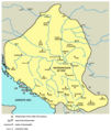
Patriarchate of Peć in the 16th and 17th century.png 1,170 × 1,383; 129 KB
-
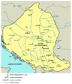
Pecka patrijarsija mapa sr.png 1,170 × 1,383; 123 KB

