Category:1630s maps of Spain
Appearance
Media in category "1630s maps of Spain"
The following 11 files are in this category, out of 11 total.
-
18. Legionis Biscaiae eta Guipuscoae typus”, Mercator (1630).png 1,601 × 1,172; 3.7 MB
-
Maure Alger et Espagne.jpg 1,340 × 976; 331 KB
-
Atlas Van der Hagen-KW1049B12 003-VTRIVSQUE CASTELLAE nova descriptio.jpeg 5,500 × 4,543; 4.66 MB
-
Atlas Van der Hagen-KW1049B12 009-ANDALVZIA continens SEVILLAM et CORDVBAM.jpeg 5,500 × 4,261; 3.13 MB
-
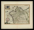
Gallaecia Regnum de Henricus Hondius (1636) (3).jpg 5,826 × 4,465; 5.9 MB
-
Gallaecia, Regnum de Blaeu (2).jpg 5,980 × 4,580; 6.06 MB
-
Gallaecia, Regnum de Blaeu.jpg 5,914 × 4,576; 6.06 MB
-
Map - Special Collections University of Amsterdam - OTM- HB-KZL 32.25.03.tif 6,808 × 5,373; 104.65 MB
-
Map - Special Collections University of Amsterdam - OTM- HB-KZL 32.26.29.tif 6,648 × 5,410; 102.9 MB
-
REo Teixeira1634.JPG 1,353 × 1,776; 810 KB
-
Vtriusque Castellae nova descriptio (8357189227).jpg 800 × 662; 134 KB


