Category:1630s maps of Europe
Jump to navigation
Jump to search
Temperate regions: North America · South America · Africa · Europe · Asia · – Polar regions: – Other regions:
Subcategories
This category has the following 35 subcategories, out of 35 total.
.
B
C
- 1630s maps of Cyprus (1 F)
D
- 1630s maps of Denmark (2 F)
E
- 1630s maps of England (1 F)
F
G
I
L
N
P
- 1630s maps of Portugal (2 F)
R
- 1630s maps of Russia (4 F)
S
- 1630s maps of Spain (11 F)
T
- 1630s maps of Turkey (3 F)
U
- 1630s maps of Ukraine (6 F)
W
- 1630s maps of Wales (1 F)
Media in category "1630s maps of Europe"
The following 3 files are in this category, out of 3 total.
-
 1638 map - Patriarchatus Romanus.jpg 12,876 × 9,509; 18.31 MB
-
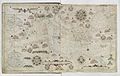 Cavallini. Atlas nautique de la Mer Méditerranée et d'une partie de la Mer Noire. 1639.jpg 10,231 × 6,446; 10.82 MB
-
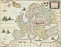 Map of Europe showing Poland and Lithuania (1561-1629).jpg 1,306 × 1,012; 1.05 MB


.jpg)