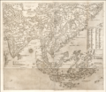
Category:1580s maps of Asia
Jump to navigation
Jump to search
Temperate regions: North America · South America · Africa · Europe · Asia · – Polar regions: – Other regions:
Subcategories
This category has the following 8 subcategories, out of 8 total.
.
C
- 1580s maps of China (1 F)
E
- 1580s maps of Egypt (10 F)
P
- 1580s maps of Palestine (4 F)
R
- 1580s maps of Russia (3 F)
T
- 1580s maps of Turkey (4 F)
Media in category "1580s maps of Asia"
The following 8 files are in this category, out of 8 total.
-
1561 map of East Asia by Giacomo Gastaldi, published in 1580.jpg 18,351 × 15,925; 41.77 MB
-
1580s pictorial map by Heinrich Bünting, depicting Asia as Pegasus.jpg 8,844 × 7,098; 36.55 MB
-
Map of Asia (1588) South Asia.jpg 800 × 600; 136 KB
-
Map of Asia (1588).jpg 800 × 600; 127 KB
-
Ca. 1581 pictorial map by Heinrich Bünting, depicting Asia as Pegasus.jpg 8,896 × 7,050; 9.97 MB
-
Gastaldi Asia.png 8,793 × 7,631; 128.42 MB


