Category:1580s maps of the Levant
Jump to navigation
Jump to search
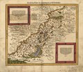
English: This category is intended to collect old maps from the 1580s that depict the Levantine coast, i.e. the area of Cilicia, Syria and Palestine, including the areas of modern Israel and Lebanon. Compare also 16th-century maps of the Near East, which should depict larger areas, usually including Egypt, Turkey, Mesopotamia and Arabia. Old maps that are thematically intended to show the Holy Land and/or its history, should instead be sorted into Old maps of the Holy Land and its subcategories.
| 16th-century maps of the Levant: 1500s 1520s 1530s 1540s 1550s 1560s 1570s 1580s 1590s → |
Media in category "1580s maps of the Levant"
The following 3 files are in this category, out of 3 total.
-
Das heilig Lande mit Ausztheilung der zwoelff Geschlechter. LOC 2006629144.jpg 4,967 × 4,289; 3.56 MB
-
Das heilig Lande mit Ausztheilung der zwoelff Geschlechter. LOC 2006629144.tif 4,967 × 4,289; 60.95 MB
-
PG UFL2.jpg 1,126 × 982; 982 KB


