OsmAnd 4.2 (iOS)

Hi there!
We are glad to announce the release of the iOS app version.
Development doesn't stand still, and now the new improved version is available for installation on your devices! Every day, we work to make the iOS version more complete and as functional as the Android version. Inevitably, mistakes and bugs arise along our way, which we try to correct immediately. Thank you for your support and feedback.
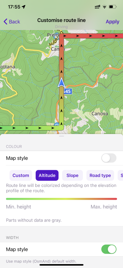
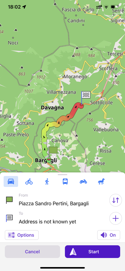
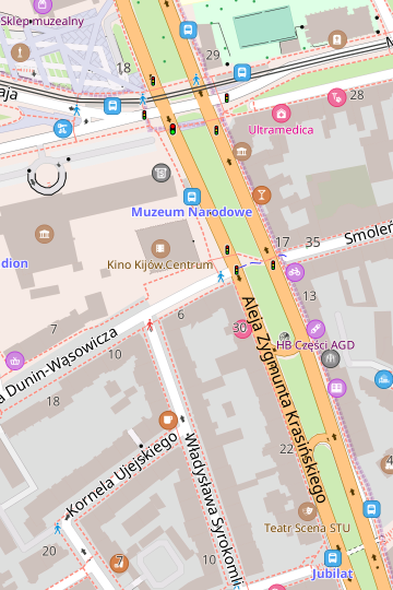
Route line appearance
This feature adds the ability to customize the width and colour of the route lines. You can configure the appearance of the route line with different settings, such as Custom and Altitude.
The functions are located here: [object Object] → Settings → Configure profile → Navigation settings → Customize route line or in [object Object] → Navigation → Options.
 |  |
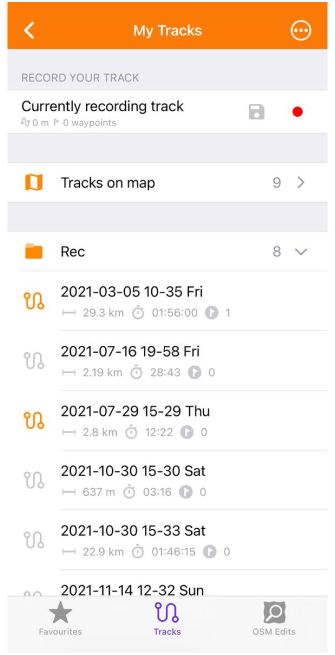
Tracks
Scroll bar for waypoint groups
Track context menu: added a scroll bar with groups of waypoints, allowing you to quickly select the fitting group.
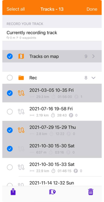
Improve track managements
In this release we have added the ability to delete more than one track at the time:
[object Object] → [object Object] → '…' button → choose tracks (the number of selected tracks is displayed at the top of the screen) → 🗑 button
 |  |
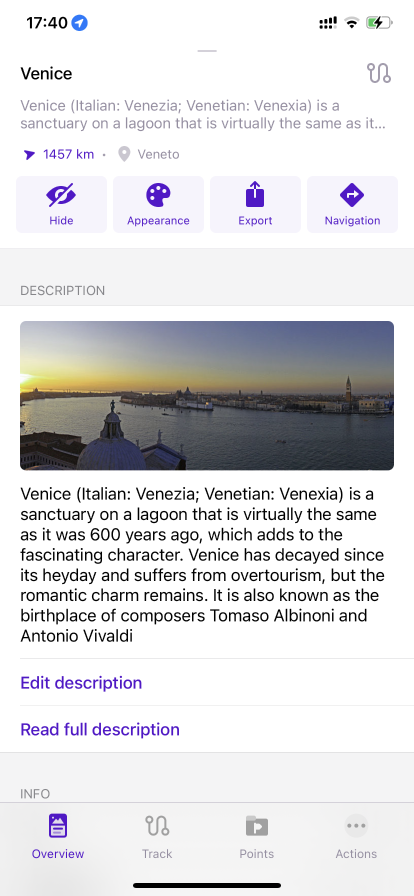
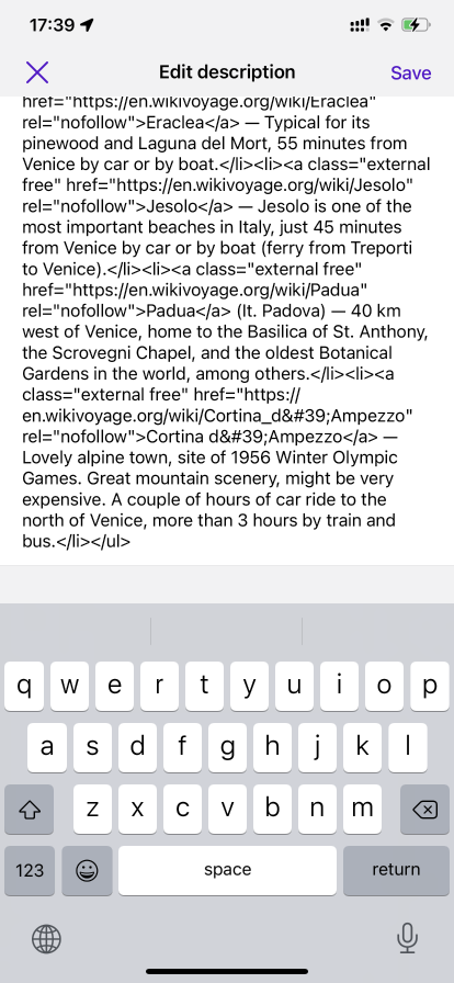
Track description
In this menu we have added the ability to view, add and edit the description: Track Context menu → Overview → Description. Here you can add new text or edit an existing description, as well as read the full version of the descriptions.
 |  |
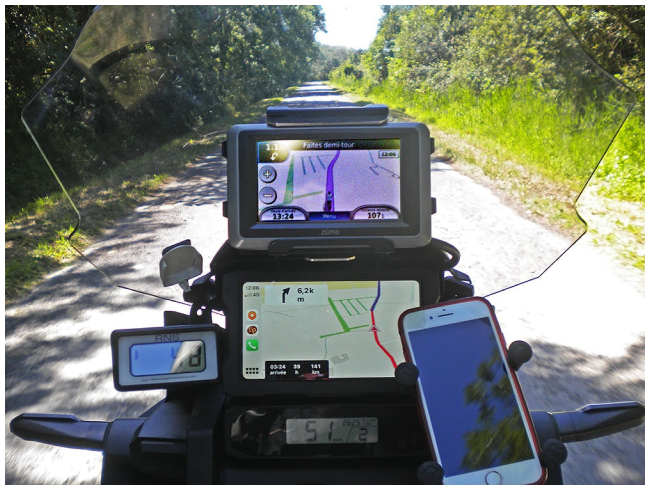
Include heading
A new parameter has also been added to the Track recording plugin: "Include heading". Now, you can save heading information for each recorded point.
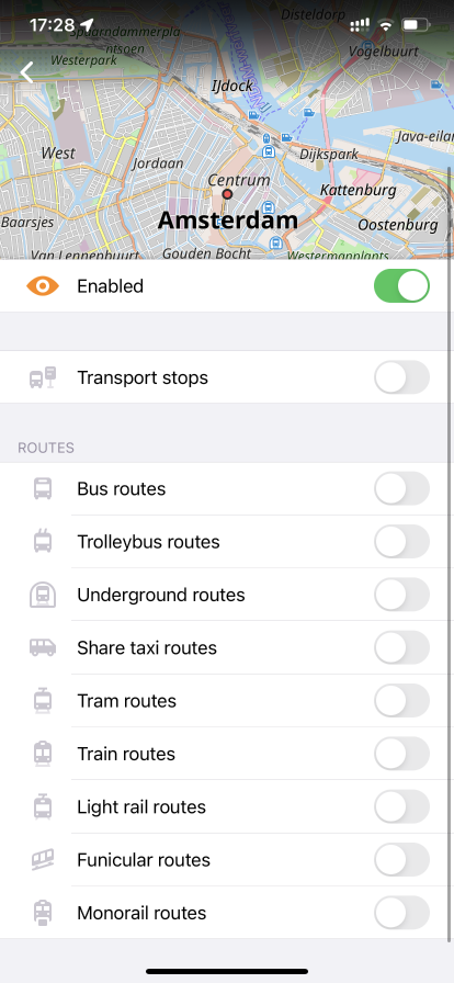
Routes
Public transport routes have been divided into types, you can find them on Configure map → Transport.
 |
Fitness and running routes were added to maps. Data for these routes are taken from OpenStreetMap project:
- The tag route=fitness_trail
- The tag route=running
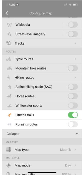 |  |
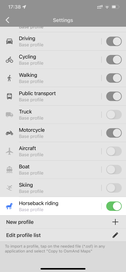
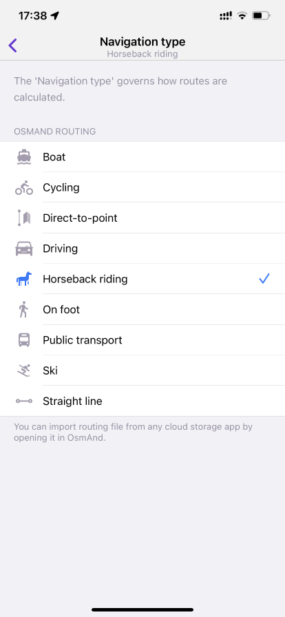
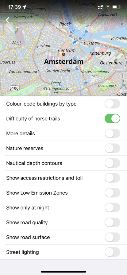
Horseback riding
Added the new navigation type and Horseback riding app profile. You can also enable Horse routes and 'Difficulty of horse trails' in Configure Map menu.
 |  |  |
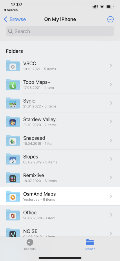
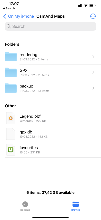
Files app
OsmAnd files are now visible in the "Files" application. You can access all tracks, custom routing and rendering files through it: Files → On My Phone → OsmAnd Maps
 |  |
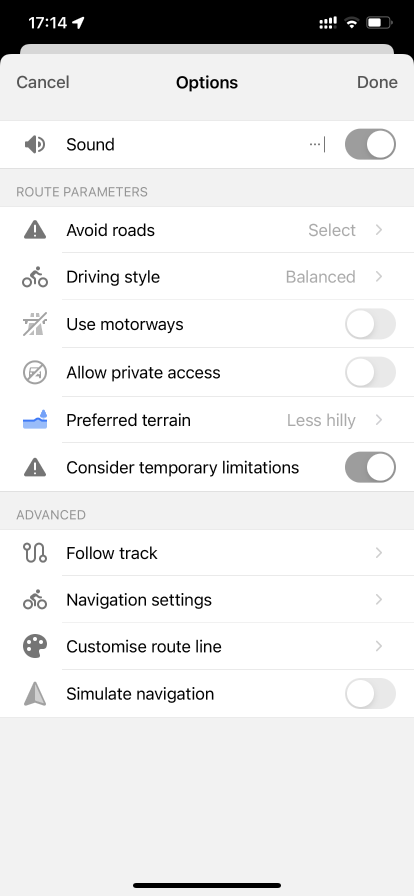
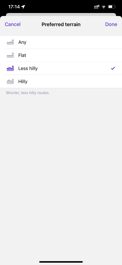
Preferred terrain
UX of options "Use elevation data" and "Select elevation fluctuation" was improved. They have been merged and renamed "Preferred terrain", which is now available for "Cycling" and "Walking" profiles.
 |  |
New map style
The style of maps "Mapnik" has been replaced by a new style "OSM-Carto" style. This was done because at the time "Mapnik" was added to OsmAnd, it was identical to the map style on OpenStreetMap.org, but we didn't have the resources to keep it up to date, so over time it lost similarity to the OSM map style.
If you use "Mapnik", it will be available after the update, but as a custom map style. After a fresh or new installation, you will need to manually import it for use. You can do it by downloading it from GitHub.
- Mapnik
- OSM-Carto
 |  |
 |  |
CarPlay
We upgraded CarPlay function:
- CarPlay bug fixes, added gestures for touchscreens.
- Fixed turn arrows color for match CarPlay light theme.
 |
Street name widget
Improved Street name widget:
- Show road shield and exit number during navigation.
- Visible for all profiles.
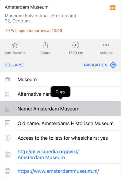
Copy details
You can now copy information from Details of the map context menu of any POI: a long press on a cell brings up the "Copy" button.
Added copy actions to the "Share" sheet
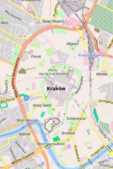
Now, when you click (long, short tap) on any pointed object on the map (POI, favorite, waypoint..) and choose "Share" button on the Map Context menu, you will find the addition of copying actions. The selected information will be copied to the buffer:
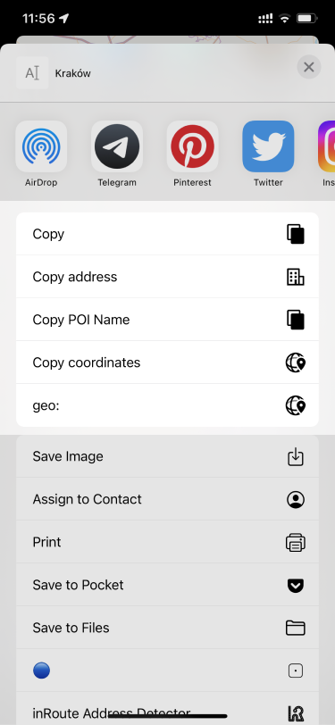
- Copy address - allows you to copy the address of a point to the buffer. Example from the image: Kraków.
- Copy POI Name - allows you to copy the name of a point to the buffer. Example from the image: Kraków.
- Copy coordinates - allows you to copy the coordinates of a point to the buffer. Example from the image: 47.25963° N, 11.39645° E.
- geo: - allows you to copy the point geo-tag to the buffer. Example from the image: geo:47.25963,11.39645?z=19.
Fixed
- Fixed import of GPX files from OSF package
- Fixed import of custom plugins with included files
- Fixed various crashes in the Route planning mode
- Fixed crashes during Navigation
Follow OsmAnd on Facebook, TikTok, X (Twitter), Reddit, and Instagram!
Join us at our groups of Telegram (OsmAnd News channel), (EN), (IT), (FR), (DE), (UA), (ES), (BR-PT), (PL), (AR), (TR).
